So on with this webinar which is as I said already principles of LBL these are what we're gonna cover today so we're gonna look at just the first bit is just a sort of overview what we did in the prints and the basic acoustic positioning principles webinar this review that little bit so those that weren't involving that can get an idea of what LBL actually is then we're going to how we deploy the system the hardware On a software that is used to actually that we used to set the system up then how we calibrate
the LBL array on the seabed then we look at the acoustic communications that are happening during that calibration but also during tracking as well in order to derive a position and and then of course write the end how we derive a position using LBL and there so it is an overview its principles lot to cover in an hour so I'm going to crack on first of all then What is LBL but those depth were there on the original webinar or you know already type up on the screen or into the chat what does LBL actually
stand for over to you so text on the screen or in the chat what does LBL stand for long baseline long baseline yet lots people putting in real good stuff people have either done their homework or they just know or they were on the first webinar which is good it does right it does stand for a long Baseline that's because we used fixed sea bed transponders so these these transponders are placed on the sea bed and they are sort of hundreds sometimes thousands of meters apart a typical large field array they usually a kilometer apart
so these are the baseline is the mess is a measure of a distance between two points of reference or point of reference anything we're trying to measure all right so they fixed seabed transform this place on a Seabed in a circle or square around the area of operation so everything we're tracking is within the array that we set up right so we surround those things up we never track outside the array on LBL and that's just down to geometry in just acoustic LBO we're always tracking inside the array so we surround the air operations and
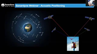
it works similar to GPS in the fact that we're using trilateration and time measurements to determine our location within array but Instead of GPS peeling a pinging all the time what happens is we interrogate our beacons so we get a position on request if that makes sense so we actually interrogate the beacons acoustically they respond we measure that time the time travel of all of those those messages and by working out how far away by by using that time measurement we calculate the distances and able to to face our system it's a range range system
and we write these trilateration Concept just like GPS receiving good and the the other the key point the key takeaway from the initial thing we did in the first week is that precision of LBL is independent of water depth if you set up an array in a hundred meters depth and and then you took the same array same jointery same distances etc an orientation and then stuck that at a thousand meters you get exactly the same performance out of the system so that's why that's what makes LBL have benefits Is it you can get high
confidence high precision tracking at depth and the the last sort of thing that we'll touch on again later is the acoustic signals that are out there there's our six generation acoustics it's protocols which everything's wideband it means it digits also we have digital coded communications going through on our sound waves and the sixty protocol the one that's the standard out there we can all the ranging responses all those that All those replies come back with some diagnostic telemetry embedded within them but any additional telemetry about data from sensors etc is a separate command using the
same waveforms and we've recently upgraded that to six plus a Newton at a new breed of hardware which is the same same hardware but better programming of processing aside and that enables that that telemetry data for sensors etc and other information to be packaged within the Range or added on to the ranging responses which makes the system more fast for faster more efficient and easier to operate and Rizzi I will cover that question later on so that is the overview that's kind of the the the the the the summary of the things that we covered
in the first webinar in terms of the principles of LBL this thing the overview of it now we're going to go into a bit more detail looking first of all anyone everyone sort of happy that In general though if you're happy with that one of the things I'll be asking you do squit some thumbs up in the cottage and window all a tick there's a green tick box the green tick at the bottom so if you're happy give us a green tick or a thumbs up and I can click more and go thumbs up if
you like and then as you go through far I'll keep asking you to sort of confirm when you're still happy so we'll leave that change the text of thumbs up or back Then back up back again all right so moving on then let's look at the the hardware and software that we need to actually set up and it'll be other way first of all the software there are basically two but the two software systems out there that's only undo for for OBL operations the first one is that if you've seen any LV operations out there
all sure this is the one you'd be familiar with no 97 98 percent of LBL construction jobs offshore are using Sonar dine fusion 6g now kind of semi rebranded as fusion one you'll see why in a second and so Fusion is a bit bit old-school it's using our sixth generation hardware so that's why band 2 and 2 plus and also our original it's also backwards compatible with a wideband one systems which is there 5g star a yellow beacon so but all it's all optimized now for red beacon 6 generation acoustics but the user interface is
a little bit old-school It's a bit load windows 97 but it's a powerful tool it's been upgrading in the background they engineer the background has been platform has been upgraded significantly in the last few years and this is a very powerful tool and very familiar to anybody who's been doing lvl Upshaw over the last or 10-15 years we've recently improved both the hardware on the software so our 6 plus hardware and protocols that I've just discussed a Second ago and I meant to be driven by our fusion to software refusing to software is a it
is enabling us to use inertial systems and acoustic LBL systems using the same software package without needing this separate PC or Hardware between the two so much easier much efficient the user interface and the the workflows for LBL operations using fusing two are intuitive and much more efficient so this is the future of LBL from you know as gradually as people Upgrade their hardware over the next few years you will see fusion to being used more and more offshore for acoustic as well as an inertial system off there alright so that's the two software systems
and we offer training for both and we and if you've got a fusion one training already in the bag we can do do a fusion to top-up course for a basic just for one day it's so intuitive if you've done the fusion one you'll find fusion - really easy to use so that's The software moving on then to the hardware let's discuss first of all the transceivers alright the main transceiver that the key transceiver that we're using in LBL systems is the roll from out of transceiver literally means the ROV navigator so it's meant to
be installed on our Ovie's it comes in two parts so you have the bottle part here that contains all the processing power and comms etc and then you have the transducer element this is just the Transducer element on the end of a cable and this is all installed in the area or on the ROV and here's an example of an ROV with it fitted nose there's the transducer at the top and there's the bottle embedded in the frame below and so it's meant for a workhorse ROV we do have a mini version of the Robin
lab which is all in one unit the smaller RVs but for the fieldwork class offshore ROV this is the beastie that we're going to be using out there you can see here that The transducer element is on a hydraulic ram to lift it above the frame of the ROV why might that be a benefit why might want to have the acoustic element raised above the ROV able to be extended above the ROV like that yeah answers on the screen or on the chat window whichever works for you what's the benefits of being able to raise
that transducer element above the frame of the ROV line of sight yet good answer Any other reasons one it might be good protecting for a moment yeah so yeah actually right Sean so we can actually track that back in as you put the Rav back into the TMS better acoustic communication true yes better for a number of reasons actually main won't be the first one being the line of sight there right now has has already identified but the other benefit really is the fact that this is a noisy bitter kit and if it said that
if you get this A little bit further away from all there's noise it makes it slightly quieter makes it makes better communication on that MetroCard but the main thing also is as retinas they're quite rightly line-of-sight you know we're going to be tracking our and seabed beacons that are potentially below the ROV as it's swimming around for flowing around so they're having this upwards gives us a little bit more angle line of sight from that well That's the robinov transducer transceiver the other transceivers that can be using there'll be our systems is and if you
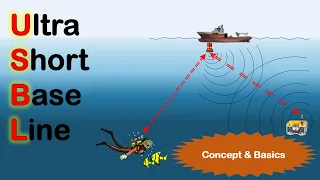
saw the USB l webinar last week you'll be familiar with this is the HP T the high performance transceiver that's our USB L head and there's also the Duncker as well so the 6g Danka which is just a may see a transducer and comms element of Perelman they gets body that look is lowered into the water and then you have a power unit on the top Which connects into your PC but those things are really used for installation and calibration so just be able to communicate with the array to get the setup done not usually
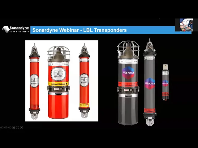
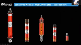
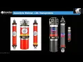
used for for tracking although you can track a vessels position from either these two transceivers using LBL ranges if you want to or abandoned so that's the transceivers let's move on to the transponders they're bits of kit That give us our positions the workhorses of of the LBL system then the fundamental part of the system is the compact right the computing and telemetry transponder and these are the 6g family ones you can tell them because they're nice shiny red red red jackets we're the big label says 6g on it so it's our sixth generation wideband
2 + 2 + acoustic technology all digital and this one here the compact 6 is the mainstay of LBL this is the the one You're gonna see on the seabed giving you the positions as we'll talk about later on all right so this is our seabed references our satellites on the seabed if you live underwater GPS the gyro compact in the middle this is mainly meant for putting on structures or other objects that you want to track subsea or get position for and there this is basically does everything this does with with an inbuilt kind
of inertial system to give you heading pitch roll and heave Data as well so you can tell the attitude of the thing we're tracking whilst we're tracking it so it's more of a moving object the AMT is similar to the compact 6 but any MT stands for automatic monitoring transponder so once you've finished the ill this could be in the array or could be on your on your pipeline or structure whatever you're tracking and once you've finished the job of actually positioning or your system you can leave that down there Subsea and it could be
storing data automatically - is it in its internal SD card which you can recover acoustically there with a manned or unmanned system the only difference in hardware between the AMT and the compact 6 is the sticky label around the bottom alright the this I'll keep clicking on the screen when I do that this one here has a sticky label but they both have an SD card inside it but this one has the function level to allow it to store data To that SD card you can however upgrade this to be an AMT whilst it's deployed
subsea so if you finish the job and think actually be right you really useful if we can store some data and leave the system just storing data subsea without us needing to be here you can contact so no don't pay the upgrade fee there's always a cost for everything and they will send you a piece of a piece of code which you just fire down acoustically to your Transducer and reprogram it to be a an AMT whilst it's deployed subsea so don't worry if you if you haven't go all the kit you need to start
with it can be upgraded Wireless of subsea in them in many respects and then this 6g or vi plus family you'll notice the hardware looked remarkably similar it's the same hardware but it's just got a different sexy red jacket or a sexy gray jacket on it rather with a rather fetching purple and pink label this just tells you that It is the latest programming and protocols inside it ok many many versions of the s60 kick can be upgraded to the to the six plus depending on the age of the of the hard way but they
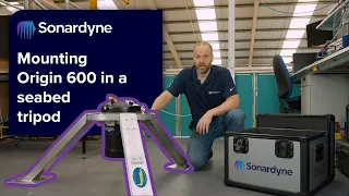
and the one on the end they're the smaller one this is the micro compact it basically does everything this one does and this one does it but in a smaller form factor so it's basically just for quick and short duration deployments really that's it So putting these things on the seabed then so you know obviously we need to have these things on the seabed to use them as position references and by far know my preferred method is the rigid stand and here's an example of one tall stands and the collars on the tops of stand
are the same dimensions that they have been forever they even the very first compact we made was a certain dimension everyone had they their buckets and brackets all made For them we've kept the same dimensions ever since it's gonna like a standardized product and there's another version of a tripod stand this one has a tray in the bottom you can fill with cement too we basically lower it since the gravity they might have put it on a more uneven seabed now these ridges stands will be deployed what most often using an ROV and in shallow
water the artery might collect it from near the surface and then lie down and deposit it Where in these bill one put on the seabed or more commonly they use a job basket or job frame so they'll lower the job basket down with all the compacts in frames in the basket and the ROV will fly back and forth to the job basket and to the locations to deposit them on the seabed and their position will be tracked usually using USB L or often another sort of profiling so now that tells you relative to us something
else as already down there all right So Bridget stands then what do you think will be the advantages of using a rigid stand for an LBL position reference one of the upsides of using these this type of deployment system and one we're going to use in these to position our vehicle subsea offset will give me y offset Rahul john curran a position won't change no movement for the transponder absolutely yes stability all these good things if there's any current down there then These things are going to stay where you put them no sway no movement
so that you know you can you can be tracking your vehicle with high confidence all good answers thanks for that so you know it's a longer asking now what are the downsides what are the problems or potential pitfalls if you like for using rigid stands what might what might put people off using this type of system you any ideas on that again use the screen Or use the chat window thank you they just missed and the straw current because they're very stable they've put on the seabed and they just sort of stay where you put
them generally deployment issues yet it's a special deployment they they can sometimes fall over in the seabed if it's not even but generally that's part of your planning stage but yeah deployment issues the fact that they they're complicate they're big they're Expensive if they tickle off on deck space so if you've got if you've got like sort of 4050 compact and deploy and you've got load reduced as this size you need a much larger vessel or a smaller vessel and do multiple tricks in order to get that stuff out there that just adds cost and
time and complexity to the project so therefore that might be why some people don't want to use the bridges stands so the alternative then to rigid stands is exactly as approaches Then using a ballast fast markers or Club mates so we can have a float collar with a tether and then we can anchor that to the seabed using either clump weights or fast marker and these are fast markers and that's the sort of clump weight example so these fast markers are concrete base with a pole hook on the pole and many of tether attaches to
that and then the tether clips into the release mechanism on the bottom of the compact and similarly here You can see your float collar compay and the float collar release mechanism here and then you've got your ballast on the seabed which with the clump weight is going to be usually gravel bags or sandbags but basically 80 kilograms of weight to keep that thing down this has an up thrust of about 20 kilograms maybe four times the downs for us to keep it on the seabed and again these can be deployed using our RVs again in
in deepwater scenario so they can be Lowered down on a job basket in the same way that Stan's can be they can also just be dropped over the side in the reasonably shallow water you can take a GPS fix on the surface as you release the thing over the side watch it plummet down and take that as your initial start position that's viable in certain certain jobs not for most but the other way if you want more accuracy or more confidence a way of putting this thing on the seabed you can use they can Consider
using an acoustic release this is basically a beacon you can track with us BL and you can attach your load and this guys have gotten regice there but it could to be worn in a float collar a ballast weight on the bottom as well you lower it down to the seabed you're tracking the position of this you're tracking the position of the beacon itself and once it's in a position where you want it you send the release command from usb old to your Release mechanism and pull down it goes onto the seabed nice and easy
and then when you want to get it back it's in the release command to the other one on the float collar and pop it comes and like I said so float collars clump weights etc so very what we know about these things now what are the advantages of using this kind of or system I've left a bit of space on the screen if you want to use it so what are the advantages of using float colors Can we have trail tracking or snail trail Rahul yeah we sometimes have problems with we'll cover that in a
second hopefully allows that one in a second advantage is stable movement well with with fast marking of float colors they're faster they're cheaper somalian yeah that's the sort of thing though you can see there and also look at the amount of space you need on the deck there's a really large deck anyway but There's a lot of beacons it's stored on the deck and that photograph right so you can you don't need such a big vessel you know faster cheaper relatively inexpensive yeah absolutely all good answers so therefore then what are the downsides and disadvantages
of these fast markers and float colors and we'll think well they might be drifted by stroke yeah absolutely subject to current they may not drift so much the but they will certainly sway And I've got a quick picture here this is as fast marker hitting the seabed off being dropped from the surface so you can see there that that collides with the seabed the beacon up above it will be kind of still traveling down for a little while and potentially could smash into the top of the fast marker or if this was a clog wait
here you've got the release mechanism actually damaging the clump weight bags and it could spill some ballast and become neutrally Buoyant and then it's then it might start drifting around but the main disadvantage if you're like is is this way collision and tangling yeah all this Valentia arabes can get tangled up in these things sometimes or tethers could get caught around them but but this here you can see here that this is being caught little by the current and it is being pushed to one side now the holy rainbow will be pushing the ones over
what you'll find with these these square Square-edged float collars is they kind of catch the breeze on why in the current and they start to spin this way so this way won't be constant in one direction it will actually sway around a tab in a circle and actually start the spin as well which obviously if you're using that for positioning that but if you're if your references are swinging around in the breeze then the position of your thing you're tracking is going to be somewhat in error so there's Always a downside for these sort of
things one one solution for that sway is to use something like this which is a hydro net or hydrodynamic flow coil it's called the low drag collar it's something we can weekly produce but you can see that this is much more hydrodynamic but that in itself presents a problem the flat faced ones we see the traditional ones that you've seen not sure if you've been offshore anyway you'll see these are relatively simple To handle on deck they're they weigh about 30 kilos so they're not exactly lightweight but at least you've got flat edges and they
come in two harp so you can break it down and move around with a bit more bit more ease this thing is a single unit there's no buy half so you slide the compact through it and clamp it at the bottom and there's no flat edges so if you imagine to handle that on a deck off or especially if it's wet and slippery That's like a bar of soap yeah just asking to move around the deck so it comes with a handling frame so it's a bit more tricky so there's always a compromise with with
these things but they see fast markers or ridges that really stands far more preferred but more expensive and more complex fast markers are cheaper easier quicker but they have disadvantage as well so all these things get taken into account during the planning stage of an LBO Dependent on what we call the error budget on how confidently you need that tracking solution to be in the middle I all depend on the choice you make for diverter for deploying your system so once we've deployed it everyone happy with those that laughing by the way give us a
thumbs up or take on the participant window stuff and it have questions fire them into chat you will be more than happy to to answer Moving on then let's once we've got those things on the seabed and we actually want to study sewer to use this system before we can use it as a tracking solution we need to calibrate those positions in now we've put them on the seabed and we've done so using drop positions all right so we'll talk about those in a bit more in a minute but things we need to have and
information the system needs the software needs to define those Positions on the seabed are these things the drop coordinates the baseline ranges how far apart these things are and also the depth difference between each beacon on the seabed because we don't live in a nice flat world and Anthony yeah the minimum length of clum way is 2 meters so if the tether is shorter than you is too short all right drop coordinates all right so the drop positions we know that the deeper you go generally they're more sort of error you're gonna have in those
Original drop coordinates what you need to do is give the software where you believe the beacons to be in the first place so that it can generate it's kind of start start model if you like and we'll just start the processing side of things now those drop corners where'd we get those from if you're using a USB L system to position those beacons on the seabed and that could be one of our systems it could be one of our competitive systems it matters not you Can use our beakers with many of our competitors systems too
so we can get a position for them on the seabed and if you're in deep water your precision of the USB L system is dependent on water depth and deeper you go the less precise that is going to be so there's going to be an error around the positions of these things on the sea where you won't have a nice even northings but you'll have unknown you'll know that that would be out by a certain amount of of Difference do I let you handle the questions on the chat the moment all right so for example
if you've got a u.s. bill system that is calibrated and you've got report on that calibration that says your USB opposition the US PL system has a precision accuracy on precision of water depth of 2 percent of the water depth and you want a thousand meters of water this eastings and northings location for This beacon you have from us PL system will be out by up to 2 meters all right so that's not good enough if you want to attract something with it we've got error budget as well within 2 meters that's why I need
an lvl system but understanding the amount of error you have in your original drop coordinates is important and you will see why very soon okay because the next thing we're going to do is get the system to calculate well that's before I carry on What happens is once you've got these Rock coordinates you enter those into the software the system will then compute how far apart these are all right based on those drop coordinates so we know that that the estimated baseline length between these two will be so far plus or minus about twice the
error you get from the usb our system all right from the original drop coordinates because then we're going to measure how Far apart they are we're actually going to measure those baselines acoustically and to do that we tell the beacons to interrogate each other and the then we work out the time of flight if you saw the webinar last week on on USB L it's the same way you are USB your system works right it's acoustic interrogation we get an acoustic response back we know that speed equals distance multiplied divided by time all right therefore
the distance to get the Distance you just multiply the speed by the time all right in this example we've gotten sent a sound speed of exactly 1,500 meters per second we send the interrogation from the beacon on the Left we hear they responded back from the big on the right you know so basically we said it's all measuring for this end starts the clock sends interrogation stops the clock when it hears the report response and that whole process takes two seconds how far Apart are those two beacons answers on the screen or ads in the
chat 1500 says Barla 15-under says Rashidi 1500 says Sean and I recognize your name view on previous webinars all you've been on training courses say but their maths is fairly straightforward and and no one yet has said 3000 meters people do sometimes and that's that does be fine but as you've all surmise it takes one second to get there or one second to get Back and so the acoustics may have traveled 53,000 meters but that means that the things are actually 1,500 meters apart all right so absolutely right now in reality the best interrogation you
know this is not going to respond instantaneously there's going to be a processing delay is going to have to recognize that's assuming for it who's got some it I've got some telemetry to embed in there some glue some analysis Of the signal put in the results of that analysis interest response that takes a certain amount of time and any time delay at this end is going to add to the time measurement overall and therefore give us an error in our in our range calculation so what we do is to mitigate that is we give it
a known delay at the other end we call it a turnaround time or ta T so that turnaround time eliminates that processing delay and gives us a known amount of delay at this End that we can then take into our calculation so now the travel time total travel time in this example two point two seconds the first thing the software does is remove that turnaround time delay at the other end to leave us with the precise acoustic distance between the toy Gusev travel time between the two and that can be converted to range slow and
range again 1,500 metres that means basically that the LBL system being a range range system is entirely Dependent on this equation right so slant range is the two-way travel time - that turnaround time all multiplied by the speed of sound all divided by two everything in LBL is based upon that equation because it's a range brain system when tracking calibrating whatever it is it's all based on that equation so therefore what the most important part of that equation ours is on a postcard On the chair circulate if you like draw something around it what the
most important part of that equation is user tools doodle on my screen writing anything sound velocity says Anthony speed of sound says Rasheeda yeah Harry has called you Circle turnaround time as well absolutely yeah I kind of gave the odds away by moving the slide forward too far it's not exactly did not the turnaround time really it's the the most important Thing is the speed of sound the turnaround time is written into the software and they and the beacon is programmed with it and you can change the turnaround time on the fly but as long
as it's the same in both the software in the hardware that's all fine but the one thing that can change in the environment is the speed of sound unlike radio where speed of light is a constant in sonar speed of sound is not a constant therefore in order to get the Speed of sound into two LBL their most important thing and they'll be is be the sound if that is incorrect if that speed of sound in the environment is different to the one you have in the software all of your measurements will be wrong and
that means your system doesn't work so to get that into the system we use sound velocity sensors we can use a profiler or we can use a CDT probe but the most preferred method is to take a direct sounds be measurement from the Environment while still tracking and for that purpose one of the options of sensors we can fit into a compact is a sound velocity sensor like you see here and you can get that map data acoustically which I'll show you how we get that later on as well all right you so that is
the baseline ranges now I'm going to talk about depth we talked about the backdrop coordinates we talked about the baseline ranges having defer Those and now we just a determine that we live in a three-dimensional world the seabed is not always flat we all know this so the beakers will not be sitting absolutely level to each other we need to take this difference in depth into effect because the system is trying to derive the horizontal distance the Latin long the eastings and northings for those bulla that's a very good question again I'll list you onto
that one that's quite a good good question but the Horizontal distance we're trying to determine how far apart these beacons are and but those baseline measurements we're measuring point to point measurement a slant range right slant range by definition is sloping so in order to to work out what that slant range equates to in terms of exactly how far apart the I was a nice into the logging we need to determine how deep their beacons are in relative to each other all right two ways to do that we Can either use the onboard sensors so
all of our compacts often but a depth sensor straight away so that's an easy way to do that you just ask the compact what for their depth in a certain time period so you have any issues with tide and you can basically define that into the system so you know exactly how deep they are that's okay you've got many of our depth sensors yeah we've got a whole range of different depth sensing we face from really really accurate ones to sort Of standard accuracy ones generally in an LBO array lots of hardware the customers are
not going to purchase high accuracies or you know science grade sensors for all of all the combats because it's expensive you might find one or two of them for user strain Gate of theorem but tidal gauges later on but in the main part they'll be kind of standard accuracy strain gauges you've got a difference in area of the readings and them and not they're not potentially They're not very very accurate altogether so the most common method of deriving the depth or defining the deck for the beacons in an LBO array is to use the ROV
so they'll fly around the ROV with a digit quartz higher Christy depth sensor and physically measure the depth of each beacon in the array and then you know we've taken out any area of tide etc they'll basically what's called a deck gloop surveil survey in the depths and That gives us the relative depth difference of all of the beacons so that can be put into the system well the system does it basically defines what I call a horizontal versus vertical but datum other all right and so by knowing the depth difference and any pair of
beacons as we go around but basically measuring that side of a triangle and we've already established were measuring the hypotenuse using that slant range calculation the baseline Calculation in order to define side B the horizontal distance what does that look like to you in terms of a calculation that you may have seen at high school if a measuring side a and we're measuring the hypotenuse in order to determine side B does anyone recognize that kind of calculation hi thanks Ezra halt yes all right we all did it in high school we all thought when we
left high school would Never have to use that again and here it is being used in some of the most advanced systems in the world still to this day those Greek mathematicians knew their onions right so using Python the background exactly we don't need to worry about it that's what the cut the software does so let's look at how that the the calibration process we've got the drop coordinates we've got the the depth calculations all in the system now we need to actually see how we get those Baseline ranges we talked about earlier on all
right so the data collection we basically get the rav to send a signal to the first of the beacons in the array telling it to interrogate all of the others all right so it basically sends an interrogation to all of those called a C is a common interrogation signal and again if you're on last week's webinar you've seen this is the same process same acoustics we use for our USB L systems there's a Common interrogation and he goes into the water it's a basically a broadcast signal that all of our beacons are programmed to this
now port as soon as I hear anything on that channel they all respond automatically with an individual reply signal individual reply signal it contains the identity of the beacon that is replying in terms of its address is 4 fig a telephone number if you like so we know who's calling and then all of that time travel data that we talked about in The equation is then sent to the ROV and then relay back up to the PC via umbilical to calculate debating to calculate all those baseline ranges now that common interrogation signal is like a
group chat all right it's a common interrogation channel goes out to all the beacons in the array and they all respond and they hear it it's a bit like a whatsapp group so if you have a human setup or what's that group you only put certain friends into it you send the Message into the what's that group only the people in that group will see the message and they're the only ones that will reply and you know who's replied because there are densities clear on screen yeah same thing we're doing subsea for the acoustics so
then we send out that we get that process happening basically one click of the mouse it starts the calibration process all this happens automatically so we're taking all these baseline measurements in all Directions not just once but many times a minimum of 10 measurements in each direction all right so do we need to define the Chancellor's communication you don't need to they're set as default but you can change them if you need to but don't you might need to change them if someone else is using the same channel all right so once you've taken all
the measurements from all the beacons in all directions it's then time to process that all right so but but What happens is if it may not be ready to process it all you may if you've asked for 10 measurements in each direction you may find that you've missed some because you might have turnaround time clashes the replies may be heading back at the same time and interfere with each other a little bit so you may realize that okay I've got I've got 10 from each of these interrogate it although from this one I got 10
from this one 10 from now on Tim For that one but I've only got 9 from this one so I need to ask this one for a separate into a separate measurement so the system automatically without the operating that are worried about it sends a message that beacon telling it to individually interrogate the one it's missing some data from so send out an individual interrogation signal basically saying whatever that address of that beacon is - 404 whatever it is I say okay - 404 where are you and it Comes back with a common reply which
is basically saying Here I am alright and that and that set gets relayed back again so it can still fill up the data set even if it's missed data during the common interrogation fully-automatic don't need to worry about it one click of the mouse all this happens automatically and the individual interrogation or and the common response is a point-to-point message a bit like a telephone call when you've dial a number You know that some person is going to clear not going to answer because it's any number you can ring now in our fusion one this
is fusing till you see on the screen but fusion one and to take all those observations all those measurements and then process the the data click a process button and start the next stage all right in fusion - it does real-time calibration so it does once round the board so it does one measurement from every beak in every Direction what has got all those first initial measurements in it starts the least-squares Network adjustment algorithm and as is adding more observations to it it's just refreshing they are refreshing that that algorithm each time and it's processing
in real time which makes life a lot easier for the operator anyone that's done it and it's tough confusing one who know that this is the bit that takes a fair amount of time we're calibrating accusing the Data you can do this live as it's going on in fusion to and some of some of the things that the system we looking at the operator were looking at in order to quality control that data to make sure there's no errors in the system make sure nothing's wrong with it then it's basically you can you can click
on one of these lines and it will basically bring up some data and a date and and with every if you're getting sort of multiple observations of any Measurements in life in general you'll get this statistical curve of data so the spread of data you get the more precise the data the more narrow this curve is going to be but it'll still pretty much have the same shape too called a boding curve right and there's a thing called standard deviation so the first standard deviation is 68% of the data and that's one of the markers
that we use to QC our data to see kind of roughly how precise our data set is and What the quality of the data is like and that first end deviation here in this example is two millimeters it gives you an idea of just how wide these two lines are apart and this is how it's actually represented in the software it's called a histogram similar to fusion one but this is diffusion to version you'll have this is just showing that between two beacons in this case two four zero one and two four zero three there's
one baseline my observation one baseline Measurement rather with lots of observations at the bottom here and one of the datasets we're going to look at is the o minus C now we talked when I said about the drop coordinates that when you first put their drop coordinates in there's eastings and northings for each beacon it computes how far apart they are alright so it works out how far apart they are and then when you take the observation when you do the acoustic measurement you're That's you observed so the O minus C is the difference between
what you just measured and what this system first computed those distances to be so therefore what is what would you expect to see in terms of a type of number in this box and you know miners see box don't give me a number give me a kind of a sort of concept a context for that number what what would be a good thing to see in that box least yeah least values is right now Potentially smaller the better is Reseda yeah resolution minimum tending to zero everyone says smaller the better everyone number of people say
zero not necessarily all right as part of the QC what you need to know is the error of your original drop coordinates if you remember I use the example of a USB l system placing those things on the seabed with them with with another two percent of water depth precision so in a thousand meters of water that might have A two meter error of those original drop coordinates so if your Oh - C is around 2 meters or less happy days right that's good because that is what you expect to see its intolerant of deployment
absolutely Harry all right so the it's that tolerance of the deployment of your over your your confidence in that original drop coordinate solution which isn't going to be perfect because otherwise you would need an LDL system alright the Purpose of LBL system is to give you almost perfect tracking subsea in any water depth so but what it's understanding the nature of your deployment system how you derived original positions is important to quality control your calibration data got more of that come on a training course alright but basically good drop coordinates help you have get good
QC and also help identify errors in the data set if for example you're expecting To see around two meters of air on those on the only one I see because that's the that's the competency order of your tracking solution when you put those things on the seabed then if you are getting three and a half three point seven four meters across all your own wine are sees all of your own minus C's then that shows a systematic error and based on what we talked about earlier on the most important thing in LDL there's most likely
to be a sound velocity error Because if your sound velocity is wrong all your measurements are going to be wrong that tends to lead you down ellika I need to look at my sound speed and look here this one say telling me sounds because 1490 if you suspect your sound speed is not 1490 i never suspect rise to fully a point zero zero you know you've got this doesn't look true to you and maybe that's the problem all right equally if you've got a couple of them That are out and then and then they all
feature that kind of one particular beacon maybe original drop corner was incorrect maybe you're you're wrong but yeah there's lots of arizim would satisfy talk about areas on our training courses with extent these training courses it dot three four days depending on the system you'd be training on we talked a lot about areas you talked a lot of quality control and And this is called a Koosh the crucial part of it is analyzing and quality control in this data other things to look at they said already the standard deviation also the average baseline doesn't make
sense if we're expecting them to be a thousand meters apart the average baseline should be around one thousand meters you know any areas there can be easily identified total spread of the data give us an idea of just how precise it is the quality of the day That's coming through lots of things that we can look at in order to to check and double-check and do it and check all of our homework etc so there's our original drop coordinates etc once we have processed that array is going to shift their positions all right it's going
to happen it's going to define those positions subsea there's going to be a difference and we can QC that data as you go through a zone we can manipulate that data and then fine tune It to get the system that we want but that's only half the story really because that is a relative array once that's complete we know that these things with within whatever error budget we've accepted here we know that these things are basically that far apart relative to each other we don't know now really is the true absolute position because the absolute
position may be out by almost as much as twice the original error of our deployment system so in Order to define the absolute position there's one step to do so you may not need to do an absolute position because you may already have some of these beacons may these may be mounted on a an existing structural part of a previous array that you already knew they were those positions for so everything has important relative to those in which case happy days crack on get the job done but if you want an absolute position for the
entire array we we Select the longest baseline we conduct what's called a boxing calibration around those which is sailing the vessel in a circle around the bacons independently firing down ranges acoustically using a USB l system or a dunker on a poll has been calibrated in on a vessel or dim condom taking gps fixes for the bessel location and then when you process that data you're basically processing for a position on the seabed with a similar Level of confidence as you're having a GPS system so it's putting an absolute position on the seabed from your
vessel using the USB L system for a larger complicated array you might want to choose a third one but what happens here the first one defines the position for the array the second one defines as orientation so you know which ways pointing relative to north and the compass and and then once you've done all that you do get a nice report so you Can analyze that data and see where everything is and and then basically crack on and start doing the next thing everyone generally happy with the calibration before I just go into tracking it's
a very quick way through in in reality on training course we'll spend you know a good time talking about calibration we spend an awful lot of time actually doing them and processing the data and looking at potential errors but you can generally have for the Concept the principles how we calibrate system if you are thumbs up or a tick on the on the participant window change the tix the thumbs up thumbs up to ticks eccentric yeah awesome alright everyone's good if you can't use odor for yes thanks Bala alright moving on as we're getting towards
the end now let's look at how we get a position so tracking of the system I'm going to look at the two separate systems fusion one with 6g and fusion 2 is 6 plus so with With 6g it's basically you'd send similar to the calibration so it's the same acoustic signals going out what we do is we tell the ROV to interrogate the array it sends out an a CIS and they respond with the IR s in the same way we do through the calibration so it's just a common interrogation they wait their turnaround times
and they all respond with the IRS and all of that two-way travel time data is fed back up to the computer to define the position of the Rav relative to those beacons on the seabed are using try iteration a little bit out in a minute but then when you want to get a sound velocity update if one of these beacons is set up to be a sound velocity source it's a separate signal so it sends a request to that beacon so it means make the system a software movie setup so every 5 minutes have a
sound velocity setting so every 5 minutes it will ping that beacon or pause tracking taking That big and ask it for a sound velocity reading it will send it back acoustically and then it'll carry on tracking again so it has to pause tracking to update sound velocity and that is because as we said the beginning although we can get diagnostic telemetry and the ranging responses any additional data that we need is a separate signal in 6g all right last improvement over 5g but it's it's still still a little bit it could be better so 6
plus we made it Better all right what we've done here is we've improved basically ROV the rover have is always listening out for signals and we can program this beacon instead of programming the software to ask will not date at the ESPY we program the beacon we tell it your my sound velocity sensor and this could be also one thing as well they've improved on fusion two is we could have a multiple number of sound velocity sensors out there and the System would apply the sound velocity this appropriate read reading but let's say this one
again is our sound velocity sensor for the reading and we could send out the interrogation CIS and the responses come back with IRS is and the sound velocity data embedded in the response and if we weren't tracking or if this work that one beacon wasn't being used for tracking has just been told to give us a sound velocity reading every five minutes then that's exactly What it will do and it will send it back autonomously and the rav will listen out and use that sound velocity reading on its own so and that again is because
in the acoustics or wideband three we can embed the telemetry in the ranging responses or a very tacit on the other end using a special c'mon language you've got now at the moment hardware the same software is much much better so how those system then by using that grant CIS and the IRS is how do we Define the position well as the basic trilateration if you've seen anything on GPS is exactly how that works so we break that down you got all these different time their travel time data convert that into ranges and if you
break that process down the first range from two three or one will tell us we're that far away from that beacon in reality that's a circle around it all right but I've just made an altar to make it easiest one and this hour could Be what's called a line of position so we know they are a V on this first range is somewhere on this line of position on a big circle around it alright second range then from two three I tooth would tell us were that far away from two 3:02 so again if this
was a circle we'd have a potential position there but also another potential position here where the two lines cross the two to array the two beacons clearly doesn't define a position number three then the third Range from two three oh three would tell us that we're where these three lines of ranges trisect so that gives us a now more kind of reasonable position for our our vehicle however what if one of these was an area of we had a bit of multipath or orbit delay on any of these system if any one of these was
an error this define point would no longer be a point that'd be a box of uncertainty in the middle and the system wouldn't know which range was was that was the problem Therefore we need at least four ranges to give us a defined position because now if any one of those measurements was incorrect because of a local sound speed issue or delay or multi for what many of the other environmental systems that can affect acoustics could be easily identifiable the foods blue one was over here for example you can see what's free lining up at
one point the one that's over here the system could easily identify that using what's Called the W test and reject it as an outlier so therefore to answer the question that we think we see they said earlier on or CV someone else tell you on what's the minimum number riskier than our caste with a minimum number of beacons it's four as the absolute minimum number of transponders however ideally five and that's because you need that redundancy that error check in the system just like your GPS system at home won't give you a position if you've
got Less than four a satellites interview it's the same thing for underwater certain dpnt like LBL need minimum of four ideally five or more to get a good system exactly like GPS correct all right so then that's tracking ROV tracking a structure is similar there's a couple of ways to do it so the fusion one thousand six G we would send a signal to the beacon on the structure in this case I've got a gyro compact which gives us heading picture more data with One active is you could have two beacons on the structure that
give you a cutie heading as well but it's the same process we saw before signal down to it and is an acoustic instruction to that beacon to interrogate the array using C is it was stay all respond with their individual responses and then the all the two-way travel time data is relayed acoustically back via the ROV roadmap transceiver up to the PC to define when this structure is relative to the array And then when you wanted pitch and roll data it was a separate message so you could you could tell that you could tell this
beacon to send this at a certain time as well and the system will be expecting to see it but if you ask for information from it it'd be a sense of command and then would have to pause tracking to do and that again slow things down a little bit so infusion to six plus just like we saw with the sound velocity earlier on we're interrogating The array it can still use the same method and we can have that pitch role in hearing the heave data embedded in the responses as well just to make things a
lot more quicker but not potentially quick enough all right so we could make that even quicker and we've done that by introducing something called fast LBL or indirect ranging that this is clever stuff in this case you'll be tracking the ROV and the structure simultaneously in the array and so you Need to be tracking both systems where normally a structure tracking you wouldn't be tracking the ROV at the same time because that just slow I used to slow the whole system down ridiculously now it actually speeds it up by tracking the ROV at the same
time as the structure what we do is we basically we interrogate everything in the array so the are Ravine interrogate everything's interrogating the beacons and it's interrogating the structure to define How far the beacons are from the ROV to define the very position but also how far the structure is from the ROV then including an interrogation was a time delay message to the beacon on the structure so every every one is slightly different unable to even get to identify which ones which after that short time delay the beat the structure itself interrogate the array and
the ROV listens out for those responses so I've replay that again so an interrogation Goes out to everything short time delay then a second interrogation goes out from the structure and the ROV is listening to the to the responses that defines that triangle how far the structure is from the ROV now far the ROV is from the beacon and how far the structure is from the beacon if you can do that for all of those and all of the array then you can define the structure position and the rav position in similar update rate as
you can from normal ROV Tracking it's called fast LBL indirect ranging and is unique to fuse them to 6 + verb + 3 technology so last little thing and I realize I've just overrun by a couple of minutes I do apologize the LBI technology has it covered the other week can be used for metrology right so to defy once we've we've positioned these structures on the seabed you may need to measure how far apart they are in order to put a Connecting piece between them so we can it's like ninja level LBL so we put
a beacon on each structure surround it usually with a braced quad to measure the exact difference and also to measure the lateral offsets and as well as the x y&z offsets and the angular offsets from all of those and once we defined they exactly how far apart these things are how far by the hub's are all that data is put into a spreadsheet that date that spreadsheet data then the mass is Applied and then put into a CAD diagram for the fabricators to weld up and cut and weld the connecting piece precisely so they can
be lowered down to the seabed and fit precisely between two hubs and it is like I said ninja level lvl like into plumbing your bathroom through measurements that you took through the window imagine just sort of measuring stuff from the window of your bathroom going away cutting the point were throwing it in there somewhere Fitting it for you perfectly that metrology complete everything I want to talk about do apologize for running a little bit but this is just summarize what we've covered we looked at what LBL is how we deploy this sort of hardware and
the software that we're using and how we best you position that stuff on the seabed and we looked at how we calibrate the array something able to use it for a position And we sort of viewed the communication is acoustic they're happening between the various bits of kit during the calibration and also during tracking and then finally how we derive a position underwater using the system if you want any more information about anything that we do then there's some information you've seen our website that's how you access this webinar your most of you are following
us on LinkedIn keep on following us to get more updates Including online training where are actually being soon going to be able to offer full lvl training remotely right so so if you can't travel to us in need training urgently send us an email the training soo-dong calm and welcome as soon as we've got that ready to go we'll let you know and we'll send you to prices and details on how to access that follow us on Twitter as well so thank you for joining us sorry for ever running a bit of slowly I hope
I Haven't impacted your day too much but thanks for your time hope you're all staying safe and keep in touch and we look forward to seeing you on future webinars thank you all guys thanks for your thanks for your messages you