okay so welcome to our slam webinar this is webinar six in our series this is the final webinar so welcome to slam by the end of this session hopefully you understand the term slam and you'll appreciate the methodologies to achieve a slam calibration of sea bed transponders so first of all what do we think slam is what do you understand slam to be at this particular moment in time before we go into all the nitty-gritty details what is slam if you've ever googled it you'll probably get the definition it is an acronym so some of
you may be aware of the acronym so what I want to know first of all is what you think Slough match is at this particular moment in time anybody tell me put it into the chat or onto the screen anybody tell me nope now there we go simultaneous my thing and localization sasai accent yep so that's the acronym so SL s L AM is simultaneous localization and mapping excellent good stuff so before we go into the nitty-gritty details it's probably worth just having a recap on a couple of things so last week's in last week's
webinar I left you with a final thought okay so we have these originally we had a full lvl array with five compacts here and then we had a for compact standard lvl array over here and what we did is we reduced them down to sparse arrays so the five compact Pentagon shaped array became a triangular three compact array and then the square shaped array the four compact array became just a line with two transponders and notice the orientation of this line here this is designed so that when the vehicle travels along this particular pipeline we're
going to get those angles of cut that we talked about before so we've got a range from the side and the range from behind as we swing through this area here and that's going to help to equalize that error Lipsitz connect it's going to maintain maintain a decent air ellipse which is going to maintain our decent precision of position okay so what I asked you in there in last week's webinar is how on earth are we going to calibrate these these two arrays we've got remember the rules of LBL we need a minimum of four
transponders in order to define position and that's for calibration and tracking so at the moment in this triangular array have we got a minimum of four transponders and in this one have we got a minimum of four transponders so what do we think can we do baseline calibrations a tick or a thumbs up into the into the participants tab or just put yes or no into the chat or even fire onto the screen if you want to whatever you want to do can we do baseline calibration the bees to a ring retail so smiley said
no so to celebrate excellent anybody else got anything to say can we do baseline calibrations okay we're all gonna go with the consensus so we're gonna go with no we can't and that is the correct answer no we can't do based on calibrations we haven't got enough points within each of these arrays in order to define the positions the references okay what about boxing's can we do boxing's again do the same thing a thumbs up or a cross or whatever you want to do or just put yes into the chat can we do boxing's for
these arranged yes we can so pre says yes Joey says yes excellent okay yes we can do box ends and you can see here this yellow circle is basically indicating that we potentially gonna box in this this first one here so yes we can do boxing's but if we just did one like this this scenario shows you we're still gonna have to do some kind of baseline calibration in order to define the other points relative to this this box okay so that's not actually going to help us doing one boxing but what about more boxing's
potentially we could box in all of them compact in this particular scenario that realistic and is that efficient if we were in real world if we were on the boat if we're on the vessel doing doing that on our project is the client gonna allow us to do five boxing probably not and the reason being is let's imagine this with deeper water imagine the radius that you would have to do at the surface with the surface vessel in order to achieve these boxing's it's gonna be quite a large radius if this was this was fairly
deep water which means if you've got five fairly large radiuses to cover with the vessel that's going to take up a hell of a lot of vessel time okay so it's something that a client probably wouldn't allow you to do because it's it's inefficient to do so you may as well have just put another transponder on the seabed and just done simple LBL relative calibration okay so yes we could do boxing's but we're probably not going to because it's inefficient to do so okay but what about this term slam the reason we're here okay so
slam we could you can see this one's maintained as a boxing we could still box one in but then slam the other transponders relative to this first point okay so slam is simultaneous localization and mapping exactly as we said before it's an acronym okay so let's look at that a little bit what we've got here is an ROV and let's imagine we've got some walls on the seabed okay the reason I've got these walls on the seabed is because it's basically telling us where SLAM came from we didn't invent it sounded I didn't invent slam
it's a term that's been around for a while it came from the robotics industry so what they used to do is they used to send a robot into a room and allow it to bump into things within that room so it could bump into objects it could bump into the walls and whilst it's doing that or it's bumping into things it's it's learning about its environment it's learning where things are in that environment okay at the same time it's also trying to localize itself within that environment so what we're effectively saying is it's simultaneously localizing
itself and mapping the environment by bumping into things but let's say it bumped into the wall it would move left a bit if it's still bumped into the wall and it's starting to map where that wall is same with an object if it hit an object it could do the same thing it could start to learn where things are in that room and then by thinking about where it's been within that room it's starting to localize itself within that room as well okay but obviously if we as a subsea positioning specialist if we sent our
RVs down and we asked them to bump into the walls or bump into objects subsea we're not gonna be very popular okay we do do lots of damage we could damage the ROV we could damage the subsea assets you know if this was a structure we wouldn't be allowed to bump into them things like that that would be an incident offshore okay so we can't do that we can't bump into things so we need to we need some way of using the systems available to us that we've talked about over the last few weeks in
order to simultaneously localize and map our positions and our environment okay so what we're gonna do is we're not actually going to map our environment we're going to map the positions of something that you'll see in a minute before we do that let's just have a recap when we saw this in there and some of the last webinars and this is our plan of our house okay what we talked about was that we'd be sat at the kitchen table let's imagine it dark or we've got a blindfold on and we need to navigate our way
safely to the bathroom okay a human being what tools have you got available to you let's imagine it's a really dark it's really dark you need to navigate your way to the toilet what tools are be available to you in order to safely make your way to the bathroom in this particular case what are you going to use but into the chat or screen what if what information are you gonna use and what what bits and pieces have you got attached to your body if you like it's gonna help you excellent brightener yeah you got
hands only so you know you're gonna feel your way around the room okay so similar to what we saw before with the RV bumping into things we're going to bump into things but we've obviously got hands so we can we can touch we can touch the walls we can move along the walls and use that information in order to know how far away we are from certain things okay so our hands are connected to our arms so we can effectively say that our arms could be similar to the range from a subsea transponder in acoustic
terms okay we know how long our arms are so we know by touching the wall if we extended our arm at full length we know how far away from that wall we are okay and as we obviously move closer to things we'd have to shorten our arm potentially so that's effectively what slam does it's looking at information that it's getting range information from subsea transponders in order to estimate position okay so by touching and feeling our way along the walls we'd eventually navigate our way along the on the hallway here and safely make our way
to the bathroom okay which brings us back to this scenario so rather than bumping into these walls let's replace the walls now with our subsea transponders and we're effectively now going to start to localize ourself because we've got range information coming in from from subject transponders at the same time we're gonna start to map positions of these transducers these these transponders on the seabed okay so we don't actually map the environment as such we just map the positions of the transponders in order to give us precise navigation and that's basically the principle behind snow is
everybody happy with that that's that's what slam basically does give me a tick or a thumbs up in there in the participants or just a yes in the chat is that really happy with the concept I've been talking about excellent good stuff thanks guys and please follow me along nicely right so our actual definition it's only line is by combining very precise relative inertial movement with acoustic ranges we can determine the position the relative separation and the orientation of a sparse array or a single transponder okay so we've got this this is system sprint have
system potentially on the rav here we're feeding range information from our subsea transponders into the Kalman filter of the inertial system and then we're using that inertial system in order to read the positions of these subsea transponders again let's assume this has got a very good position because it's got sprint now blah blah blah okay so the basic principle behind it is over here we've got an ROV with a known position so how it came to that known position is is dependent on what systems they had in place in the first place in this particular
case so they may have a USB L system in which case they could they could kick off he is dead reckoning with USB l once they're at the seabed they might have a DV L so they get bottom lock which is gonna give them a really really nice precise position once they've got bottom lock and USB I'll feed and pressure don't forget they've got a pressure sensor feeding them further there's ed up the zed estimation okay if they haven't got a USB l system they could utilize another transponder on the seabed okay it might be
a known position it might be a sub C transponder that's that's been reconnected to a comp structure repopulated a bucket on a structure that probably has a published position so it's it's a known coordinate and they could use that in order to position the vehicle in range aiding mode okay so whatever position you've got here it's a known position it's a good position as long as it's going to keep dead reckoning running for the I NS that is sufficient enough to start this process okay over here you can see we've got an uncalibrated seabed transponder
okay it's the one we've just deployed okay so we've got our reveal known position we've got a deployed subsea transponder we deployed that probably using the USB L system if we've got one and what we took from the USB L was an initial drop position exactly as we would with with an LBO system okay so we've got an initial drop position with an important part it's the error estimate okay so not only do we send the initial drop position to the to the I ns initially we also send the error estimate associated with the initial
drop position this is quite important because this is what the Kalman filtering here in the NS is going to use as a starting point the estimation of position but it's effectively how confident we think we are in this position we're going to tell the Kalman filter in the i ns that we are that confident in that position okay and that's give me that's what it's going to use that as a starting point we're then going to run some kind of trajectory okay because we're only using ranges here we're not we're not we're not we're not
like --usb our system we can't calculate angles and bearings and things like that this is still a range range system so we need to do some kind of trajectory in order to collect a sufficient amount of ranges at a sufficient geometry a range of different angles in order to define position or something okay so we're gonna run a straight line trajectory in this particular case and what you'll basically see the process is when we got our first range from over here the first thing you'll see is that the initial drop position will shift to the
length of the range okay and then what you'll also see is that the error lips responds to the direction of the range exactly as we've been talking about before you know that the error lips is constrained in the direction of the range okay the semi-major axis of this error lips will be the same as our initial error estimate for the first range that we can okay so first thing happens is the position shifts to the left for the range we get an error ellipse associated with it with the direction of the range because we're fairly
confident in this in this two-way travel time human sounds beats correct and all that sort stuff and then we need to do some kind of trajectory in order to start to refine this position so we are fairly confident in this direction because that's the direction of the range so if you think about this that we want to constrain in in in multiple directions in order to refine this part of the air ellipse that's what we're going to do okay so this elongated bit we need to do that straight line trajectory in order to start to
constrain this side of the arrow net okay obviously eventually we want to make an error lips equal so we move along we do our trajectory we get another range this time your lips shrink slightly because we're now more confident in the position of this transponder and it also may move it may move still okay may shift it slightly so the slam algorithm may may shift the substitute transponder each time it gets arranged until it's fairly confident that's that's where the transponder actually is then we move again and we get another range again there a trick
and it's starting to get to a level where it's really confident in the position so in summary no more dynamic sense imagine we're ranging and ranging we're not just taking three or four ranges we're taking lots of ranges as we swing by in our straight line trajectory in this particular case we're going to get to a certain point where we've covered enough area in order to be very confident in the position of this transponder in in all directions so we've equalized the harelips okay and this straight line trajectory is what we call a two dimensional
slammer of 2d slam and that is effectively utilizing the slammer algorithm in order to define horizontal position of our sub C transponder and what we've effect you done is we've covered an area greater than sixty degrees which has given us a sufficient angle of cut enough information enough range information over sixty degrees in order to define a better estimate of the transponder location okay you'll notice there's a 150 meter offset we're going to talk about that in a minute that's to do with our depth error okay so is that really happy with the concept so
far is is everybody happy with what two-dimensional Slammys two-dimensional slam is basically moving our V relative to a sub C transponder affecting range information in order to define its horizontal position give me a thumbs up or a tick just in there in there in the participants tab or yes in the chat excellent it's tough okay so I've just talked about that 150 meter offset okay so in the straight line trajectory we are 150 meters minimum of 150 meters away from the subsea transponder as we swing by it and the reason for that is is to
reduce any depth error in the system okay so what you can see here is when we when we're calculating depth we take a slant range and we can utilize the depth information in the system in order to make that into a horizontal range but we know how far away we are in horizontal terms okay but if there was any depth error let's take the example of a 9s range aidid system initially there was any depth error in this sub C transponder if we took the slant range the two-way time of flight would be whatever it
is whatever it's calculated based on sounds me but if there was a depth there in it at this end and we were close enough to it that would translate into a horizontal shift in our iron s position okay so you'd effectively see this let's imagine we had a depth error what it does is it pushes the horizontal position of the iron s incorrectly okay because the to wait time of flight would remain the same okay but what we're doing is that we're obviously estimating this end utilizing the i-ness so the principle remains the same because
we are estimating this we need to maintain a fairly decent distance away in order to reduce the effect of any depth error okay the same rules apply in LBL usually but the further you are away from the subsea transponder the less effect any depth error is going to have on the position of the vehicle okay so if you can get these longer longer ranges but still maintain efficiency that's gonna be best for the for the position estimate of this end as well when we talk about slam saying just an example just do it just to
give you some numbers if we had a one kilometer slam range and there was a one meter depth error that would effectively equate to a 1 centimeter horizontal range error ok so any estimates that we're making over over a kilometer if there was a 1 meter depth error would only equate to about 1 centimeter error in the position estimate okay but let's make that a shorter range let's make that a 50 meter range we're still going to maintain that 1 meter depth error but look what it does to the horizontal range error that's gonna make
it a 20 centimeter error which means that we're gonna that's effectively gonna enter our system let's go into our slam algorithm and so if we're trying to estimate re estimate the position of this transducer we could potentially have a 20 centimeter depth error 20 centimeter horizontal position error if we get too close okay so the whole reason we do that 150 meters is because it still maintains efficiency you know if we went to one kilometer that's a hell of a distance away in order to do these do these calibrations so 150 meters is far enough
away to maintain a reasonable amount of range at horizontal range error so if there is any depth error in the system 150 meters is effectively saying that we're definitely going to achieve better than 20 centimeters in our horizontal positions so when we're talking about slam were effectively less than 20 centimeters in our position estimate okay does that all make sense to people so basically in summary we're just using this in order to reduce doing these 150-meter offsets in order to reduce our error estimate any any depth error effect in our position estimate that makes sense
to everyone just give me a thumbs up or a tic or yes or no excellent thanks guys brilliant right let's move on so just in summary this is a video apologies it was a bit clunky we're running it over a network obviously but this is basically showing you with a 2d slam okay so we've got an RV swinging by our transponders and it's fixing their positions as its as its covering that 60 degree angle of cut that we talked about okay notice we've got a hundred and fifty metre offset and we're five meters above okay
so this is this is quite possible and we've been doing this in various places across the globe already we're calibrating these long lines of transponders just by doing a two dimensional Slough no it says an f2 f2 fusion - this can only be done in our fusion - software in real time okay so we've just talked about reducing the depth error estimate in a two dimensional slam but we can also use the slam algorithm to define depth okay so to define depth and horizontal position we call this a 3d slam okay so a three in
each lab is in order to define depth in a 3d slam we're gonna take ranges from away from the transponder and over the top or as close to over the top which we can get still maintaining line-of-sight to the sub C to the Rove knife transducer on the top of the vehicle okay and the reason we're going away and over the top is because we need a big vertical change we need a big vertical change for the Kalman filter to observe in order to refine the estimate for this transducer here okay so we're refining depth
at estimate for the transducer so by taking ranges away and over the top you've got this big vertical element that's observable to the Kalman filter in the RN s and that allows it to estimate depth to it to a high level okay what we came up with with with a trajectory that you could run subsea we did lots of early tests with this and this was the best that we came up with that's easily manageable for an ROV with its tether and all that sort of stuff but you can see we've got this offset circle
subsea transponder is here it's offset circle and the closest we get is five meters as what we're going to do is basically start here at the back of the circle we're gonna swing in you're gonna come within five meters ideally would go over the top because the the Rob Knapp transducer is on top of the vehicle we can't go over the top so we maintain this five meter distance which is perfectly adequate in order to define this is depth estimate very so we'd swing by and then we go back round to our starting point and
one circle would be enough in order to refine both depth and position because not only are we estimating depth by taking ranges away and over the top or as close to over the top as we can get we've also got this angle of cut the 60-degree cone that we've achieved with the radius of this circle this is typically a 40 metre radius circle the ROV would maintain was heading to a 40 meter radius circle that would give you the angle of cut the 60-degree in order to to define position and we've also gone away affecting
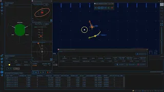
ranges and over the top in order to refine depth okay that's 3d slam if you saw in the software and this is fusion to software again you can only do this in fusion - in real time so RB is doing it's offset circle you're gonna swing by closest point of 5 meters we've got a horizontal estimate going on here and a depth estimate going on here so you can do the depth comes right down as we swing over the top and on the screen here you can see there's this fan appearing which is where we're
getting decent range information into the Kalman filter so you can see that's likely to end up as a nice 60-degree cone which is enough information to refine our horizontal position of our transponder okay that's what it looked like in freeze-frame okay so horizontal estimate here depth estimate here this is an indication of how far the subsea transponder is moved based on the drop location that we initially gave it which brings us back to our scenario okay so I just do how old on earth we calibrate this we talked about slam so the process we're likely
to go through Israa boxing the first one because it's useful to have an own cordon on the sea bed in order to kick off the eye nests and dead reckoning all that sorta okay we can also position everything relative to that once we kick this process off but you wouldn't necessarily need to box in a compact as I said before it might be a repopulated structure compared with a known coordinate okay so in this particular case we're gonna use range information from this initial transponder we're gonna 3d slam our first transponder that we put on
the seabed ranging to all of them we're going to fix this one in 3d then we're going to position our next one ranging to all of them then we're gonna move on to the next one we may fix this one and use the range information from all three of these to position these two in 3d really slow the slammer algorithm has a maximum of three transponders in it at any one time so obviously this one we would have to fix at some point in order to calibrate these three these further three okay and that's why
I said we might fix this one or we might leave it in the slammer algorithm whilst we go and do these two because we've got the maximum then of three in the slam computation okay not to say you have to do that but that's that's the limitation currently okay so that's basically how we would calibrate our triangular array and our line here and as you saw before we could do a long line of transponders quite happily using this this type of technology is everybody happy with that so far before I just talked about a real-world
example just give me a thumbs up or a tick that's a that's a basically the process of a 3d slam how you would tackle that problem that we talked about excellent everybody's happy that it's tough okay let's just finally touch on a real-world example metrology is a good place to go because it is a highly precise task to do subsea so we did a comparison between a full acoustic metrology and slow metrology and we've got very very decent results that's comparison so what we've got here is our now we're going to put our connecting piece
between the two structures this is what we call a point-to-point metrology so it probably got a gyro come by here and the gyro come back here the reason the gyro come back is because we want to collect pitch and roll information and having information in order to complete the metrology but what we can use the slam algorithm for is to define the distance between these two points because we can define the horizontal positions and we can also define the depth using the same algorithm so our AV would run a series of trajectories this particular case
it's doing a big circle collecting ranges all the way around these two transponders and what we'd also do is a smaller circle here where we go over the top or as close to over the top as we can in order to define the depth okay so we do a 3d slam here and then we do a trajectory here to define horizontal position which would give us results this is the results that you see so we did the trajectory around the outside to smaller circles to define depth and the results you can see over here so
compared to a conventional metrology this is our horizontal distance we're going at a difference of 8 millimeters and our depth difference compared to our conventional metrology was only 16 millimeters so it's incredibly incredibly competitive you know if you can see in the picture here there's two other transponders in a brace quad network so we compared it against the for conventional braced quad metrology that you're likely to see most commonly used so just to conclude why would you use farce lvl and slam so just just to finalise this whole series really is in when we're using
these systems there's an incredible amount of vessel time saved because we've got less transponders the time saved to calibrate these things is is a lot you know we've saved a lot of time deployment time calibration time and all that sort stuff so it's incredible amount of vessel time saved which is money to the to the end client you know they've saved a lot of money we can do these large footprints so we can spread these arrays out quite quite large large areas and still maintain capability to calibrate them quite happily utilizing the systems we've got
with fewer compacts something 100% line-of-sight of compact is not necessary so you know we can we can dip behind structures we can we can can travel longer distances between transponder updates and we still maintain a fairly high precision it's fast and simple to mobilize so we've got these these systems that we can mobilize onto an ROV and the current spread that we use is that his eyes is a sprint Nav with one connection to the topside because it's got a pressure sensor and a Doppler built-in and the connection for the Rove nav is just one
connection with power and coms into the top and sprint none so it's very very simple to set up our nest can become a standard fit on the ROV so what we started doing at Sona dainese rather than going to survey companies with with with these systems we actually go to the source so we go to the ROV team and the RV manufacturers and the AV manufacturers and we and we fit these systems are standard so that across the board anybody that's using that that particular system has the capability to do this this type of technology
so money saved and removal and replacement costs for them for the end-user you know that the survey company may save a lot of money themselves because I'm got a remobilize all these systems all the time is there a standard fit on the vehicles themselves so it also provides greater re capabilities so you got these RVs that have got these highly advanced systems in place constantly which means that it's that it's improving the RV capability from from the offset and then finally faster update rates of position and sensor data with white Bentley infusion to we haven't
talked too much about this what we have in the in previous webinars but not today but but obviously by coming on a training course and you're going to learn about all these advantages that come from using wideband 3 infusion 2 and how that ties into slam and sparse networks and that's what's done so we've improved the efficiency of everything across the board using these systems which brings us to the end of the webinar so hopefully by now you understand what slam is and you appreciate the methodologies to achieve a slam calibration of sea bed transponders
just to recap we've we've been through the whole webinar series we just finished webinar six so that is the conclusion of the series excellent it's been a pleasure delivering it all if you want any more information on our training courses we are going to be running full training courses starting in June and that's LBL course is an iron s courses and Ranger to us PL courses so we are in the process of doing online conversions and they will be ready in June so if you want any information on those contact as a training on the
website or on LinkedIn or Twitter or you can email us at training at Sona 9.com thank you for your time and stay safe you