august 29 2005 after passing over the caribbean hurricane katrina made landfall along the gulf of mexico by the time the skies cleared katrina had killed more than 1800 people caused roughly 125 billion dollars in damages and went down as one of the strongest storms to hit the u.s in a century five years later nasa revisits katrina as captured by nasa satellites while these images can't tell the whole story of the hurricane and its impacts they remind us of the power and destructive nature of tropical cyclones in the weeks leading up to katrina nasa's aqua satellite
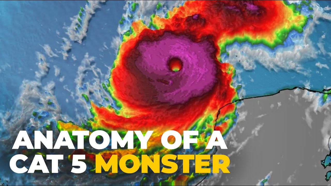
captures sea surface temperatures with the amster-e instrument warm ocean temperatures indicated in red provide energy to fuel the growing storm as katrina moves it leaves a trail of cooler water in its wake stirred up from below two days before landfall nasa's miser instrument on the terra satellite witnesses growing cloud tops as the storm gathers strength just before landfall the trim satellite looks inside the hurricane at hot towers powerful thunderstorms that help propel katrina to category 5 strength the same satellite reveals heavy rains green means at least a half inch of rain is falling per hour
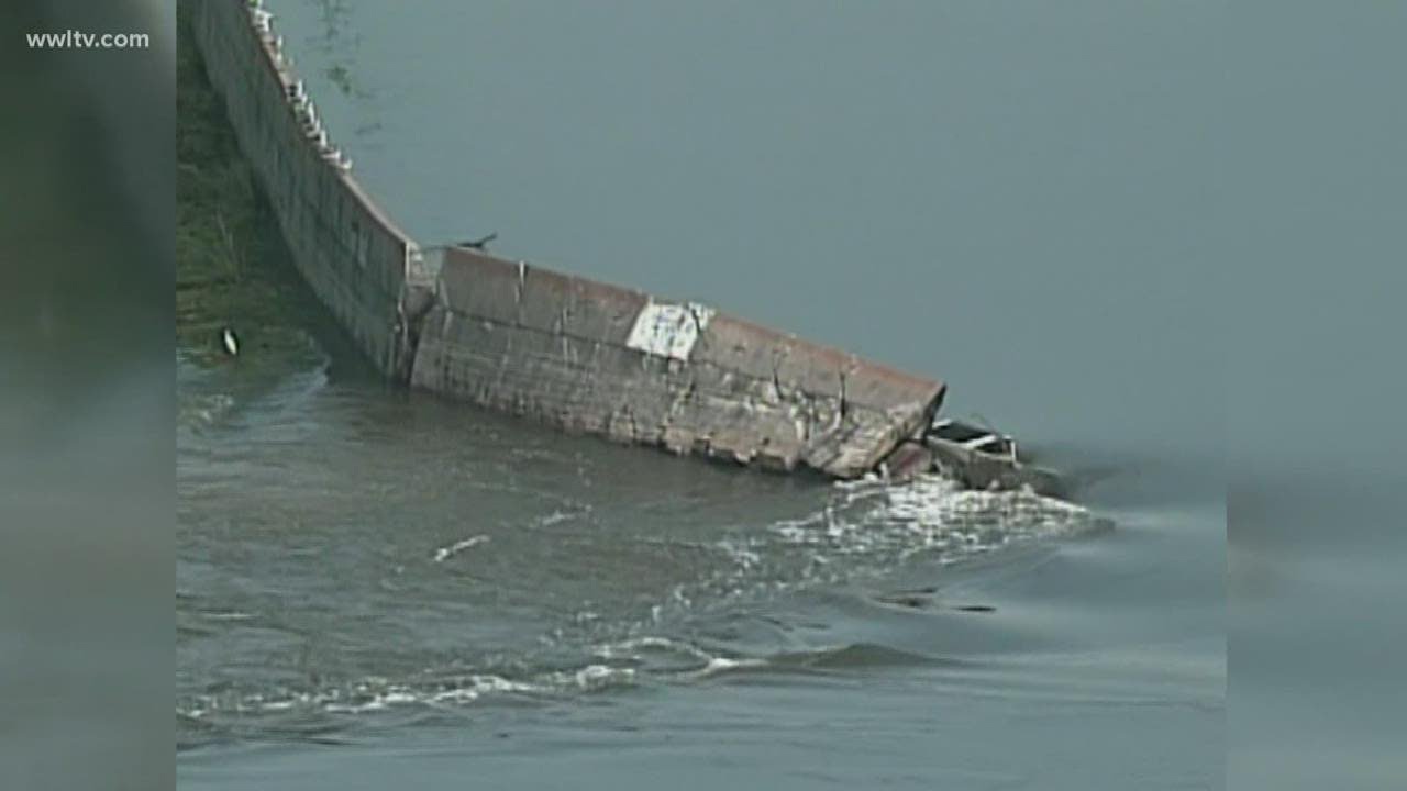
yellow an inch red over two inches per hour as the hurricane sweeps through trim's multi-satellite analysis reveals where the hurricane delivered the heaviest rains shown here in yellows and reds finally landsat satellite imagery shows us the extent of flooding in new orleans first the city before the storm with lake pontchartrain to the north two days after the storm made landfall much of the city is flooded by the catastrophic levee failures today landsat sees a city still rebuilding from the storm nasa satellites continue to provide detailed observations of tropical cyclones around the world to better understand
how they work and so we can prepare for those yet to come you