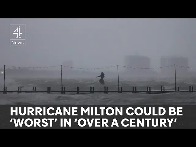
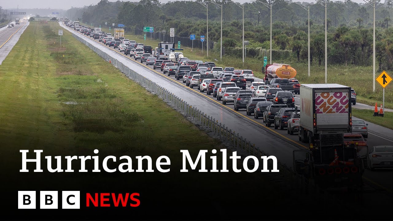
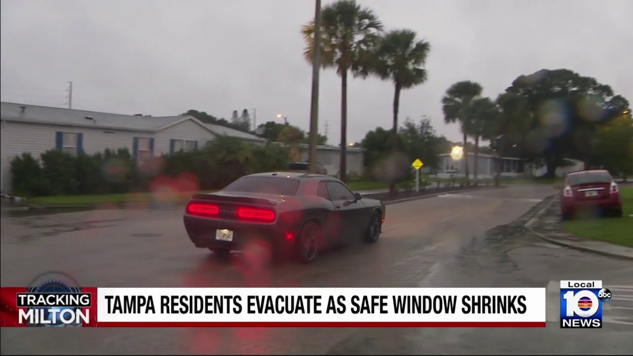
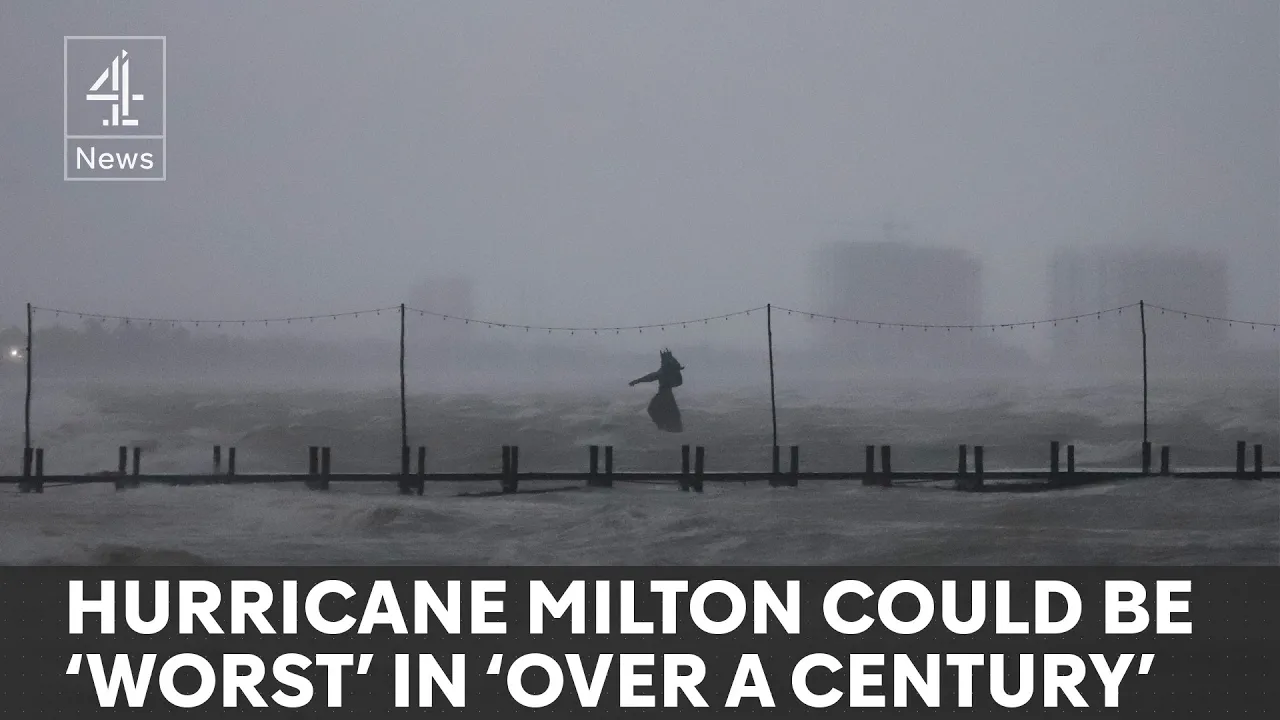
hurcan Milton is on its way and these residents aren't taking any chances cars jammed Bumper to Bumper as tens of thousands of residents of Florida's West Coast flee the impending storm that experts warn could be the most powerful to hit this region in a century it's also the second hurricane to hit the coastline in as many weeks and is currently barreling towards the major city of tamper whose mayor had a stark warning for anyone even thinking of staying put this is literally catastrophic and I can say without any dramatization whatsoever if you choose to stay
in one of those evacuation areas you're going to die the president today canceled plans to travel abroad to oversee preparations as the monster storm hurtles towards Florida bringing life-threatening storm surge and heavy rainfall we're driving our preparedness for hurricane in Milton which uh could be one of the worst storms in 100 years H Florida it's a matter of life and death and that's not how pero it's a matter of life and death Milton began as a category 1 hurricane before exploding to a top level Category 5 with Winds of 180 mph in record time leaving
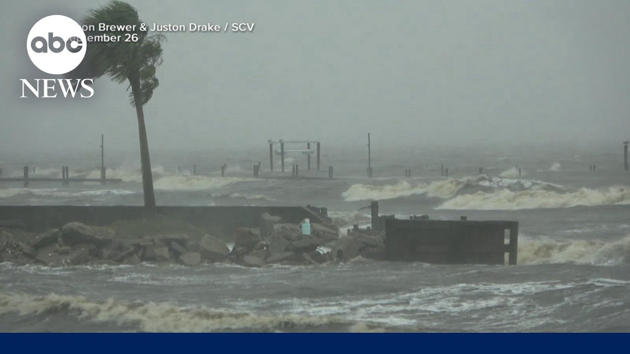
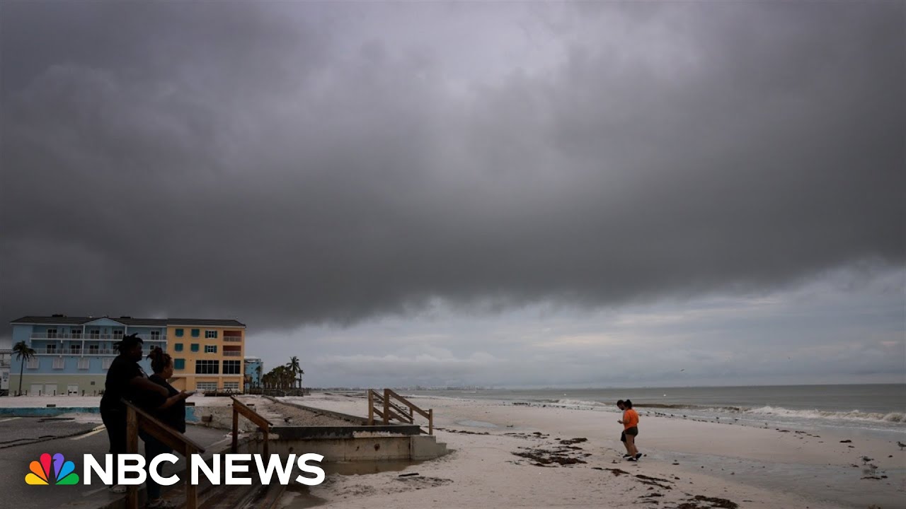
one veteran meteorologist stunned and choked up as he delivered a News Bulletin it's just an incredible incred inredible incredible hurricane uh it has dropped it has dropped 50 mbars in 10 hours um I apologize this is just horrific although Milton could weaken before making landfall the wall of water it is pushing ahead of it won't this storm surge is often the greatest threat to life in some areas of predicted to receive up to 15 ft of water the highest ever for the region to make matters worse residents are still reeling from the aftermath of hurrian
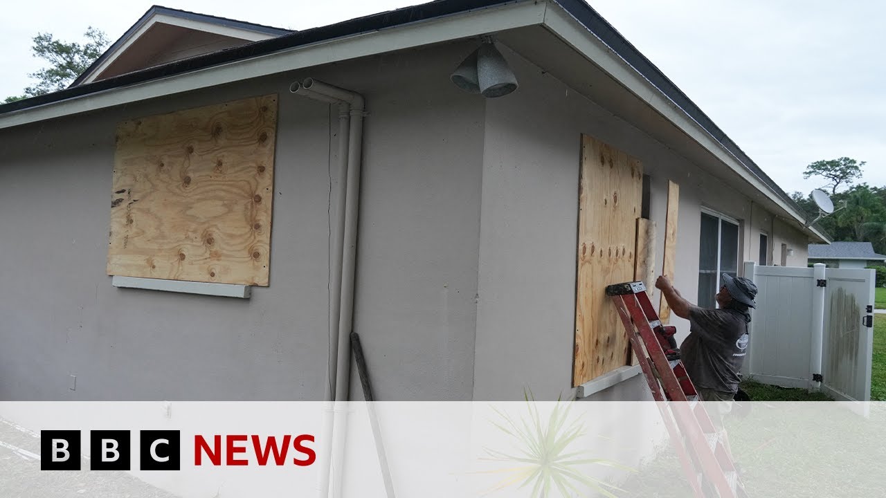
Helen which hit a fortnight ago a race against the clock to put debris out of Harm's Way and evacuate before tomorrow it's really frustrating that the last hurricane came the storm and they've screwed around and haven't picked the debris up and now they're scrambling to get it picked up and if this one does hit it's going to be flying missiles stuff's going to be floating flying in the air fed by the warm Waters in the Gulf of Mexico Milton became the third fastest intensifying storm on record in the Atlantic Ocean the heat in the sea
has been abnormally high and that heat acts like Rocket Fuel propelling the storm forward propelling the politics too Florida's Republican Governor Ronda santis yesterday reportedly refused calls about the storm from vice president kamla Harris because they in his words seemed political in turn Harris blasted disanti after being briefed by emergency experts just utterly irresponsible and it is selfish and it is about political gamesmanship instead of doing the job that you took an oath to do which is to put the people first she also criticized her rival Donald Trump who she said was spreading lies including
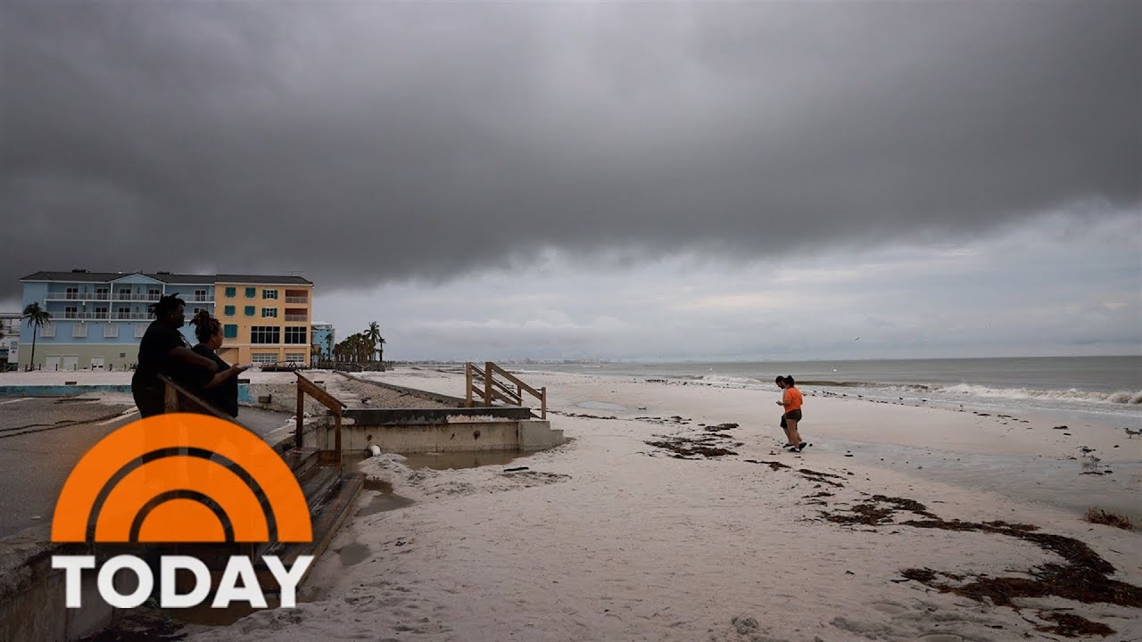
claims that funds were being diverted from Storm survivors to migrants there's a lot of Miss and disinformation being pushed out there by the former president about what is available in particular to the survivors of Helen and first of all it's extraordinarily irresponsible it's about him it's not about you on the ground it's about preparation doing everything you can to get ready to brace yourself before the monster storm descends so just how remarkable is this hurricane compared to others our weather presenter Liam duton is in our London Studio to explain more Liam thanks Aisha well hurricane
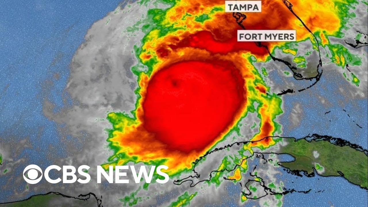
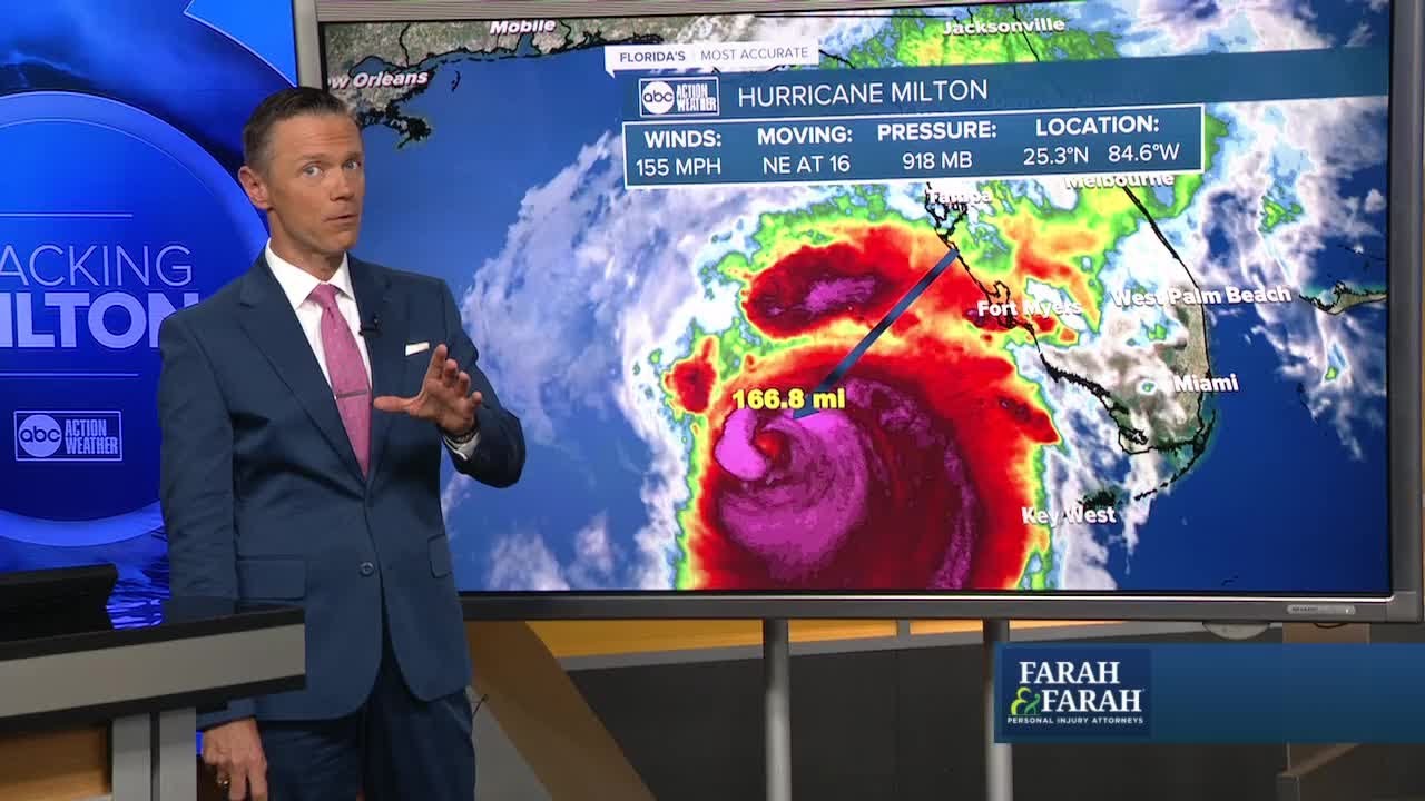
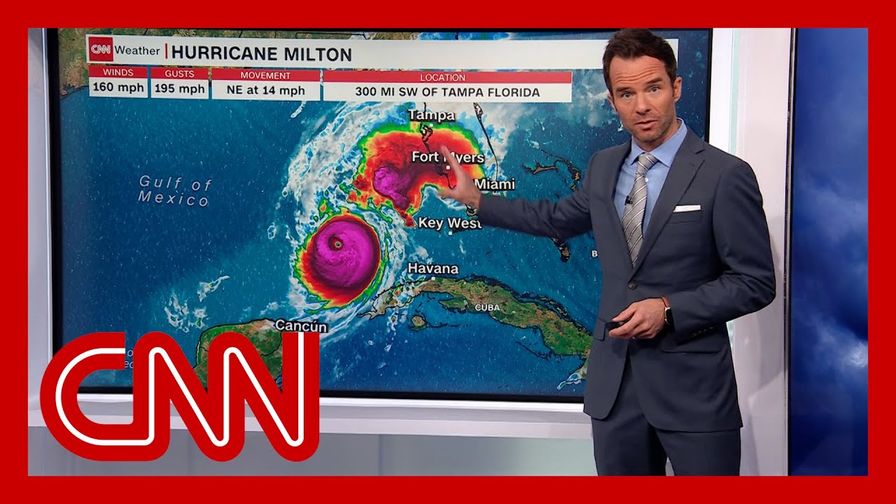
Milton is a phenomenal storm here it is on the satellite picture earlier today spiraling around very quickly some very strong winds and of course it rapidly intensified from a tropical storm to a category 5 storm in just the space of 24 hours now this storm is the fifth most intense at atantic hurricane on record in terms of its pressure Peak winds so far have been up to 185 milph that's a top end Category 5 storm and it's delivered the strongest winds on record so late in the year across the Gulf of Mexico now as we
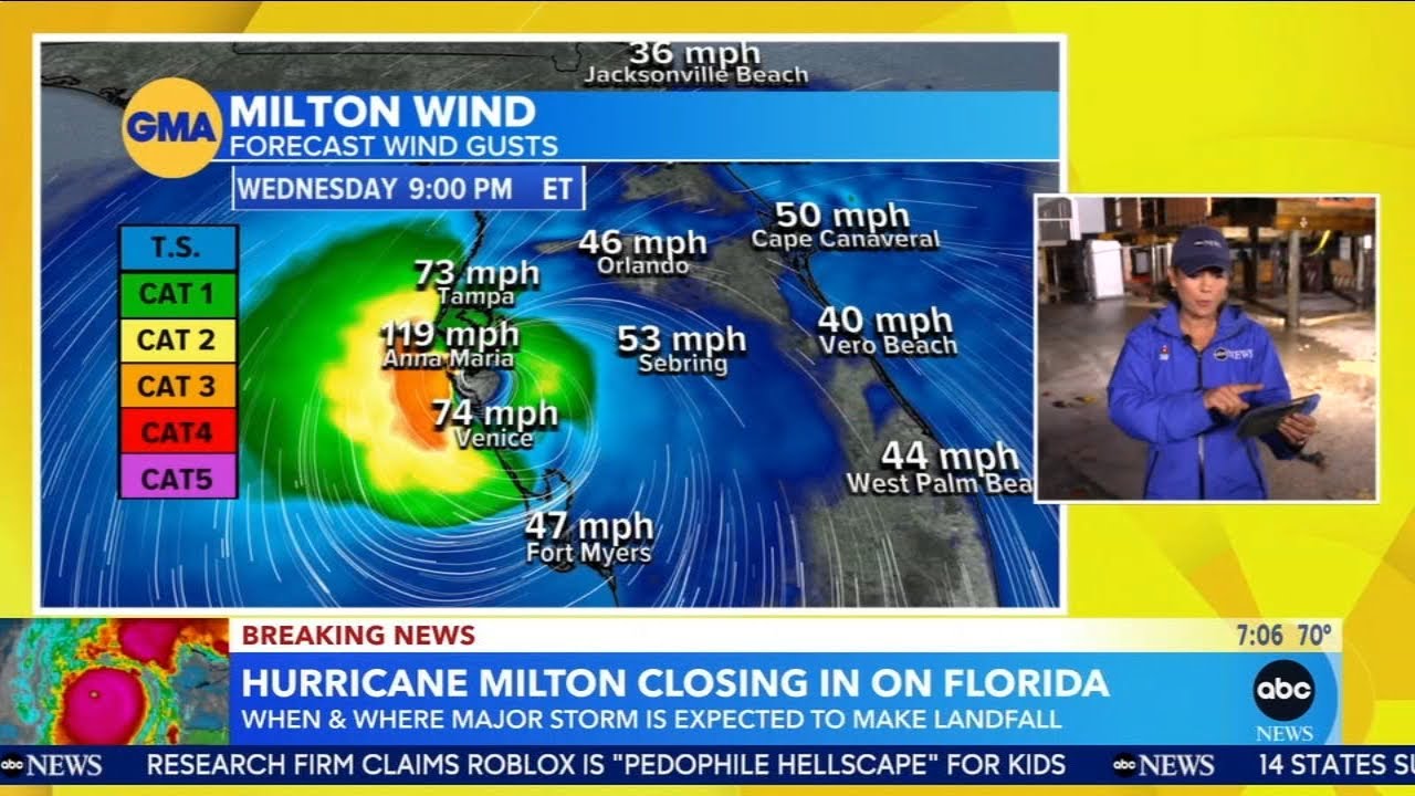
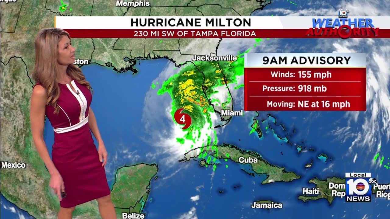
know these storms are fueled by the very warm Waters and with the climate change and the oceans becoming even warmer rapidly intensifying storms like this one are expected to become even more common as we head further into the future Liam we've seen a lot of changes with this storm what the latest predicted path that it has well Elisha thankfully today the storm has weakened ever so slightly but it's still a powerful category 4 storm and in the next 48 hours it's going to Barrel eastwards across the Gulf of Mexico likely making landfall on the west
coast of Florida late Wednesday into the early hours of Thursday local US time as a category 3 storm and with that there'll be very heavy flooding rains damaging winds and a tremendous amount of storm surge that is a very big concern you say there's concern about storm surge why is that when we think of hurricanes you usually think of wind don't you you do and it's simply because storm surge is the biggest killer the greatest cause of fatalities over the Atlantic hurricanes over a 50-year period almost half of fatalities were down to storm surge compared
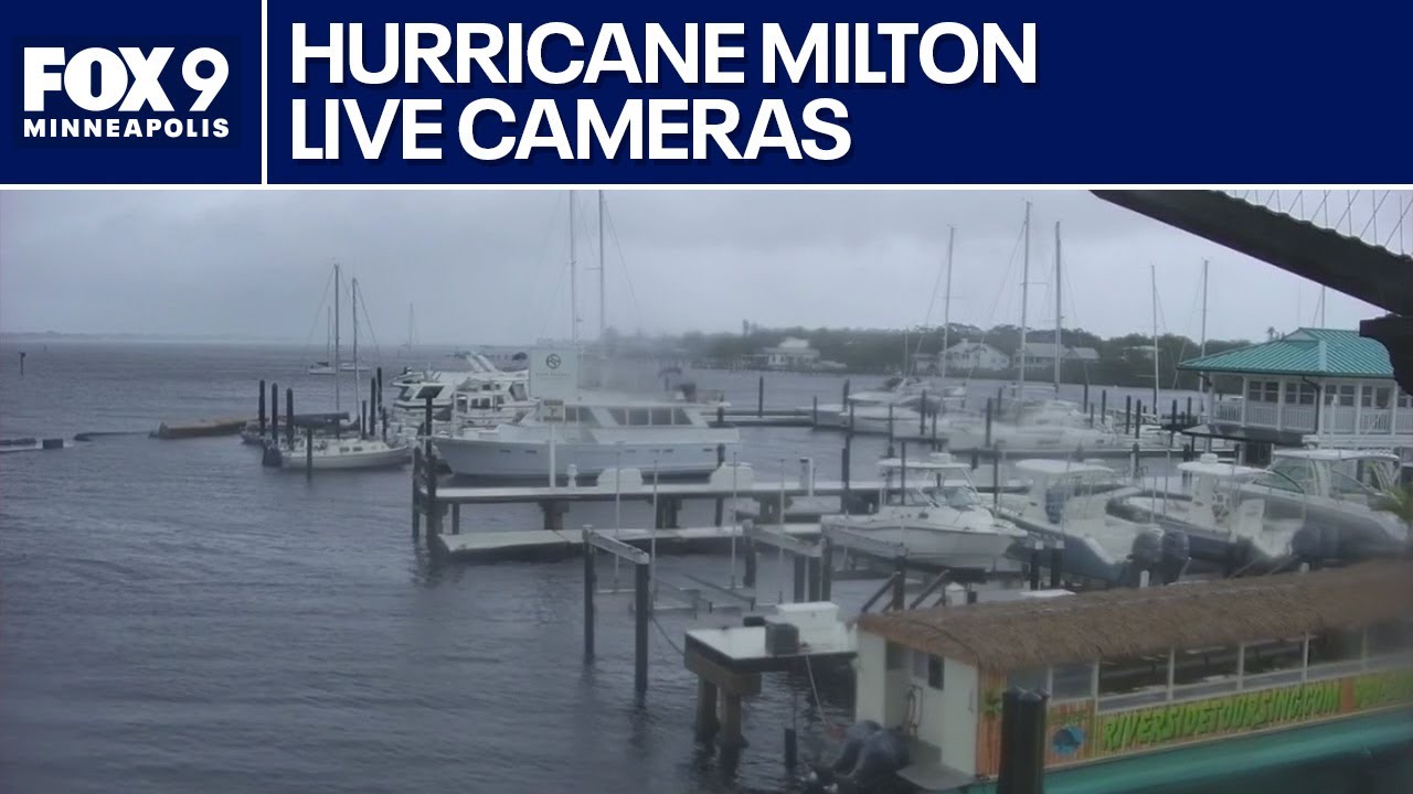
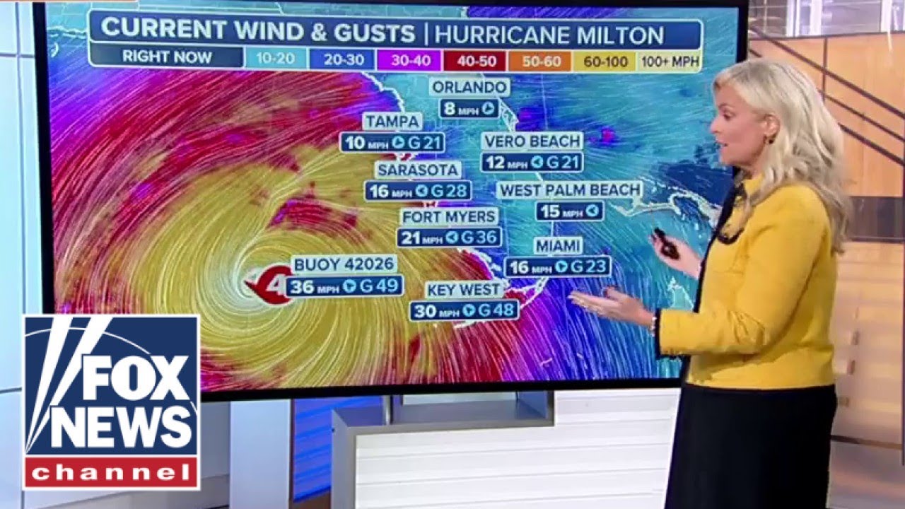
to just 8% due to the wind so how does storm surge work well on the southern side of these hurricanes you get these intensely strong winds they literally lift up the water throw it towards the the shoreline and the water just keeps going in land sweeping away and inundating everything in its path now this is the latest prediction from the National Hurricane Center and the peak storm Sur around the Tampa Bay Area could be as high as 10 to 15 ft that is higher than a double decker bus a very worrying and developing situation indeed
Aisha thank you Liam I know you'll be keeping an eye on that for us