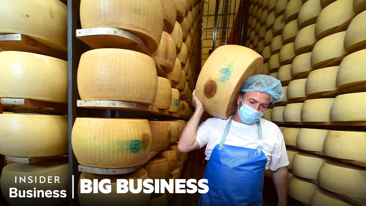
Wind is the driving force behind our weather. It’s part of what turns a sunny day into a stormy one. But climate change is altering wind patterns.
Winds will change as temperatures rise. In the United States, hurricanes are getting more powerful? devastating ever-larger areas.
Weather disasters are also becoming more common in Europe, in part because climate change is affecting the jet stream - strong winds ten kilometers above the ground. The jet stream is like a guide. It’s a highway for storms.
The high-altitude winds are affected by arctic temperatures. And recent developments are alarming. We know that when winds increase, so do extreme weather events.
Shifting wind patterns pose a threat. Wind is the motion of air, triggered by differences in temperatures and air pressure. Multiple studies have found the wind speeds of winter storms are getting faster - increasing by up to five percent in Central Europe.
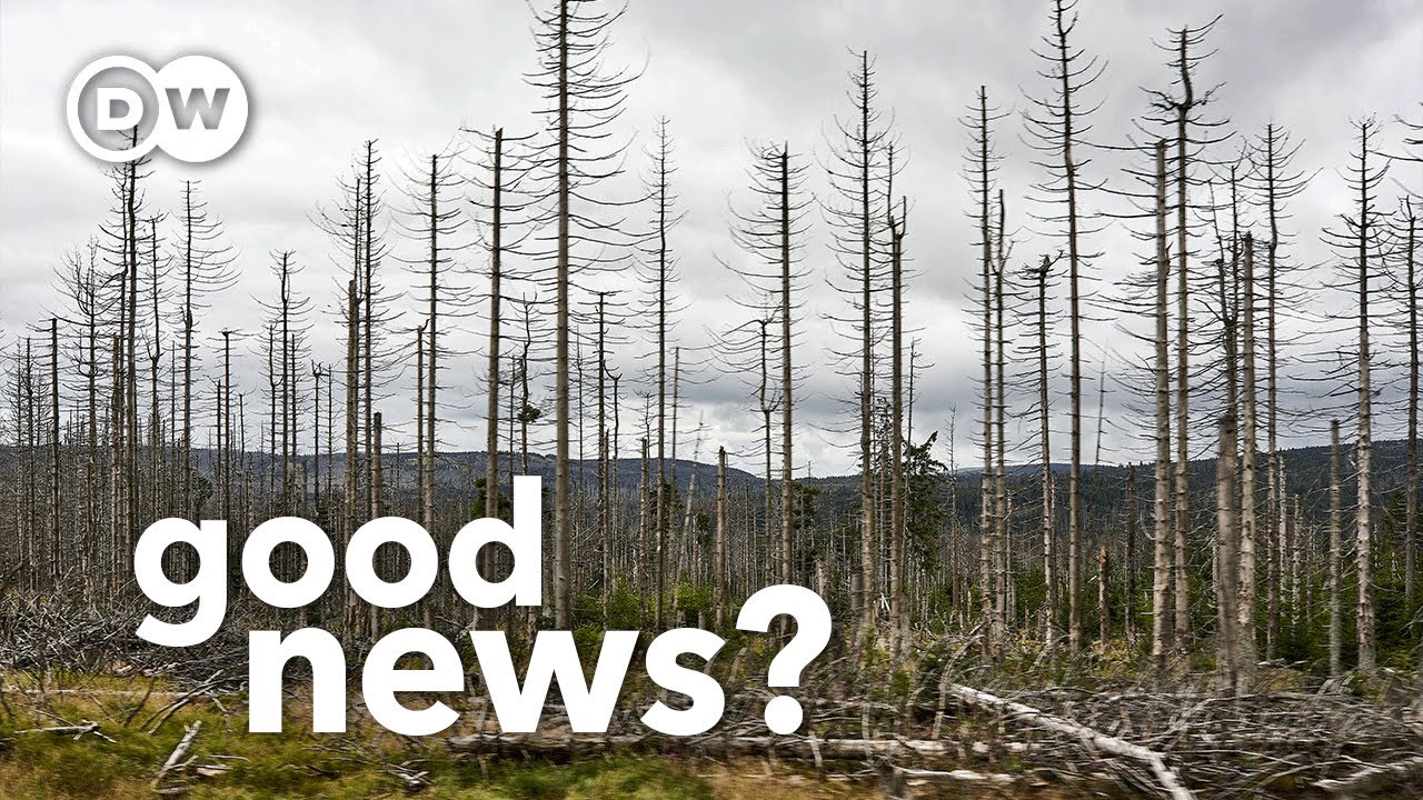
Storms are also lasting longer and wreaking more havoc than before. That effect is clearly observed in our forests. In the last thirty years, seventeen percent of the protective canopy in European forests has disappeared.
In part because of storms getting more powerful? ? and causing extensive damage.
Like here in the eastern German state of Mecklenburg-Western Pomerania. Heiko Schulz and Mathis Jansen are looking at a group of coniferous trees in the wake of a storm. Heavy rains and hurricane-force winds from the Atlantic snapped trees while knocking down and uprooting others.
Extreme summers are compounding the problem. The heat takes a toll on the trees, making them more vulnerable to insects. Once the trunks are infested, they become brittle and more susceptible to storm damage.
It’s a vicious cycle. The fallen logs must be removed from the forest or else they’ll become breeding grounds for insects. Dead wood cannot defend itself, so pests can easily eat into the bark and multiply.
Healthy trees that aren’t under heat stress can produce resin and fend off attacks. It’s clearly a jewel beetle, with this cloud-like pattern - in contrast to the longhorn beetle. The side edges are well-defined.
Different from the bark beetle. Classic example. Yep, textbook.
And down here - that’s jewel beetle larva. This is an insect that will benefit from climate change because it loves heat and can locate weak, damaged trees from about 20 kilometers away. They’re multiplying.
Climate change is triggering a dangerous chain reaction in our forests. Ordinarily, this storm would create the ideal conditions for a pest infestation because now there’s all this breeding material for the insects - or at least there would be if we weren’t here. We had a similar situation in October 2017 with Storm Xavier.
But back then, there wasn’t enough time to clean it up. In the spring there was still some of this material leftover. And then when the bark beetles emerged around April and May, they found the right temperatures and material to breed.
You can imagine what happened. In order to save the forests, storm debris must be removed quickly. But this requires more machinery and more personnel.
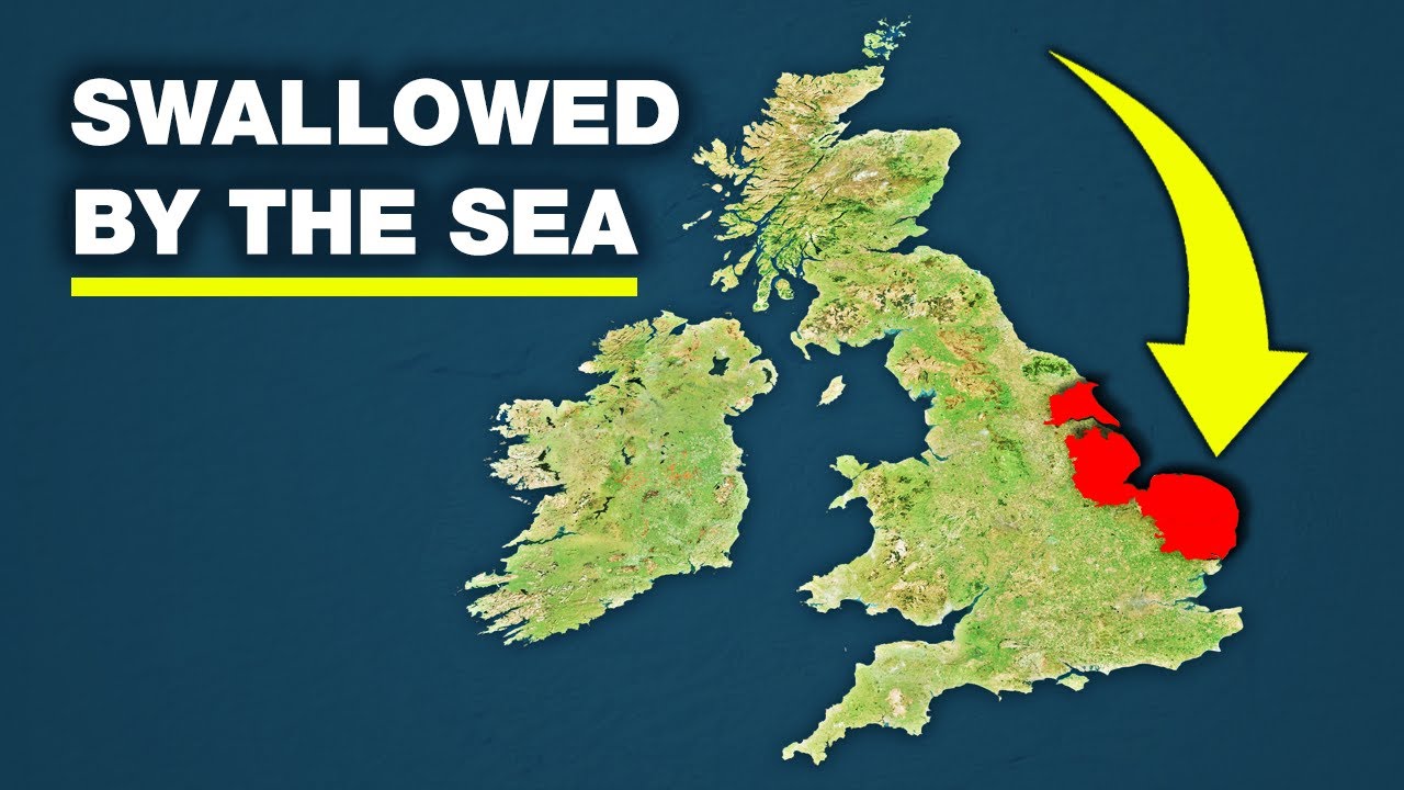
In southwestern France, the winds sweep to the Atlantic coast unimpeded. Workers in the town of Soulac Sur Mer regularly clear sand off the streets. The sand must then be returned to the beach.
During winter storms, it plays a crucial protective role when the waves crash relentlessly into the coast. The effect of rising sea levels can also be seen here. In 2014, a series of winter storms brought waves that were a meter high.
This apartment block was in danger of being swallowed by the sea. Since then, the town has installed artificial breakwaters and raised the dikes. But that hasn't solved the problem.
Researchers believe that the top speeds of storms will be even higher here in the future. Every spring, the region's coastal observatory inspects the damage from the winter season. Let's go there and set up.
Thomas Bulteau and his colleagues are installing their measuring equipment at the beach in Biarritz. They pair their base station to a satellite using GPS. It measures the exact location of the device as well as its distance from sea level.
The measurements have become necessary because our coastline changes drastically every year. These shifts are threatening the coastline in some spots. These regular measurements are critical to track the changes.
Our data provides a solid foundation for planning and risk management on endangered stretches of coastline. Offshore rocks help protect the beach on this stretch of the coast. Still, the potency of storms has long-since been a problem, as has the rising sea level.
During strong storms, sections of the cliffs simply break off. The beach is battered by two opposing forces: The wind carries the sand away, blowing it inland. And storm surges wash the sand toward the sea.
The beaches are becoming shallower by several millimeters each year, slowly leveling out with the sea level. When we have storm after storm with heavy rainfall, as we did recently in December, we see major movements along the coastlines. The precipitation then accelerates the ground movements even further.
It’s a combination of the sea, wind, and rains that are all taking a toll on the Basque coast. As the beaches become shallower, the sea has an easier time working its way deeper and deeper into the cliffs. The sandy coastline is in danger of disappearing.
Protecting it against future storms would cost billions. I think we’ll have to come to terms with relocating houses and people. At the moment, the legal and financial framework is lacking for such a solution.
But it’s becoming evident that living safely on the coast will only be possible if nature is given more leeway. But that means we have to retreat further. I think that's realistic.
At the Potsdam Institute for Climate Impact Research, scientists are investigating how climate change impacts our weather. What is the relationship between extreme heat waves, relentless rainfall, and powerful storms? Efi Rousi and Stefan Rahmstorf are studying shifting wind patterns.
Until now we have seen some changes. And actually what we have seen is very much depended on the region and the season, so for example in the winter we do see a strengthening of the storm tracks, especially over the northwestern Europe. In summer, we see the opposite.
We see the weakening of the storm tracks. Winds will change as temperatures rise, because the Earth doesn’t get warmer simultaneously or uniformly everywhere. And the driving force for winds are temperature differences between different regions.
It’s quite clear that wind conditions will also change due to global warming. And this will of course impact people. The driving force for our weather operates at about 10,000 meters above the ground.
High-altitude wind is created when warm air masses flow from the equator to the colder north. The earth's rotation directs these air masses around the globe from west to east. A first wind band is formed near the subtropics.
A second, stronger band forms around the 60th parallel. It draws its power from the temperature differences between warm air from the south and cold air from the north pole. This north polar jet stream drives low- and high-pressure areas across our latitudes.
But researchers have discovered that the jet stream is slowing down. The arctic regions have been warming faster in low level so near the surface of the Earth, compare to the rest of the globe. So practically this means that this temperature gradient - so the differences of temperature between the poles and the equator - becomes smaller, compared to the past, to the normal.
And when we have smaller differences, this would mean weaker winds and weaker jet streams. The Arctic. It’s become three degrees warmed in just the last 50 years.
That's a far swifter pace than the rest of the planet. Since the start of industrialization, Earth’s temperature has risen about one-point-one degrees. On Spitsbergen, meteorologist Marion Maturilli of the Alfred Wegener Institute is researching what’s leading to the accelerated warming - and what effects it’s having.
She also coordinates all the scientific work being conducted here at the joint French-German station. Research in the Arctic has become more important, in part because climate change is more pronounced in the Arctic than in other regions of the world. And here in Ny-Ålesund, it’s possible to measure and document the effects of warming in different areas as well as study the individual processes.
Ny-Ålesund in western Spitsbergen is the world’s northernmost settlement. It’s an important place for climate research. Eleven nations have research facilities here.
The French-German base’s observatory has many different instruments. Maturilli has already documented the first consequences of the rising temperatures. In the winter months especially, the air currents are coming more frequently from the south.
There’s now more warm and humid air coming from mid-latitudes. This impacts precipitation and the clouds that form here. It’s also altering the local climate, which is concerning.
I’ll fill the balloon with gas? Observatory engineer Fieke Rader helps with various studies at the Arctic station. Every day at 12:00pm, she launches a balloon with a probe that sends back weather data.
Maturilli uses the data to determine how rising Arctic temperatures affect the jet stream. To gain a comprehensive understanding of the effects of global warming at various altitudes, balloons are launched simultaneously from different locations around the world. They fly up to 30 kilometers high before their rubber bursts.
These are crucial for my research because it’s the only way to get measurements 30 kilometers up, and the height resolution is very high as well. The balloon rises 5 meters per second and takes a measurement every second. We get a reading every 5 meters.
Other devices can’t do that. Maturilli’s measurements clearly show that the jet stream has changed. Changes to wind patterns inevitably impact Earth’s living beings.
In a forest near the village of Chizé lies one of the most important bird research centers in France. Henri Weimerskirch regularly sets off from here on expeditions to the planet’s most remote regions. For years he’s been going to the Crozet Islands off the coast of Antarctica to study wandering albatrosses at a breeding colony where they raise their offspring.
In 2012, he made a discovery. After analyzing the long-term data which we’d collected over 20 years of observing these birds, we noticed changes in the movement patterns of albatrosses. We also noticed the birds were having more success reproducing.
Even the average weight of the birds had changed. On average, the adult birds weighed about one kilogram more than two decades prior - even though they hadn’t increased in size. The population of albatrosses in the breeding colony also changed, with more chicks surviving each year.
The researchers only discovered the reason for these developments after analyzing the region's weather data from the past 20 years. The change in wind conditions is why. We could prove that the flight speed of the albatrosses had increased.
Due to the higher wind speeds, the birds flew significantly faster. And their weight increased too. They expended less energy foraging because they found the same amount of food in less time.
That’s why they gained weight. The albatrosses benefited from a westerly wind flow that had shifted further toward the South Pole due to rising temperatures. It was a chance discovery that proved for the first time how profoundly changing wind conditions affect life on Earth.
Until then, the impact of climate change on animal behavior was completely underestimated. The fact that it could change the speed of an animal species’ movement especially surprised us. The drastic effects of changing wind patterns are already being felt by German farmers.
The interaction between rainy and dry phases has become more erratic. Farmers have to increasingly deal with crop failures. Farmer Jan Wittenberg now relies on plants that can cope with freak weather events.
Lupine has excellent root growth. It stretches downward with a taproot and can unlock water reserves that elude other plants. It also helps improve the soil structure so that other plants can thrive too.
In fact, last year, which was our second extremely dry year, lupine gave us top yields, despite it being so dry. And all the others, especially the grain, essentially failed. Climate change has long-since arrived in the heart of Europe.
But for farmers who still doubted that fact, the heat wave in the summer of 2018 opened their eyes to the harsh reality. Wind didn’t drive rain clouds over their fields for weeks. We’d been discussing climate issues and the advent of extreme weather events for a long time, and unfortunately there were still people who didn’t want to believe it.
But I think that was a wake-up call for everyone that the situation was getting worse. Weather conditions had changed, and we had to adapt. Jan Wittenberg in Lower Saxony already began adjusting to these changes years ago.
I haven’t plowed for over 20 years because I’m convinced that no-till farming is better for the soil, the plants, and the system. For one thing, we can manage extreme rainfall better with ground infiltration - water can travel down through those vertical corridors, sinking deep into the soil. And we don't experience as much erosion from wind and water.
While the lupine has just been sown, the rapeseed fields are in full bloom. Wittenberg's goal is to extend the harvest as long as possible. We have to try to adapt.
That means we may have to adjust our crop rotations, cultivate other crops, and most importantly, cultivate many different types of crops. We must increase diversity so that we spread the risk. The risk is lowered when diversity is greater.
Are extreme summers in Germany a result of changes in the Arctic? Marion Maturilli is seeking the answer to that question on Spitsbergen - where the weather is much too good for researchers’ liking. In past Septembers, it was often above zero degrees Celsius too, but the difference in the past was that the fjord was rarely completely free of ice.
Those times are now over. Even in winter, it no longer freezes over. Maturilli and her team are on their way to another measuring station.
Here, the scientists filter and analyze particles driven in by the wind. Air pollutants show us just how connected wind systems are around the world. We measure pollutants here that the wind has carried over great distances.
Pollution from industrial regions or even from Siberian forest fires reach the Arctic and can be measured here. The next stop is a glacier on the bay’s eastern shore. This is where the ice in the fjord comes from.
But it’s continuing to break away. The glaciers on land are also retreating. As a result, the sea level is rising.
But compared to the South Pole, the masses of glacial ice here at the North Pole are small. Maturilli considers the disappearance of the ice cover on the oceans to be even more serious. When sea ice retreats and covers less of the ocean, it exposes more of the water’s surface.
That means less sunlight is reflected, simply because there’s no white surface to do so. Instead, you have the dark water surface absorbing the heat and further warming the ocean-atmosphere system. That's a feedback loop.
Also, the exposed water surface is conducive to more evaporation into the atmosphere. That means: The atmosphere becomes more humid and warmer overall. That impacts cloud formation, among other things, and there again is that feedback loop, so the climate gets warmer.
Yet another reason the Arctic is getting warmer. But does it really affect the jet stream? At the Alfred Wegener Institute in Potsdam, climate scientists are processing the data from the Arctic and creating models.
They’re calculating if what’s happening there is accelerating climate change. Meteorologist Dörthe Handorf also studies the sea ice in the Arctic by analyzing satellite photos. We can see from these curves that the sea ice is decreasing relatively continuously.
If we look at individual years through the lens of any given month, so here for example the values in September, we see that the sea ice has decreased since the late 1970s and this negative trend is about thirteen percent per decade. Without sea ice in the north polar region, the Arctic continues to warm at a much faster pace. Dörte Handorf has factored this trend into climate models and is studying what that means for the jet stream.
We’ve shown that reductions in Arctic sea ice cover can impact the jet stream. When there’s less sea ice cover, the jet stream weakens in late winter and blocking weather patterns can occur more frequently. Blocking weather patterns occur because the slowed-down jet stream is no longer flowing as tightly around the Earth.
Its loops increase in size and comes to a standstill. As a result, high-pressure or low-pressure areas remain over a region for longer than usual. The red high and blue low pressure areas are not alternating as they once did?
which can result in extreme weather events. Such fluctuations in the jet stream have always existed, but the Potsdam researchers have proven that climate change can trigger them? with catastrophic consequences.
There’s a very clear connection between the jet stream and extreme weather events. For example, there’s sometimes a phenomenon where very strong loops - vibrations in the jet stream from north to south - stop on the spot. And that results in long-lasting weather situations.
And depending on what that situation is - if it’s rain, for example, it can lead to flooding. And if it’s a high-pressure system overhead, it can lead to heat waves and drought. We don’t know yet whether those weak stages of the states of the jet stream are becoming more frequent or different.
However, what we can say is that even small changes in the jet stream, even if it is a little weaker in summer for example could bring this proportional units in parts on the surface on extreme weather. Changes in wind patterns are one catalyst of extreme heat waves and devastating droughts like those we saw in the summers of 2018 and 2019: High-pressure systems stuck in the weakening jet stream. When low-pressure areas are trapped in the jet stream, it can lead to steady and heavy rainfall, as was the case with the flooding disaster in Germany’s Eifel mountains in 2021.
But when is a single weather event directly linked to climate change? In Potsdam at the German Meteorological Service, Frank Kreienkamp calculates these correlations. This new branch of science is called attribution research.
In our climate models, we first simulate the situation as it is now. The reality of where we are as humans and the changes we’ve brought about. Then we take the same climate model and simulate it as if humans had zero influence - in other words, that neither greenhouse gases nor land use had changed.
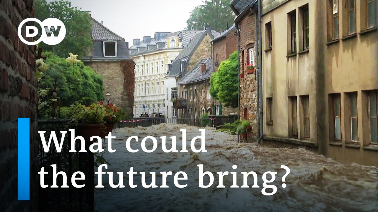
And when we compare the results of the two models, we either see a change or we don’t. The 2021 flooding disaster in Germany that resulted from heavy and continuous rainfall was one of the year’s most severe weather events. Attribution researchers used their comparative models to assess the incident.
Climate change played a role in the events that triggered the flash flooding in the Ahr Valley and Erft River. It increased the probability by a factor of 1. 2 to nine compared to pre-industrial times.
We can’t give an exact number because the information is not that precise, but you can draw an example from it. Currently, this occurs every 400 years. If we take a number between 1.
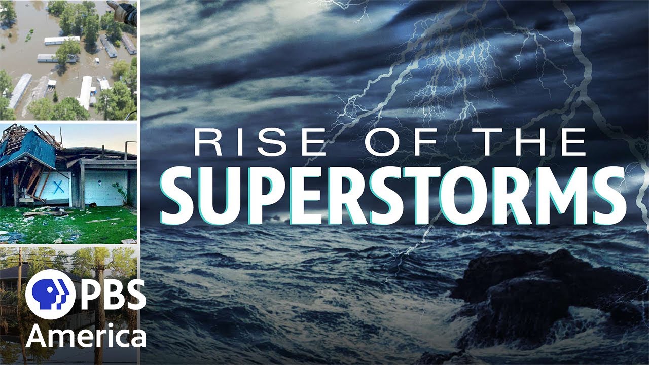
2 to 9 - namely the number 5 - it would have occurred every 2,000 years if it weren’t for climate change. Princeton University in the US state of New Jersey is one of the world's most prestigious research institutions when it comes to understanding climate change. Professor Tom Knutson and his research group investigate hurricanes and how climate change is altering them.
He also studies the consequences for people living in regions where hurricanes occur more frequently. We’re expecting hurricanes are going to be more intense as the climate continues to warm. That’s not a huge effect - the size of that effect is something like three percent.
Now that three percent in windspeed implies a greater percentage increase in damage by the way because we think damage from hurricanes goes up not just linearly with windspeed but perhaps as the third power of the wind speed so that really may indicate something more like a ten percent increase in wind damage potential. New Orleans in the state of Louisiana. The debris lining the streets and the blue tarps are signs of a recent hurricane.
Exactly 16 years after Katrina destroyed large parts of the city, another hurricane wreaked havoc here. Ida - a Category 4 hurricane, the second-highest designation - swept through the city at about 240 kilometers per hour. Repairing the damage is a daunting task.
For D'Artanian Stovall, August 29th, 2021 marks the day he lost his home. He’s since moved in with his brother. It’s difficult just standing here and looking at it.
I mean there are so many memories, so much work that I did on the house. My family had been here since 1978, so it’s been quite a while. It’s surreal, that’s the only word I can really find to describe any of it.
As you look at the other houses, you think maybe I’ll have some roof damage, or? It’s a funny thing it’s just? my house fell.
This is just unbelievable. The storm reached Louisiana on the morning of August 29th. Meteorologists warned of the danger, but evacuation was out of the question for many residents - including D'Artanian Stovall.
He remained at home, hoping the storm would pass. He was upstairs when the wind hit his house, tearing it apart at the seams. He had to escape from the rubble.
I’m up in the air with a lot of it because I’m deciding if I stay in New Orleans. The entire process of hurricane preparedness and kind of hunkering down or deciding to go somewhere else. And they seem to be occurring more often.
And this was the anniversary of Katrina - the 16th anniversary. And you just get tired of the process. Even when you don’t get hit by it, the prep to deal with it.
Louisiana got hit with full force of Ida. But experts think hurricanes will be even more destructive in the future. Another effect that we’re expecting out of hurricanes is an increase in the rainfall rates, because a warmer atmosphere holds more water vapor, typically.
So these hurricanes that are happening in this large scale environment when there’s more water vapor and the hurricanes are converging this water vapor towards the storm, so we expect that to be a seven percent increase in rainfall rates for every one degree Celsius rise in the sea surface temperatures. Hurricane Ida is seen as fulfilling the prophecy of climate change. The storm moved along the east coast of the United States, bringing relentless rainfall.
More than 90 people died. In Lambertville, New Jersey, the rain caused a stream to burst its banks, transforming it into a raging torrent. The waters pushed the house of the Cepparulo family off its foundation.
The family of four had evacuated thanks to a storm warning. To my left would be the children’s room. My daughter and my son would have been - their rooms were right here.
That’s where the water first came and hit and pushed everything up from the ground floor. We had a large hardwood floor and it buckled into a V and once the water came into the house, it pushed everything right out of there, right down into the creek. The Cepparulos' house has since been demolished.
Their neighbor’s house was also unsalvageable. Officials won’t allow them to rebuild because the chance of a similar disaster is too high. The dangers of heavy rains, brought on by future hurricanes, are increasing.
The propagation speed of tropical storms and hurricanes over the US land regions has decreased since 1900. When a storm slows down that means they’re going to spend more time over any given region. So a storm that’s going more slowly, you’re going to have a greater accumulated rainfall in a region, which leads again to more flood risk.
The European Organization for the Exploitation of Meteorological Satellites in Darmstadt. European weather services get their data from its satellites, which are a key source for monitoring weather. Paolo Ruti is the facility’s chief scientist.
He’s working to improve forecasting but his employees have only been able to measure the wind in space indirectly. We get very detailed information on the infrared and visible channels, and we derive this information. We have different clouds at different heights, so we determine the movements of the clouds and from the movements of the clouds, we infer the wind vectors.
It’s important because it gives the model the capacity to well-position the storms und to well-position the dynamics of the storms how the move towards the certain part of the continent. So far, satellite observations have revealed little about the jet stream. But a new measuring system is set to change that.
It’s already being tested in space so that researchers can glean how high-altitude wind influences the weather on Earth. What is happening to the surface and what is happening 10 kilometers high are really extremely important to understand and to predict those systems. So those are the areas where we would like to have more and more observations.
And we have now a kind of prototype who is already flying which is called Aeolus one - the God of wind - so it’s already giving us the possibility to understand these systems. The European Space Agency developed the satellite and its wind measurement system. A UV laser scans the area between the satellite and the Earth's surface.
It uses the reflection of molecules beneath it to measure their speed. The satellite has been orbiting the Earth since 2018. At the Leibniz Institute for Tropospheric Research in Leipzig, Holger Baars and Sebastian Bley regularly check the data from the Aeolus satellite.
These are last week’s measurements? Yes. Its measurements becomes available about three hours after Aeolus passes over any given region.
Each of these rectangles represents a wind measurement taken by Aeolus, and Aeolus measures about 30 kilometers from the ground up. We can see blue colors and yellowish-red colors. You can see here on the scale - in this example, red colors show easterly wind and blue colors show westerly wind.
Darker rectangles indicate stronger wind. That dark blue strip represents the jet stream. There’s a bit of color variation that’s visualized here quite nicely.
That's because there's a lot of turbulence, so it's difficult to take precise ground measurements from space. Let's see what the radiosonde measured. Every Friday, the satellite flies over Leipzig.
Then the researchers launch a weather balloon, outfitted with a measuring probe. How high up did it measure? The radiosonde was 24 kilometers high.
Good, then it covered the entire altitude from the Aeolus measurement. Exactly. The balloon probe in Leipzig may take more precise measurements than Aeolus, but only the satellite can provide comprehensive data on the jet stream.
Aeolus measures with a precision of five to eight meters per second in cloud-free areas. If you know you’ll get a random error or imprecision within those parameters, then that's perfectly fine for use in weather models. The German Meteorological Service in Offenbach.
Here, scientists review Aeolus data from space and translate it into weather forecasts. This is where Alexander Cress first gained direct access to data about the jet stream. We use Aeolus in our global model.
The jet stream drives the high- and low- pressure systems on Earth, especially in the Northern Hemisphere. The better we can predict the path of the jet stream, the better we can predict the path of low- and high- pressure systems. If the jet stream slows down, there could be a cluster of extreme weather events.
This data should help better predict disasters in the future, allowing authorities to order evacuations earlier. It’s a big advantage to have comprehensive wind observations that we didn’t have before. Take the last flood catastrophe for example - such events will increasingly affect us in the next ten or twenty years.
And the better and more accurately we can measure winds over the Atlantic or the Pacific, the sooner we’ll be able to predict them and warn people. But merely predicting the weather conditions brought on by the changing winds is not enough: We also need to adapt. In Lower Saxony, a long dry spell is battering the fields of organic farmer Jan Wittenberg.
His lupines aren’t getting enough rain in the late summer. These here are actually good - these three. The other three haven’t fully matured.
A lack of water makes things difficult for all plants. The lupine handles it like a pro but yields less. It still a good product though.
If you remove the little ones, you’ll still get full, beautiful grains. It’s good quality and suitable as food, but there’s less of it. That's how it is.
Nature cuts back when one factor becomes scarce. And in this case, it’s water. Lupines are just one of ten crops Jan Wittenberg is harvesting this year.
He already harvested a great portion of his fields before the dry spell began. In general, he opposes irrigating fields. There’s no question that some crops need targeted irrigation.
But I think it’s fundamentally wrong to react to this increasing water shortage by pumping in water artificially. That leads to competition between drinking water and irrigation water, and between the water that nature undoubtedly needs. We can't solve these problems by ramping up irrigation.
That will only treat the symptoms in the short-term. We need to look for long-term solutions and work with nature. Back on Spitsbergen, Fieke Rader and Marion Maturili are headed to a field outside the Ny-Ålesund research settlement.
They’re studying a piece of land that was previously iced over all-year-round. Now, in early September, the ground has thawed out everywhere. It's very uneven though.
Every stretch of ground is a little bit different. Once every month, Fieke Rader hammers down these poles into what's called permafrost to assess how much it’s thawing. Can you check if the pole’s still moving?
Hold it here. Not moving anymore? The depth is 95 centimeters.
Based on the temperatures, we’d expect more, but as I mentioned - the ground here is very uneven, so it varies greatly. That's why it's important that we measure at 12 different spots and always measure the same exact hole, so we know very precisely how each specific hole changes. Fieke also has to swap out a filter that collects the CO2 released by the thawed soil.
There's a filter in the tube that stores the CO2 coming out of the soil. Then scientists can analyze what kind of CO2 it is - whether it's CO2 that's been released by plants that are growing here now or that are fresh in the soil, or whether it's CO2 that's been released by the soil itself. In other words, very old organic material that’s been in the soil for many years and is now being released due to the warming.
The thawing of the soil further drives climate change. There are exchanges between the soil and the atmosphere, partly of gases and partly of heat and moisture flows. And that in turn has an impact on the climate and the processes that are reflected in this coupled system between the atmosphere and the soil.
Climate change has altered the wind, and the altered wind continues to drive Arctic warming. Glaciers and sea ice are retreating. The jet stream is more often sluggish as a result.
Heat waves that lead to crop failures and parched forests are becoming more likely, as are devastating heavy rainfalls. But there is still time to act. Luckily, we’re no longer dependent on burning material to generate electricity.
We can generate electricity with photovoltaics and wind. We don't need to burn material for heating either - we have heat pumps. And we have induction stoves for cooking.
So the key factor is to get out of fossil fuels quickly and use these alternatives. To meet the Paris targets of one-point-five and two degrees, we have to go one step further. To reduce the concentration of greenhouse gases, we have to take them out of the atmosphere.
One way to remove greenhouse gases from the atmosphere is to increase the amount of forest area worldwide. Mathis Jansen and Heiko Schulz from the Mecklenburg-Western Pomerania state forest are doing reforestation work at a former spruce conservation near Schwerin. We’re in the process of forming a new tree population here.
We're doing it now with hardwood. Our colleagues are in the process of planting red oak, because we want to establish a population that’s better equipped to handle dry summers and ongoing periods of drought. We’re no longer relying on spruces and certainly not on monocultures.
We’re developing a mixed forest. Everything going to plan? Good planting material?
Roots OK? Reforesting this area will take a lot of time, work, and money. It will be decades before the targeted logging of individual trees becomes profitable.
We don’t know what the tree species of the future will be. There are certainly tree species we expect to have better characteristics than others to withstand these changing environmental conditions, like droughts in summertime, dry periods, extreme heat. Our strategy is to bet on a variety of trees, spread the risk, and bring in different tree species.
This single reforestation project won’t increase the global forest area. It’s about repairing damage, which is also urgently needed to address climate change. But it’s no easy task.
If you look at the current climate models and projections - which look very bleak in parts - you really worry about which tree species will survive in the future. Or how our forests will look in 2100, or whether it's just a matter of preserving them somehow and storing CO2. Perhaps the economy will then take a backseat.
That could happen. At the Karlsruhe Institute of Technology, researchers are looking for a way to not only remove greenhouse gases from the atmosphere but harness them. Roland Dittmeyer and his team are working with a variety of companies.
This system from a Swiss company sucks in air and passes it through a filter. Chemical molecules in this filter can bond with the CO2 in the air and with the water vapor. In other words, these two components are separated from the air.
At some point, this filter is fully loaded and sort of locks its doors - both front and back. Then the collector heats up, which causes the CO2 and the water vapor to come down from the filter and be extracted. Then the water is condensed, and you have pure CO2.
Carbon monoxide is isolated from the CO2 and enriched with hydrogen. The mixture contains high levels of carbon, which is the basis for combustion fuels. CO2 from the atmosphere is to replace oil, gas, and coal.
The real art here is to achieve high-energy efficiency during the conversion. We put in renewable electricity and produce energy sources, which of course contains a certain amount of energy and the rest is loss. But if you can effectively interlink the individual steps of the process, then you can achieve high-energy efficiency.
The system here functions similarly to energy crops. The idea is to filter CO2 from the air and replace fossil fuels climate-neutrally. So far, however, these technologies have been extremely costly.
I believe that this method is indispensable for combating climate change. We have no real alternatives to kerosene for certain applications, such as long-distance air travel. And at the end of the day, if I synthesized the kerosene using CO2 from the air and renewable electricity, then I basically have a cycle.
When it's burned, it of course creates CO2 in the atmosphere again. But because I've extracted my CO2 from the atmosphere with renewable electricity, it keeps the cycle going. On his fields in Lower Saxony, organic farmer Jan Wittenberg has been practicing agriculture that protects the soil, environment, and climate for years.
He also factors in the changing wind conditions by making use of trees. With a wind like this, you can imagine that a row of trees can serve as a windbreaker. Handy when there’s a drought.
The soil doesn’t just fly away, the trees help prevent wind erosion. The trees also draw out water and nutrients from greater depths to disperse for their fruit and foliage. This also generates humus, and of course the field can benefit from that in the long term.
This kind of integrated agriculture is called agroforestry - meaning Wittenberg designates parts of his cultivated land to the trees. We want to plant three big linden trees here, and with this we want to give a signal to the state about this combination of trees, fields, and grassland. And they’ll stand exactly on the border between grassland on one side - which is being newly developed on former arable land - and our arable land on the other.
Jan Wittenberg is a pioneer. He’s long since adapted his farming to the new conditions brought about by rising temperatures and the changing jet stream. Just carrying on with business as usual was never an option for him.
We’re seeing what we’ve sown by altering the climate, and we must reckon with the consequences as well. That means we ourselves have to change. We of course have to put enormous effort into ensuring we don’t change the climate even further.
But we have already created these conditions, so it’s up to us and nature to adapt. And for that, we need new ideas. There’s no use traveling down the same roads we’ve always gone down, hoping fate will somehow intervene.
Changes to the jet stream have become a dangerous driver of climate change. And their driver is the greenhouse gases that we as humans keep producing.