[low static humming] [sprawling atmospheric music] ♪ ♪ - Welcome to the geospatial revolution. - In a world where everybody's texting, geospatial technology is critical to understanding what's happening at a particular location. - It's the speed of the internet.
It's the capability of remote sensing satellites. It's software like Google Earth. Taken altogether, you have an explosion in the way we view the Earth.
- Everybody's somewhere, everything's someplace, and a map is a way of organizing all of that information. - It's information from aircraft, from satellites. It can be a collection of information from a tower that you've set up.
- We've been using maps for hundreds and hundreds of years to know where we are. Now that nice lady tells me which way to turn. - Turn right then turn left.
- Virtually all of the information that you're sharing with anybody these days has some kind of geospatial tag on it. - It's really the human element. There's basically this entire information ecosystem that we have access to now.
- I can receive information. I can transmit information. I can broadcast my location.
And that is revolutionary. - It's amazing. It's cutting-edge.
It's-- well, changing the world. - In 1/10 mile, turn right at stop sign. - Some people will call this a GPS.
It's not. It's a GPS receiver. It is, I think it's fair to say, a miracle of science and technology.
It's able to collect signals from global positioning satellites far up in space. - Each one of them is, every moment of every day, saying, "This is the location that I'm at in orbit around the Earth. " If you know where you are with respect to three satellite points, you can use mathematics to determine where you must be on the face of the Earth.
- There are millions of coordinates encoded in this box. - Recalculating. - And it can take those coordinates and render a map on the screen for you.
- Turn left on Whitehall Road. Then turn left in 0. 3 miles.
- Where do all those coordinates come from? Where do those streets come from? Lots and lots of people driving special cars continuously up and down every single road and digitizing those roads into a database that then can be downloaded into this little box.
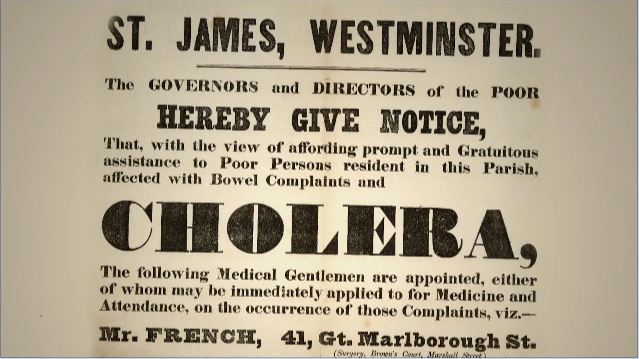
[electronic beep] - There's nothing new about mapping. You can imagine without being able to talk, somebody showing where you're going, and draw a line showing where the river is and an X where they are now and an X where they're gonna go. - Viewing the Earth has really been based on technology.
The Babylonians etched the lay of the land on clay tablets in 2300 B. C. And then in the 15th century, with the advent of printing, they started making maps using wooden blocks.
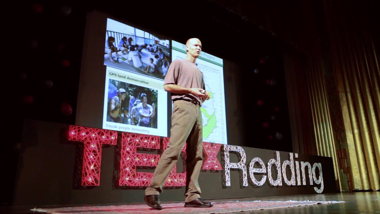
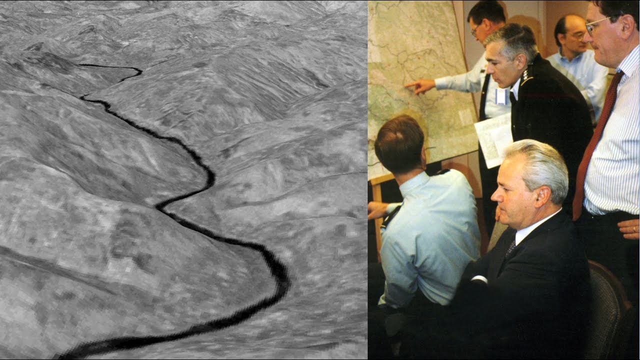
- Surveyors would map by making measurements in front of them to a reference point and then back behind to the reference point they had just passed. That information had to be transcribed into a map. - From in the air, it's as if we sent out thousands of surveyors all at once.
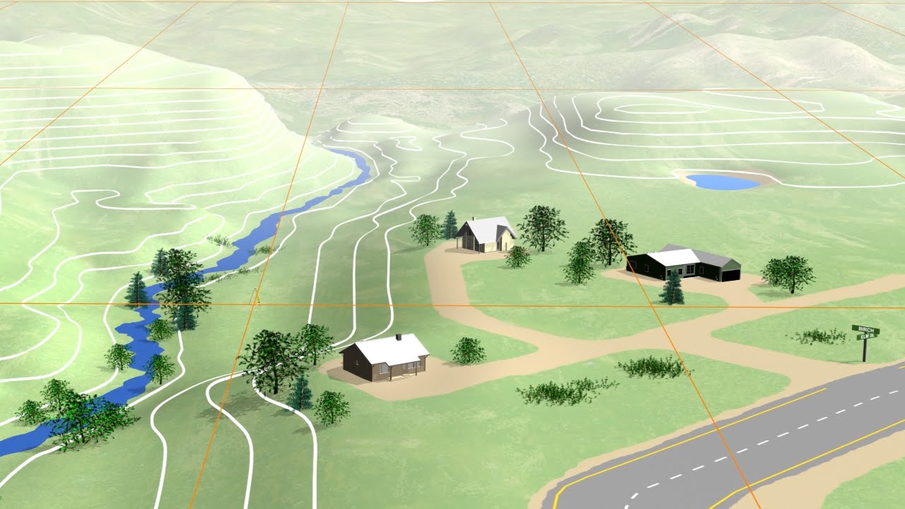
Remotely sensed data provides highly accurate measurements of the Earth and the features upon it. [rocket rumbling] - We rely on satellites for pictures of the Earth, for communications, for navigation, for weather. - Geospatial technology has become woven throughout the fabric of how we live.
- About 50 years ago, people came along and started building on big old mainframes geographic information systems which would integrate on a map information about culture, about population, about demographics, about physical environment. GIS allows us to bring it all together. - I used the first commercial GPS receiver.
Took two men to carry it. Our antenna was a meter-square piece of aluminum. We had to have a generator for it, massive batteries.
- The census bureau in the United States needed to capture all of the line work for roads, railroads, hydrography, and then boundaries. That formed the basis of the first TIGER files in the late 1980s in support of the 1990 census. Tiger was an impetus to technological developments like MapQuest, Yahoo, followed by Google.
- Google Earth introduced people to the coolness of place. "I am here. Where's the nearest Starbucks?
" Or, "Where's the nearest hospital? " - Now we're all carrying around GPS. We've got really rich interfaces that allow us to do things that we would only imagine previously.
- On a mobile device, you are the center of the map, and the city is around you, not you see a city and then look for yourself on the map. It's putting you in the map. [electronic tone] [horn honks] [phone rings] - Say you find yourself in a location that you don't know very well.
You might want to find a place to have dinner. Well, what places are around? And which places have other people rated very highly?
Maybe you want a particular kind of food within a 15-minute walk. - I've got not only a restaurant, but I've got the map. I can find the reviews of it.
I can find out what the menu is. - We're moving away from me having to actively search for something to now search is telling me what I should check out that might be interesting to me. These are the things where location and search start to come together.
- We're becoming individual sensors. We're creating this huge sensor network of people holding these mobile devices. And that information is two-way.
[electronic beeping] - It's not just passive collection, listen to your GPS technology tell you how to get to some place. You're gonna say, "Wait a minute. "I see a problem.
"I want to report that problem. I want to see that someone's going to respond to that. " - We were playing basketball.
We see, like, the ground keep on moving. I see a lot of people, some of them dying, like the ceiling, like, killed them. - I have both extended family members and close family members who live in Haiti, and the first reaction was more, like, surreal, "Is this really happening?
" - We needed to know where we could go in, and so we used geospatial technology to prepare the area with information before we even got there. - Approximately 2/3 of the cell towers stayed active. And aid workers and Haitian nationals were posting information saying that they needed help.
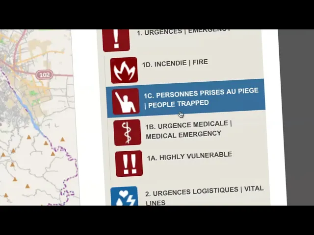
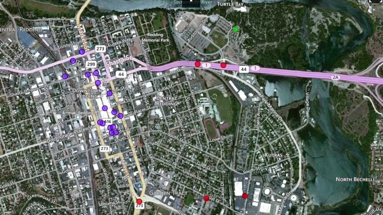
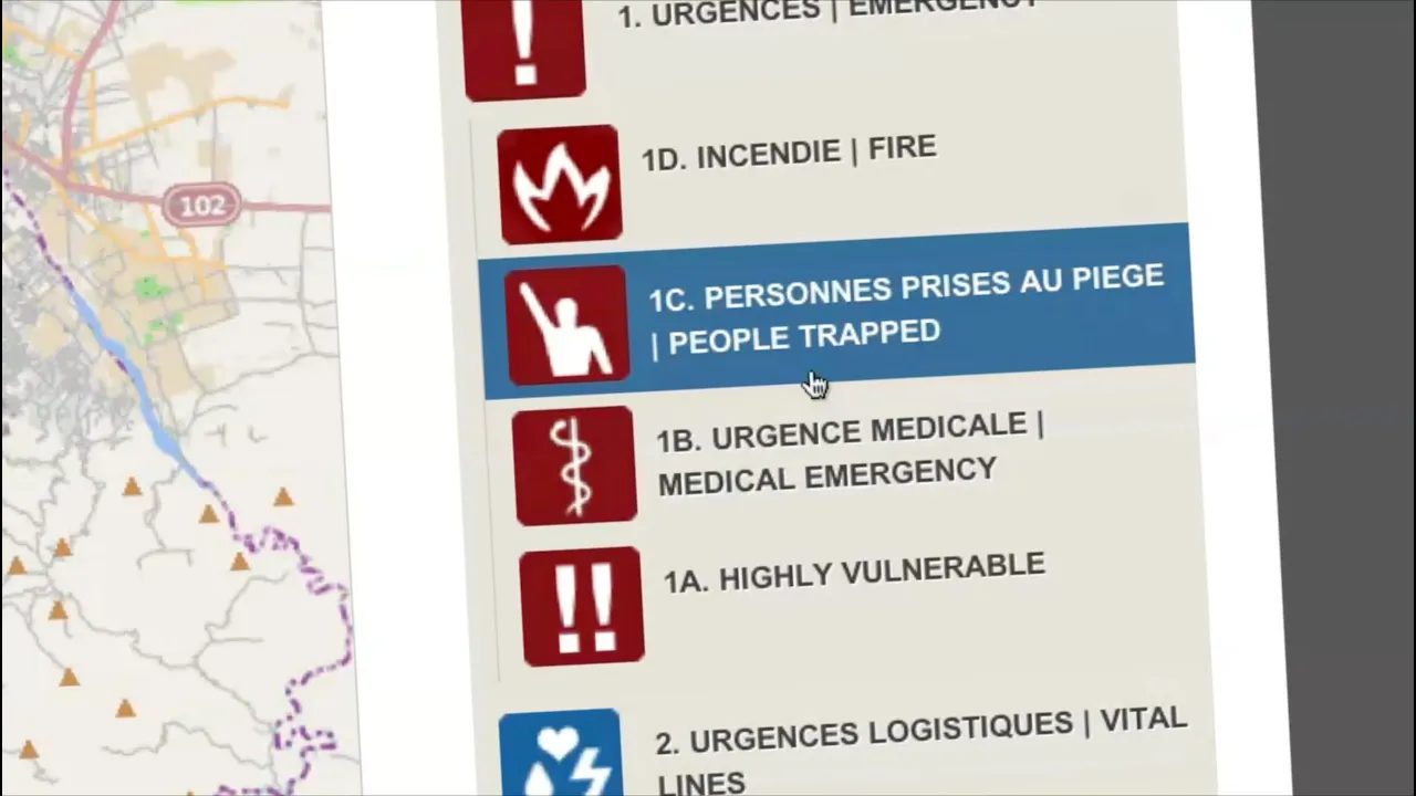
- I was watching CNN and immediately called our USHAHIDI tech lead in Atlanta I told him that we really need to move and set up an USHAHIDI platform for Haiti. - USHAHIDI is an open-source platform for crowd-sourcing crisis information. Basically, that means you are following local media, Twitter, Facebook, text messages, any sort of information you can get.
Once you aggregate this information, you map it, you have a real-time picture of the actual situation on the ground. This information can be used by rescue workers or anyone. - With an USHAHIDI platform, you can decide what kind of map you want to use.
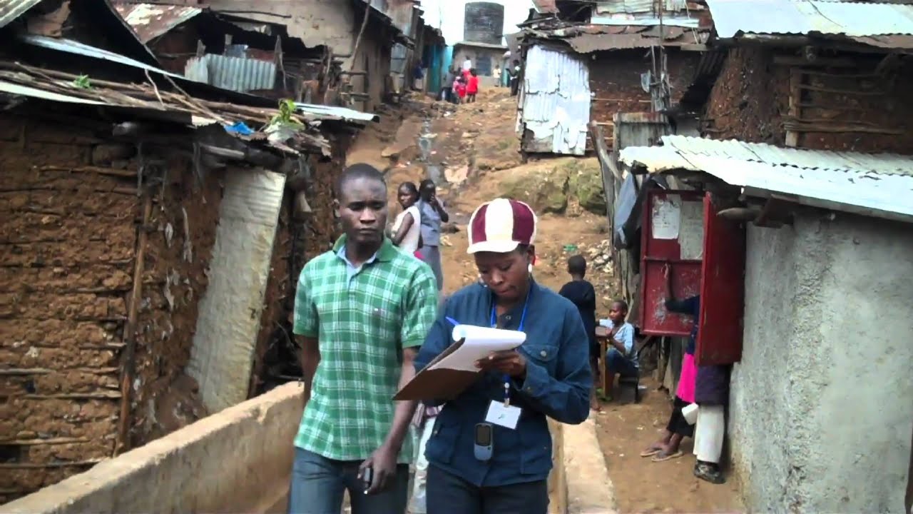
OpenStreetMap uses crowd-sourcing to do street mapping. And within a few days, OpenStreetMap had the most detailed map of Haiti that was available. - There were maps of Haiti before the earthquake, but they just weren't up-to-date anymore.
So people started using donated satellite imagery to trace in OpenStreetMap collapsed buildings, clinics, hospitals. - Within a week or so, we had trained over 100 individuals at Tufts University to map the incidents and the alerts. And then a text number, 4636, was set up.
for reporting. But these text messages were all going to be in Creole. So we started getting as many Creole-speaking volunteers as possible.
- And you go to. . .
- I found out about the 4636 effort through a friend of mine. So I got online, started getting involved, basically staying up late after putting the kids to bed, try to translate as many text messages as I could. - Our top priority is Port-au-Prince.
- It's good. It's got translations. - There was this energy.
- Today's SMS. - People from basically all over the world creating this sort of, like, support system over the internet. - A soccer stadium was serving as a camp for displaced persons.
But we didn't know it was there. Through USHAHIDI's mapping ability, we knew that that would be a location to take aid. We wouldn't have seen it without them.
- USHAHIDI alerted the world that if you've got needs in Haiti or you're trapped in a building or you're out of food or you're injured and you need help that you can alert us. - Whether you are that person in Des Moines, Iowa, who's reading Twitter or Facebook or you're a Haitian on the ground, with mobile technology and open-sourcing of information, you're suddenly empowered. - I work by California.
- Being able to stay online translating those text messages, and you know that that information will be forwarded directly to a specific aid organization. That made it feel like almost I was on the ground helping. - A map is worth a million words.
Maps communicate with everybody. That's powerful. You know, you can make a difference.
You can look at relationships and patterns and processes and models, help save the world. - I don't think we can project 50 years out, but given what we're seeing today, it's just a fantastic explosion of location technology. And location-based data.
And now we have the devices to read it and capture it and visualize it. And that's something that's really helping the geospatial revolution truly explode. - Revolutions rarely end up the way they started.
That's almost the definition of a revolution.