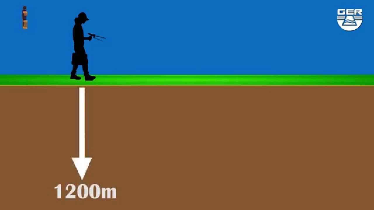
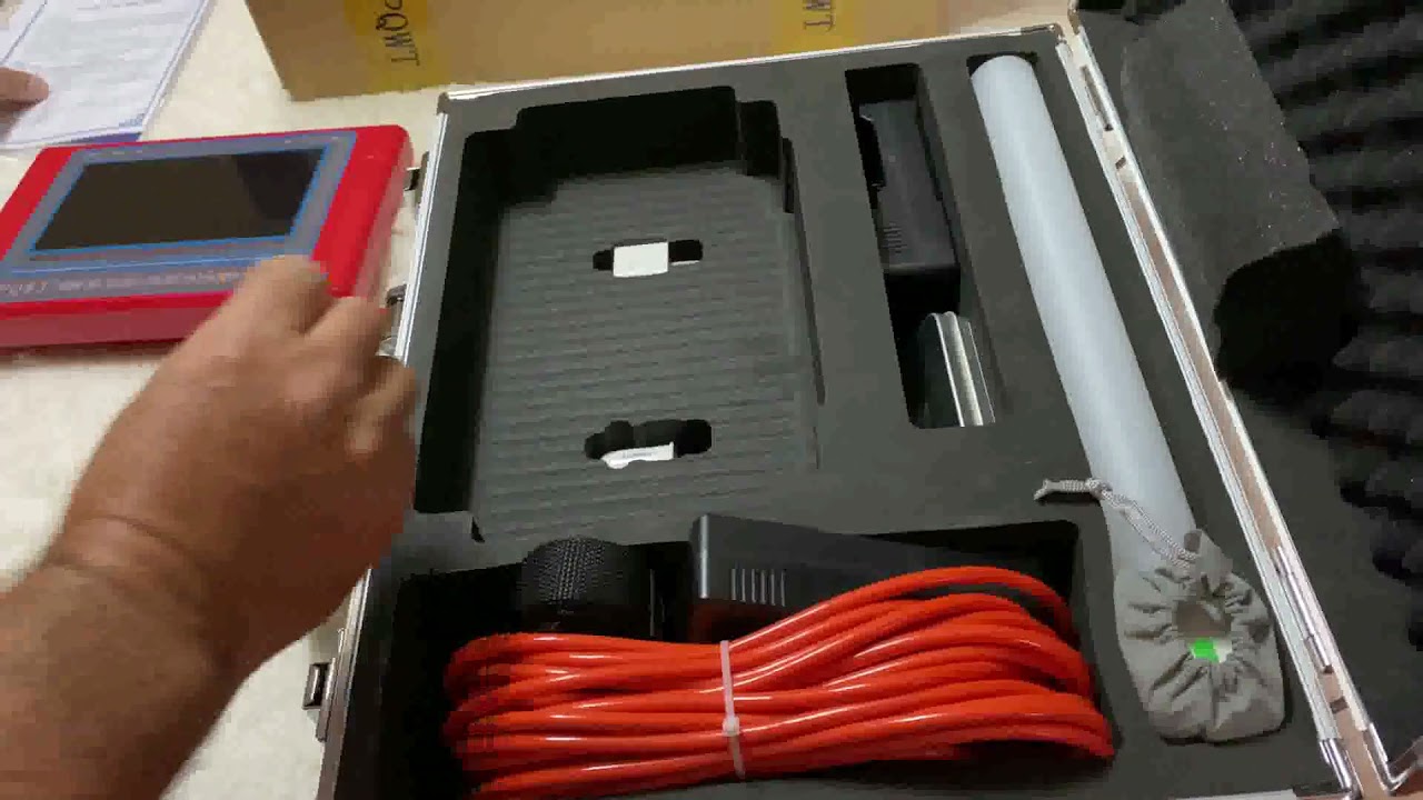
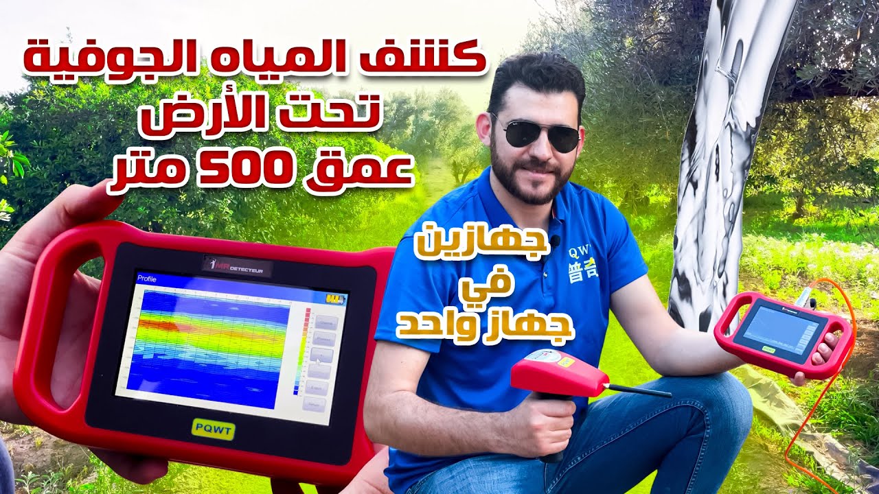
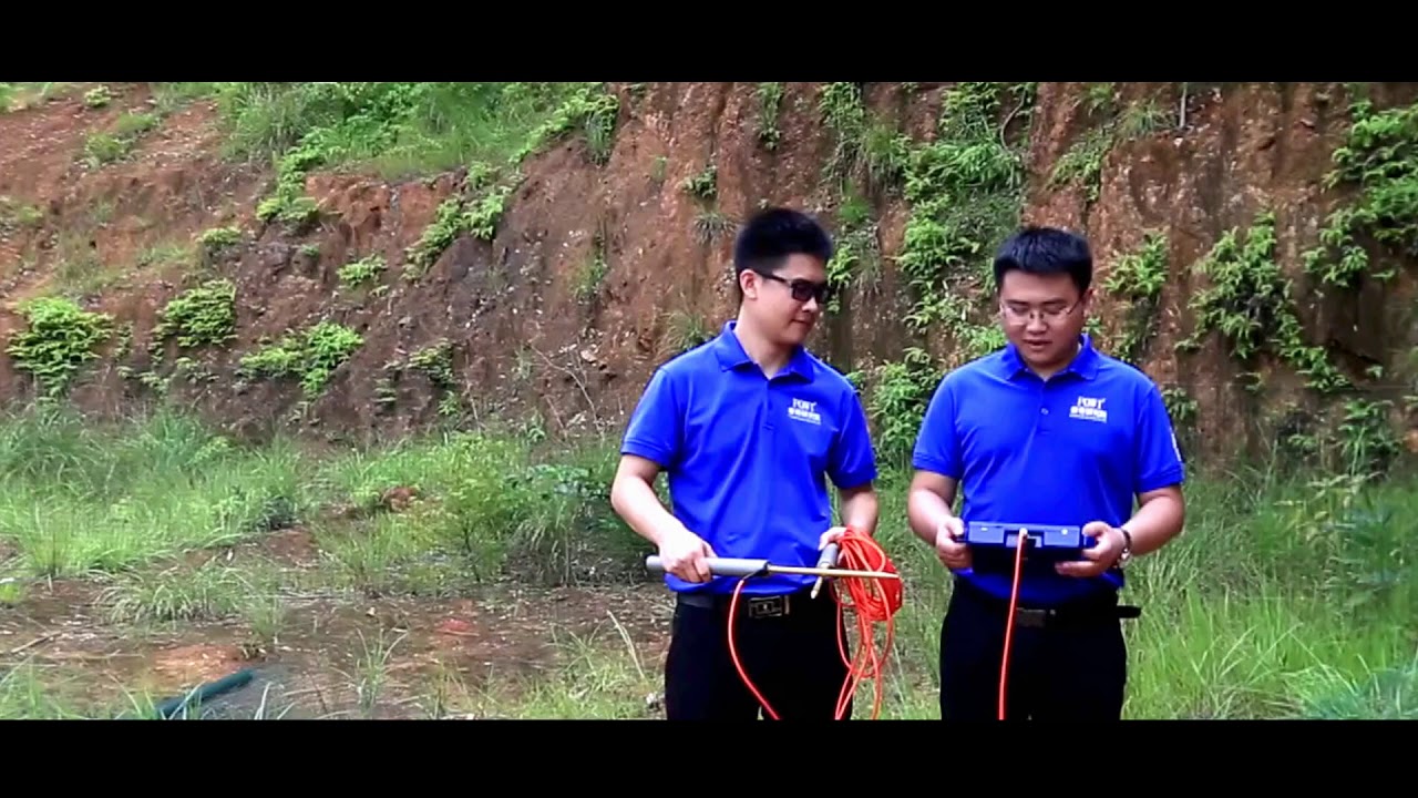
EQ WTTC series of East Germans have the following characteristics one realize full intelligence of mapping with one button with adoption of our independently developed PQ WT geological exploration software system - it can save 999 measuring lines and each line can save 999 points 3 automatic storage of data curve graph and profile map for all the data curve graphs and profile maps can be imported to cell phone' for storage 5 adopt industrial level 7 inch high-definition touchscreen 6 adopt a brand new hello electrode rod in the measuring line I will show you the East German operation
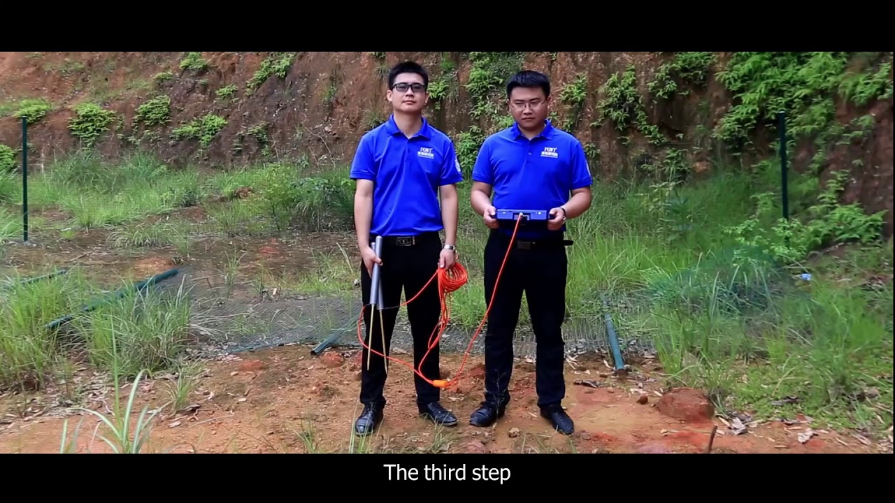
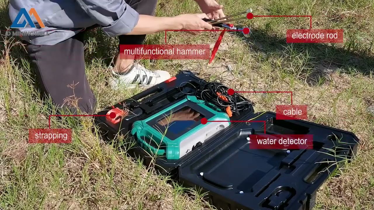
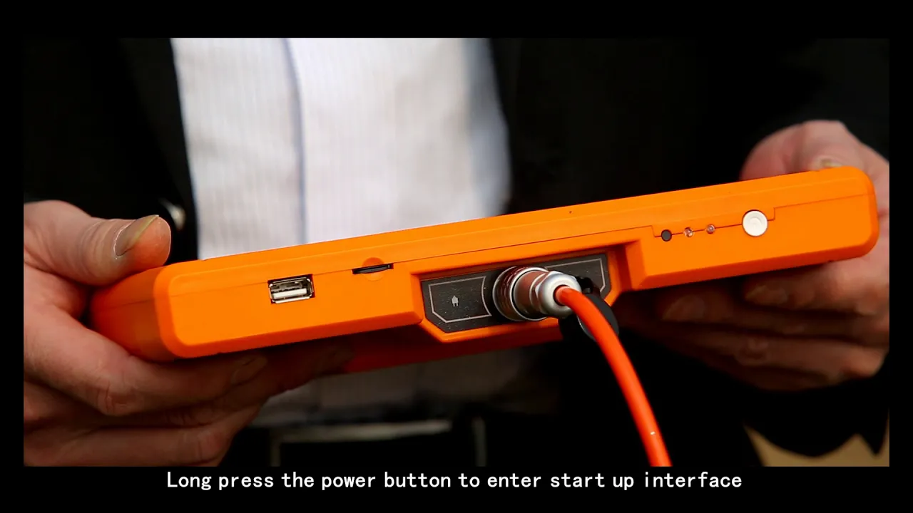
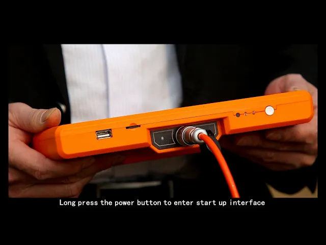
flow with adoption of pqw t TC 300 water detector full intelligence of mapping with one button first let's check the main components of East German before measurements host the machine connection cable alloy electrode measurement step 1 wiring select one tape of 50 to 100 meters and a polo pin the scale and the place needs to be measured along one straight line make mark for the start point geophysical prospecting is made perpendicular to tectonic line step 2 long press the power button to enter startup interface and six options will be displayed including single frequency 3 frequency
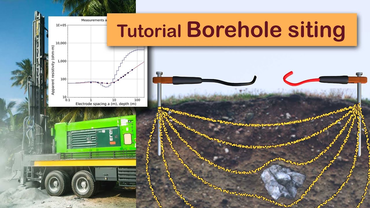
profile survey file explorer settings surface today we adopt a profile survey measurement method select profile survey to enter measurement interface before recording for two connected elect foals together in a crossing way and then click line test on East Germans the green light on means the line is normal in the following adopt a 10 meters electoral distance for measurements plug electrode near to the host the machine into the place with zero meters to the scale plug electrode and the other end into the place with 10 meters to the scale plug-in electrode rod to select the measuring
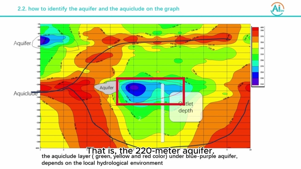
line click record if for recording after data collection the East German display screen will show record completed with a reminder sound then move forward that you elect rolls by one meter click record for the data collection and the second point after record completed the instrument display screen will show record completed and so on repeat the valve operation process for measurement after one measure line is finished the curve graph will be displayed on the screen automatically click profile the a sermon where draw profile map automatically and click plus or minus the picture can be zoomed in
or zoom out based on requirements attentions the electrode rot Shahnaz shake and should not contact meto objects on the ground during sampling it is suggested to test over 15 points for one measuring line it is forbidden to use East Tremont confounder storm weather it needs to avoid regions with high pressure line or with great ground rod point 1 in profile map is 5 meter to the scale point 2 is 6 meters to the scale and so on to better use instrument and improve well completion rate users can send pictures to our geophysical prospecting water communication
platform through a mobile phone and communicate with our hydrogeology experts who name poogie geologic exploration equipment institute looks forward to cooperating with you creating brilliance together and making contributions to our geological exploration calls double zero eight six seven three one eight four zero six six double one six a six one three five four a ninety seven zero nine double nine mr. Frank

![I went through the secret passage to the treasure room❌ [Great Discovery]](https://img.youtube.com/vi/0kBy1Y4juHc/maxresdefault.jpg)