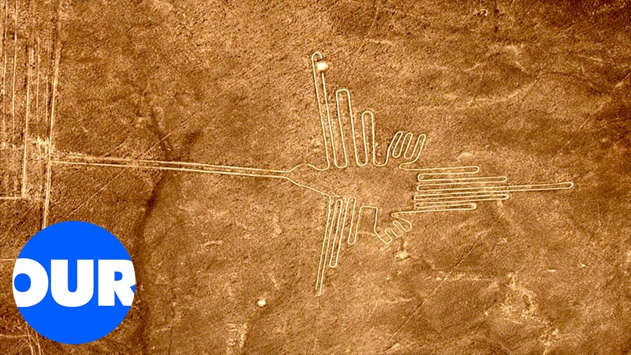
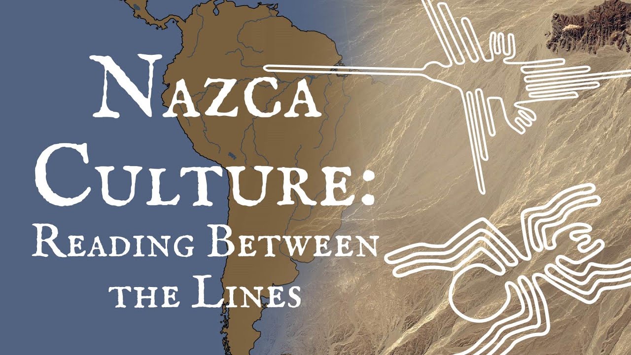
if you ever fly over the deserts of Southern Peru you'll notice distinct white lines against the rusty red background look closer and you'll see some clear shapes straight lines rectangles triangles swirls it seems like they're parts of huge drawings you notice a monkey a whale a condor a hummingbird and whatnot the lines were created more than 2 000 Years Ago by the people of the Nazca culture thanks to a dry climate and strong winds in the desert most of the Nazca Lines are visible today to create them the Nazca people removed the top layer of
Pebbles and revealed the soil beneath the ground the color of the soil changes from reddish brown to yellowish gray so the lines always look different it looks like the creators of the lines started with small scale models and increased the proportions to create full-scale designs scientists have tried to decipher the meaning of the Nazca Lines ever since they were first discovered in the 1920s but the first mention of the lines was actually much earlier in the 16th century Chronicle of Peru where they were described as Trail markers in the desert since you can't really study
the lines and their symbolism from the ground the lines became world famous only in the 1930s with the Advent of commercial planes a decade later American Professor Paul kosok was doing his research on the lines and noticed one interesting thing when he looked up from the line it was pointing directly at the Setting Sun It Happened One day after the winter solstice and the scientists concluded that the lines must be the largest astronomy book in the world German scientist Maria Risha who got the nickname the lady of the lines supported the theory that the geoglyphs
served as a calendar and had some sort of astronomical purposes she dedicated 40 years of her life to studying the lines and swept them inch by inch she also moved into a small house close to the lines to protect them from unwanted visitors then in the 1970s American researchers called the astronomy related Theory into question they noted that in a region like Nazca one of the driest places on Earth with only around 20 minutes of rain per year water is a real treasure and the straight lines and trapezoids must have had something to do with
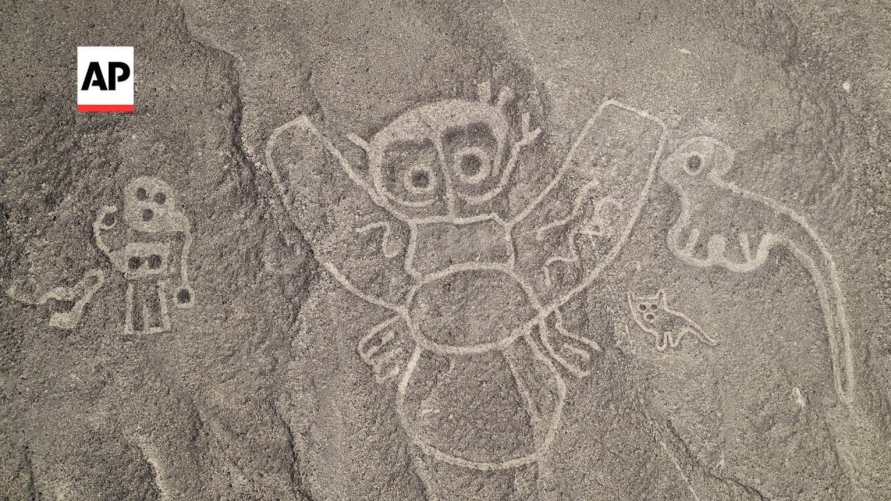
it they could be pointing at locations for rituals that the local people organized to obtain water and make crops more fertile the images of animals in the Andes region are also related to water spiders are thought to be a sign of rain hummingbirds stand for fertility and monkeys living in the Amazon symbolize an abundance of water in more recent years the Nazca Lines have become the research ground for archaeologists from Yamagata University they're using high-resolution aerial photography and drones to discover and catalog geoglyphs the team has identified a total of 358 geoglyphs so far and
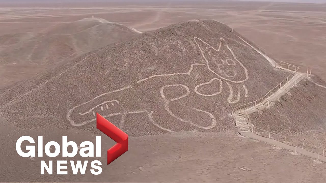
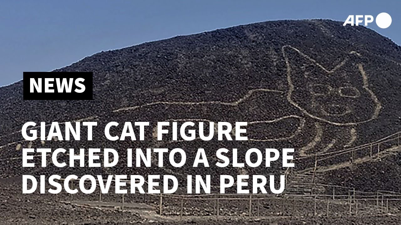
168 out of them in 2022 alone they found images of humans camelids Birds orca whales cats and snakes most likely created between 100 BCE and 300 CE some of the images are around 10 to 20 feet long so it's no wonder no one was able to detect them before the largest geoglyphs by comparison are 1200 feet across which is about the height of the Empire State Building the researchers believe the Nazca Lines were used as a form of communication in the desert the linear ones pointed the direction from Valley to Valley the ones drawn on
slopes seem to have been drawn along ancient Pathways between settlements the scientists now plan to find patterns in the geobliffs depending on their distribution they use artificial intelligence to analyze the images the AI generates designs that are likely to be painted in the desert and the team then checks if they're actually among the Nazca Lines another famous Peruvian geoglyph is a candelabra slightly taller than the Washington Monument you can find it on a Seaside Hill in the paracas peninsula researchers managed to establish the approximate age of the Candelabra by analyzing the nearby artifacts it looks
like it dates back to around 200 BCE the drawing is etched deep into the sand and it was never meant to look like a candelabra one Theory says that the drawing was supposed to resemble the Trident of an incandeity to please it another popular theory is that Sailors used it as a beacon for navigation Effigy Mounds National Monument on the Mississippi River has 195 known Native American Mounds most of them are conical in shape and there are also several that look like birds deer Turtles bears and Panthers scientists have established that the Mounds date back
to around 450 BCE and the images are somewhat younger a study of the Mounds found some copper bone and stone tools the Builder's descendants say that the Mounds served as ceremonial sites this story is passed down from generation to generation some historians believe the Mounds could have been also used to Mark celestial events or territories the American southwest and the nearby regions of Mexico have over 300 intaglios which are giant images engraved in the ground the most famous of them are the Blyth in taglios in California West of the Colorado River Blythe Giants are a
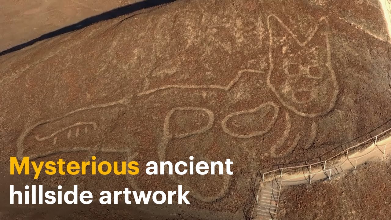
group of six figures including that of a human being and an animal scientists believe the images are somewhere between 450 and 2 000 years old according to the local Mojave tribe there is an image of mustamhol the creator of Life the animal figure shows a mountain lion who served as his helper the largest figure is almost as tall as the Leaning Tower of Pisa the creators of the intaglios had to scrape the dark Rock of the desert until the lighter soil showed up it's nearly impossible to notice them from ground level that's why they were
only discovered in the 1930s when a pilot flying over them accidentally looked down the best way to see the Giants is still from a helicopter Kazakhstan can boast its own Nazca Lines a cluster of around 260 Earthworks in the north of the country the step geoglyphs are a variety of geometric shapes including squares crosses circles and a three-prong design the creators of the images used materials such as dirt rocks and lumber to build them out of the ground a local Economist first spotted the geoglyphs while browsing Google Earth in 2007. archaeologists suppose that the structures
go back 8 000 years but they still don't know who built them or why one Theory says that the lines helped track the sun's movement NASA got interested in the discovery since the lines are much older than the ones in Peru they took photos of the step geoglyphs from space trying to solve their mystery another fact that makes the line so special is how huge they are one of the largest of them has sides as long as an aircraft carrier the only humans who could have built them must have been the nomadic Stone Age tribes
but it's unlikely that they had such Advanced tools if they did that would mean that archaeologists need to rethink the abilities of our long ago ancestors organizing such a huge amount of people to work together on a complicated project is an amazing feat although the White Horse on a lush green hill in Oxford sure England could easily pass for Modern Art it's actually one of the most ancient geoglyphs it was created between the bronze and iron ages and is the oldest chalk Cut Hill figure in Britain whoever created it had to remove the turf to
reveal the chalky white part of the soil scientists can only guess why this piece of art was created it could have been a fertility symbol or a way to Mark territory aerial images prove that the horse has changed over time because of the soil it took several centuries to reveal a larger horse-like shape that lies under what we see now that's it for today so hey if you pacified your curiosity then give the video a like and share it with your friends or if you want more just click on these videos and stay on the
bright side


![Nazca Lines, Peru [Amazing Places 4K]](https://img.youtube.com/vi/ROrrCkxR2tY/maxresdefault.jpg)