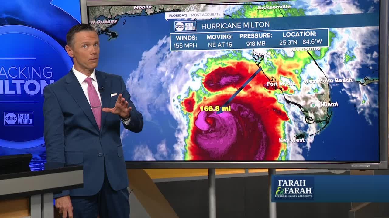
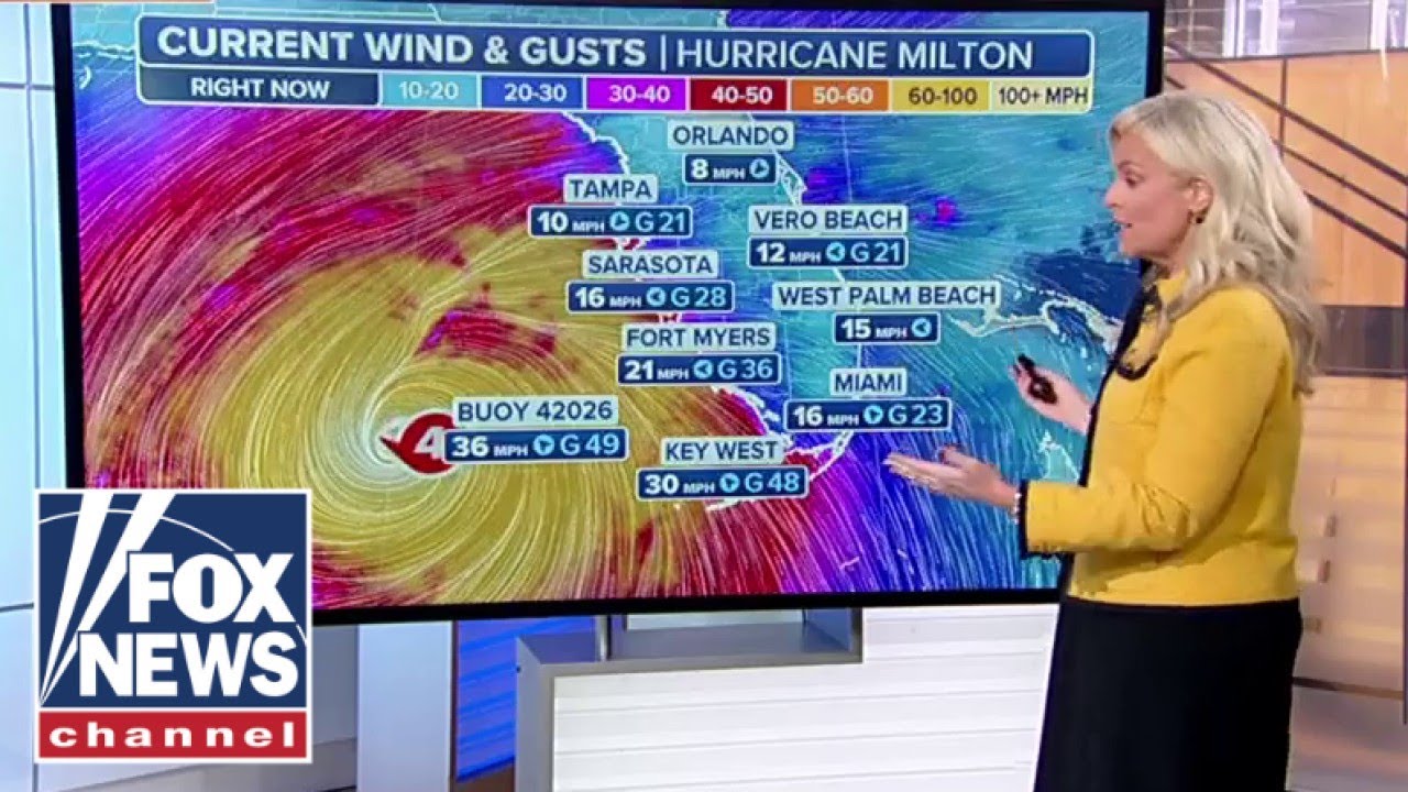
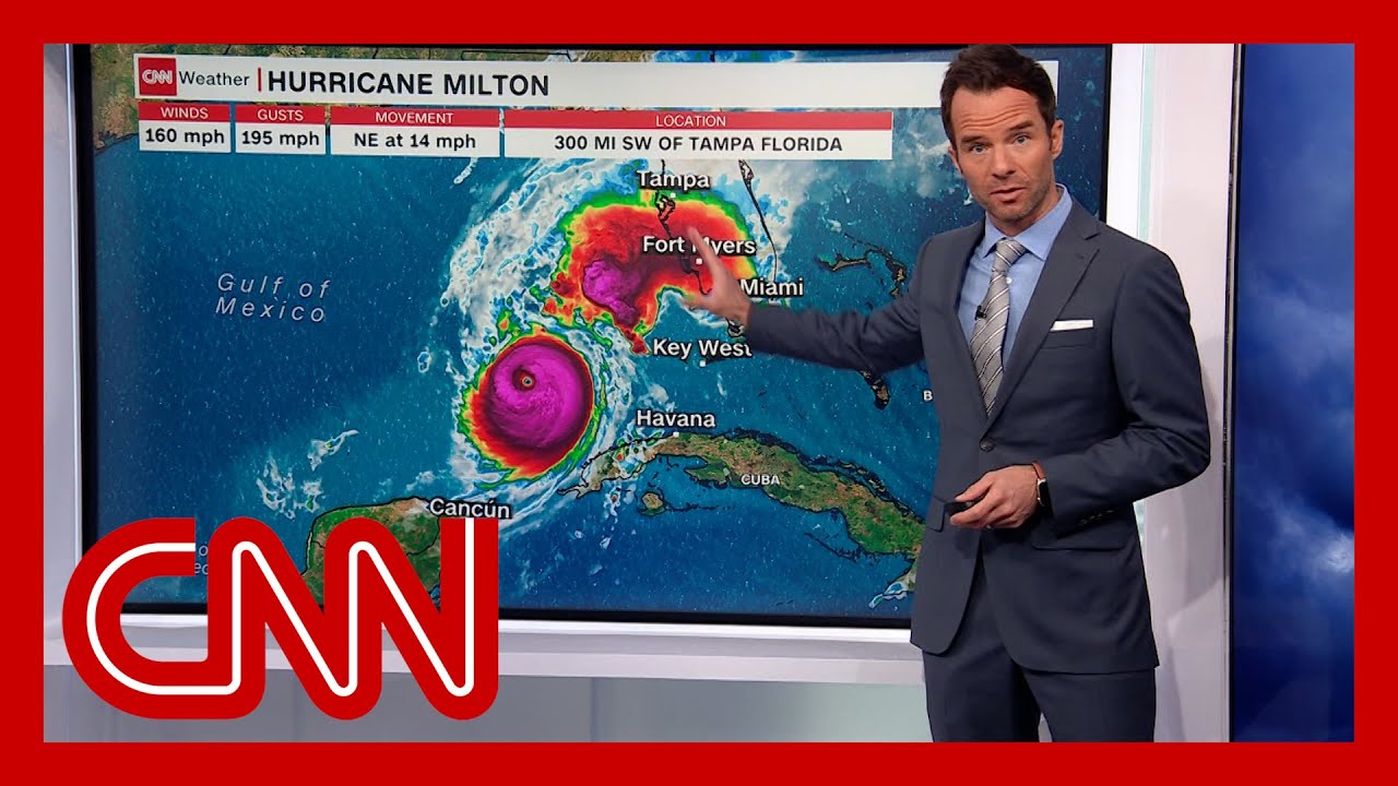
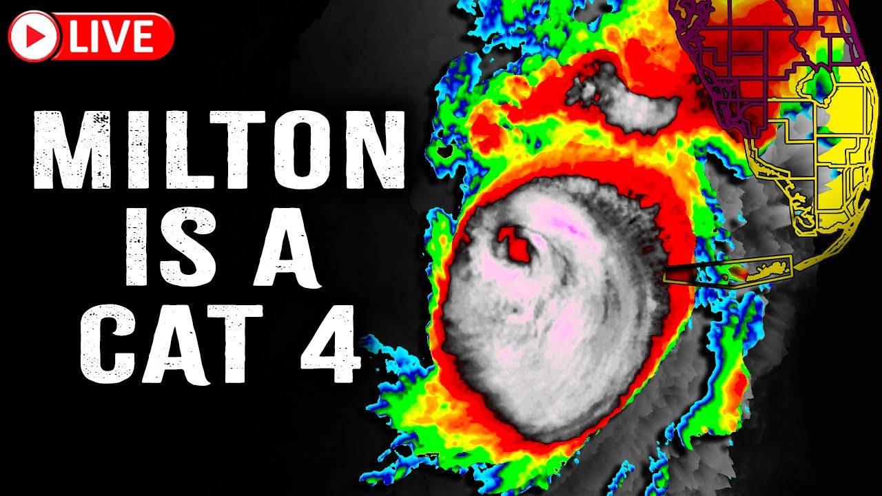
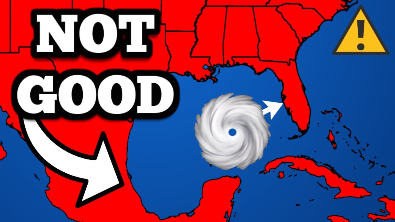
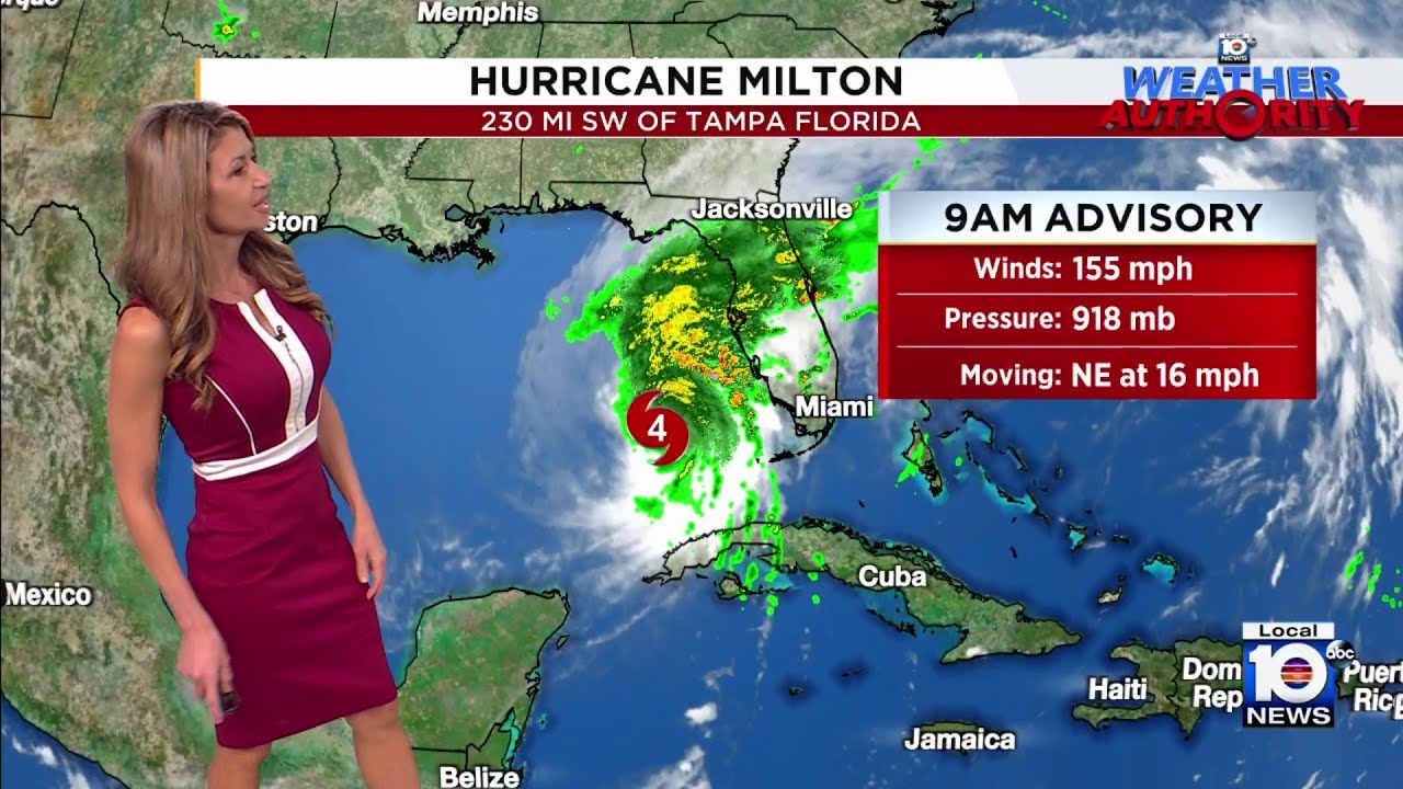
everyone this is a 5:00 pm update on Hurricane Milton now if you're just tuning in haven't seen the information that has played out today uh let me just bring you up to speed Milton has undergone a rapid intensification period uh all day to day and is unfortunately now a category 5 hurricane on the saffer Simpson scale so let's look at the current statistics um maximum wind speeds 180 mph pressure down to 95 mbars uh movement to the east at at 10 and you know the the question everybody wants to know is is where will Milton
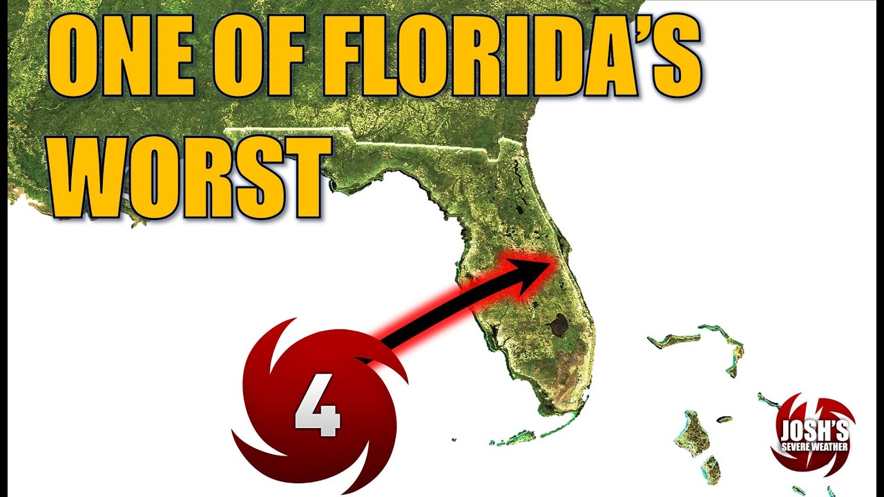
go and what sort of impacts it will bring generally going to move continue moving to the east overnight tonight and then gradually turn towards the Northeast uh on the day on Tuesday and approach the Florida Peninsula on Wednesday here you can see just offshore of the Florida Peninsula 1: p.m. Wednesday with Max Winds of 145 milph it's then going to move somewhere across the Florida Peninsula potentially staying a hurricane during its entire uh Tre across the Florida Peninsula and emerge out in the western Atlantic now we've got a lot of changes with this particular advisory
so I'm sort of zoom in here so we can unpack this map for you so all these colors here are are conveying what sort of impacts that you might experience in your community the cone doesn't tell you that so let's not focus too much there let's focus on this so the yellow area here is a tropical storm watch means tropical conditions tropical storm conditions are possible and look they extend all the way down now into Southeastern of Florida including Miami day Brower County the red area here is a hurricane warning so the warning is different
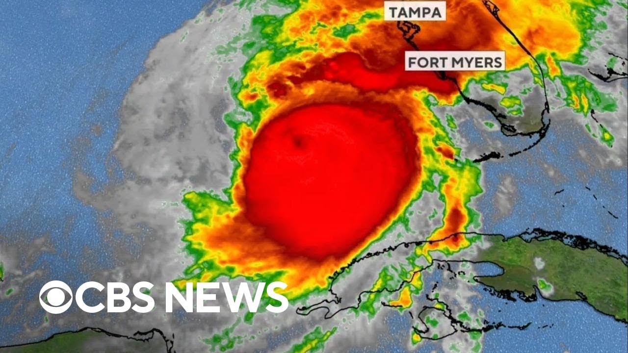
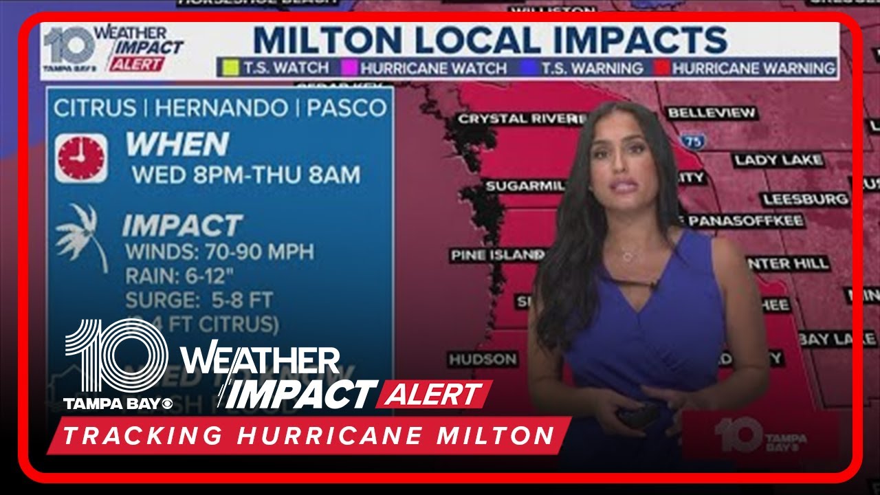
from the watch because it is saying and conditions are expected so what does that mean if you're in this hurricane warning area so let's zoom in and look closely at some of the towns uh Tampa Cape Coral Orlando basic basically the entire I4 Corridor you need to be preparing for Hurricane conditions so no more you know waiting and and looking you need to be uh securing your home making sure this is the time to put up your shutters if you're going to do that um if you're going to leave or Evacuate the area this is
the time to do that because this means that conditions are Poss expected generally within 36 hours then on the East Coast here the Treasure Coast you're under a hurricane watch portions of this area could be upgraded to a warning at a later time so you need to be uh paying attention and stay tuned often and that includes uh Jacksonville and Palm Bay and then finally you got a tropical storm warning is the Blue Area here uh this area down here is a hurricane watch and a tropical storm warning but the take-home message is if you're
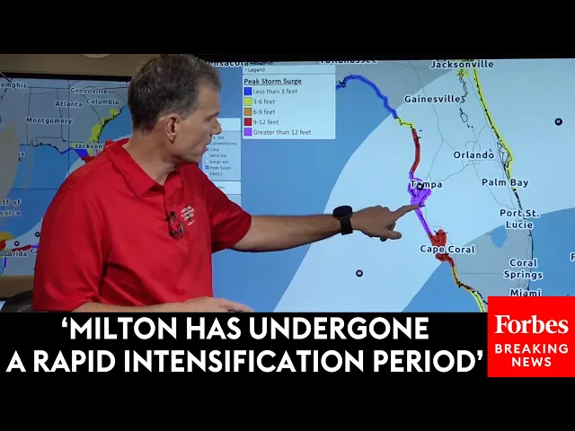
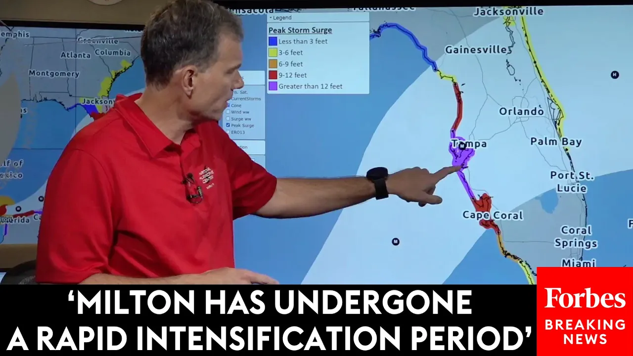
in this red area you need to be in action mode you need to be taking action to protect your house to protect your family now it's not just going to be a wind threat let's look at the storm surge threat too I think most people know now the Florida West Coast is incredibly susceptible to storm surge and that's why there is a storm surge warning now in effect from basically Flamingo down here in flate Everglades National Park all the way up to just north of Cedar Key that includes Cape Coral Tampa Bay Fort Meyers Sarasota
why is it under a storm surge warning because let's look at this the the peak storm surge forecast now the purple's going to jump off the map here and it should somewhere in this purple area not everywhere somewhere in this purple area we are predicting 10 to 15 ft of storm surge put that in perspective I'm 6 feet tall that's more than two of me high and if this is realized that is more surge than was experienced during Helen so to sort of put that in perspective on each side of the purple area including the
Cape Coral area let's see if we can get this one 6 to 10 ft of storm surge still incredibly High storm surge amounts very impactful and then even to the north 5 to 10 feet of storm surge um look how far south the storm surge makes it all the way down uh to chakalos area 47 ft again I'm 6 feet tall that could be potentially over my head and then um we've added a new area here on the the Florida East Coast or Treasure Coast potential for 2 to four feet of storm surge but let's
talk about this purple area well this entire colored area in the Florida West Coast because a number of you are under mandatory evacuation orders and you're wondering why I'm under a mandatory evacuation order I'm so far away from the center or so far away from the cone the evacuation orders are often based off this storm surge forecast and because we expect Milton to grow in size before it makes landfall it's going to spread the wind and storm surge impacts well away from the center so let's not focus so much on where the center may or
may not track because when it comes to what impacts you may feel uh that can be incredibly misleading now we'll end with one more Hazard here the rainfall um so the rainfall threat uh this is a this is the excessive rainfall uh graphic which tells you where flooding from rain could occur so anywhere in this red area you need to be on high alert for a flash flooding potential uh even before even before the hurricane makes landfall and that includes uh Southeastern portions or Metro Miami day portion so basically all hazards are in play here
a multi-hazard event um you know you really have to be thinking about significant widespread power outages for days uh where this the Milton crosses the Florida Peninsula um significant down tree significant power outages maybe the in ability to move around for several days so I'm going to leave you with this what do you need let's think about what do you need to be home and stay home without power for several days what do you need to be safe what do you need to be comfortable in those conditions and I want to urge everyone if you've
been ordered to evacuate those evacuations orders are serious and you absolutely must follow them that's it for us we'll be back with our next video briefing tomorrow at 11:30 but you can get more timely and the latest information at hurricanes.gov