[low static humming] [Music] Right now, you can track people with their knowledge or without their knowledge. But is that really an invasion of privacy, or is that just new technology? It’s important that we be able to look at any place in the world, because if trouble strikes, our government has to deal with the situation.
We are the eyes of our nation, if you will. You need geospatial intelligence to target bad guys. Mapping to some degree has always been driven by a conflict, shall we call it-- war.
In the face of the Bosnian-Serb offensive, another Muslim enclave falls. Crisis in the Balkans. In the summer of 1995 a wave of ethnic cleansing wiped out the Muslim populations in villages in Eastern Bosnia.
The shelling continued for a second day. A line of siege was established on the hills around of Sarajevo. There were snipers shooting people.
Tens of thousands of people were killed. In Bosnia and Herzegovina you had three separate groups. You had the Croatians, you had enclaves of Serbs, you had enclaves of Muslims, it was a real mess.
Finally the west decided it had to, it had to iron the situation out by cutting up the country. So this is what the Dayton Accords were all about. Richard Holbrook knew that this was a high stakes game.
Had Dayton failed, it would have meant more war in Bosnia-Herzegovina. We had to figure this out so that everybody gets a fair shake here. I believe that it will not last too long.
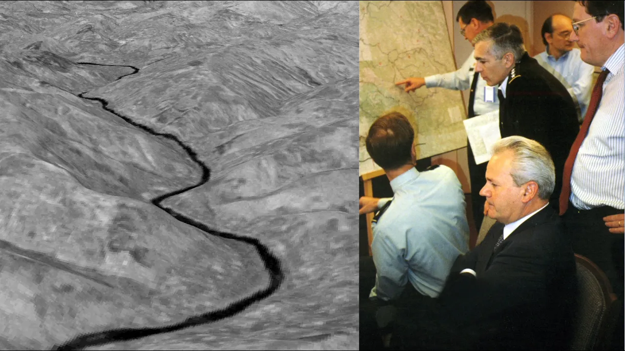
And the only way to do that was really geospatially. And there’s various sources of information that are put in. .
. So we brought in this thing called Powerscene. We took digital terrain elevation data and we overlaid it with imagery.
You had a joystick. You could fly over the terrain, back down into the valley. We were able to get them to agree that yes this was a majority Muslim village or this was a majority Serb village.
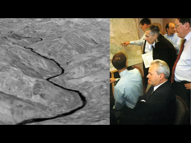
Gorazde was an isolated enclave, which was populated by Muslims. The Bosnian Muslims wouldn’t give up this piece of ground, they demanded secure access to it, the question is, where would the lines be drawn? Eventually, the solution was to build a road to open a corridor to them.
We used Powerscene to fly a route over the mountains that was far enough away from the Bosnian Serbs that the traffic would not be intercepted or shot at. We needed a wider corridor, and we had to demonstrate that to the president of Serbia. Milosevic was smart.
But he wasn’t a field soldier; he had never walked that terrain. Well, can’t we make this more narrow? Why so many kilometers?
And I said, “Well, you can see right here, Mr President, here’s the mountain top on one side, here’s the mountain top on the other. You can’t draw a line down the side of a hill like this and have it defensible. They have to have the high ground on either side of this valley.
He could see this with real terrain. Ultimately, he couldn’t beat the argument. And we had our road.
And that’s what we needed. This was the first successful use of deployable digital technology in diplomatic negotiations. For the great efforts that the United States invested It was hugely satisfying and emotional to know that we helped end a war.
After nearly four years of 250,000 people killed, the people of Bosnia finally have a chance to turn from the horror of war to the promise of peace. Geospatial Intelligence to the war fighter is everything. Being able to lay the maps down to get you spatially oriented, and then layering imagery on the top of it in a digital world so you can see where you are and what you're doing.
With all this technology available to everyone, the real enemy is time. We have to turn inside the enemy's decision cycle. We have to be able to make the right decision faster than he does.
If you're going to use precision-guided munitions, you need very precise coordinates. We cannot have collateral damage to anything that’s important, safe and precious. We use geospatial information for route planning.
Special forces need to know the best way to get into a compound and get out. There you go, just lay it down. The Buckeye program collects, processes, and disseminates high-resolution terrain data.
We use an electro optical camera, along with a LIDAR sensor. We fly it over major routes to extract detailed features of what they’re going to encounter on their operation. So how high are the walls?
How wide is the road? What's the depth of the ditches? Where are they gonna land their helicopters so they're not seen so they're not heard?
We try to give them multiple routes. Is the terrain flat so that they can land easily? We’re looking for placements of IEDs.
Improvised Explosive Devices - IEDs - are very difficult to detect. We might fly a sensor down a road at one date in time. Get a view of what that surface looks like, and then the next day or even hours later fly over that same route and then see what's been disturbed, where have IED's been planted.
You can monitor an area continuously to see who planted it? Where did they leave from? How did they get there?
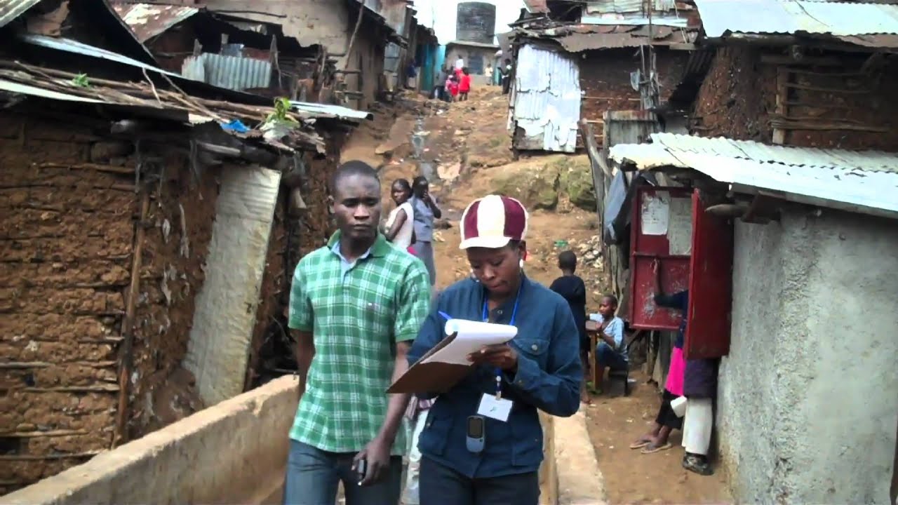
You have to understand the hearts and minds. Often what is important to the people relates to the earth and the earth's feature and the geography of the earth. The importance of human geography, human terrain, is really in a soldier understanding that aspect of his environment.
Understanding the culture that he's operating in. Different aspects of society, culture, economic systems all of these pieces translate onto the physical geography. We look at languages that are spoken in one neighborhood versus another neighborhood, understanding an education level.
We put it onto a map to help explain the complexities. Really fine grain details depending on what the commander needs. How can we understand what’s important to them so we're not just doing things that we think are important but may be totally inconsistent with their value systems.
That's the biggest challenge. We're putting them in harms way. We owe it to our soldiers to provide them with the best information that all of this technology is capable of providing.
[phone connecting (from 911 call)] 911 – what are you reporting? . .
. bank here in Redlands has just been robbed. When somebody calls 911, geospatial technology is present from the get-go.
The value of GIS for us is really all about putting police officers where they need to be when they need to be there. Which way did he go? He went toward State Street – I believe he’s going west.
[sirens] There was a bank robbery at the Bank of America right in the center of downtown. We can put in the address of the incident. We plug it in - we tell it that we want to see one, three and five minute perimeters.
If the suspect drove for 1 minute, officers are going to set up a perimeter around here. This is three minutes out. This is five minutes out.
Copy Hello – We have the suspect in custody. Thank you for staying on the line. Okay?
Okay, bye. It all starts and ends with a location. In a first responder environment.
. . You wouldn’t happen to have your ID on you, would you?
geospatial technology ties in with longer-term investigations that are ongoing at a particular house that's known for selling drugs. Perhaps one person in that house is actually an undercover detective- critical information to know. If you have a 100 square mile area to provide patrol service to, and a couple of officers to do it with, hot spot mapping gets people to the middle of where the problems are.
It involves a crime analyst evaluating different crime types and then how closely related those are by location. I wanted them to be able to see what was going on recently so I put a 2-week density map of residential burglary with hot spots along with the incidents on top of it. As soon as he pulls up the map, we’ll work from Cajon Street.
. . Sharing that helps improve efficiency with limited resources.
In California, all registered sex offenders who are on parole wear a GPS unit. Certain sex offenders are prohibited from going within a thousand feet of a school or parks or places that kids congregate. Everybody who has the actual bracelet um can be tracked on this map.
I can go in here in real time or playback what he did. And I can say, yep, that’s a school. That’s where he’s not to be.
Then we can get them off the street. One happened to be in Redlands. This particular person seemed to go out of their way to drive by a university campus.
Did a little research and found that that university campus was where he had committed his previous offense. Oh my gosh, we’re goin' to that. We watched as his points traveled right into the university campus where his parole conditions said he couldn't be….
. Parole! ….
and were able to pick the guy up for violating his parole. The notion that somebody's really watching uh where these people go is important if those bracelets are to have any deterring value. If you have a GPS tracker in your phone.
That's a great tool for emergencies and for law enforcement that will help you. But what happens when the person tracking you is not law enforcement. Maybe it's a spouse.
Maybe it's an ex-boyfriend. I love you Mom. I love you too.
He can have turned on the GPS locator in your phone without your knowledge. Anne Ard: An abusive spouse or stalker doesn’t need high-tech spyware to locate exactly where you are. Cell phone providers have a plan where you can sign up to be, to track your family members.
And you may know that that’s in the fine print of your plan, but you don’t ever think that it’s going to be used against you. If you are fleeing domestic violence you may not be thinking, "Oh well y'know he's y’know set up my cell phone in a way where he can track me. " You may not even know that that's something that can happen.
Woman: Hey Mom. Yeah, it’s me. We’re here.
We’re safe. We have to always remember that technology can be misused. And can be used to hurt victims.
Being able to understand where something is happening, what it is that’s happening, and why it’s happening. We really can focus on a problem before it becomes a crisis. With each advancement we have to look for all the positive benefits of the new reach of technology, as well as manage the downside.
I think a surveillance society is not only inevitable and irreversible. I've come to this conclusion it's irresistible. And it's not governments doing it to us, it's us doing it to ourselves.
But it does bring up the point that the more data that’s available out there the more transparent the world becomes, and the question is is how do people feel about that?