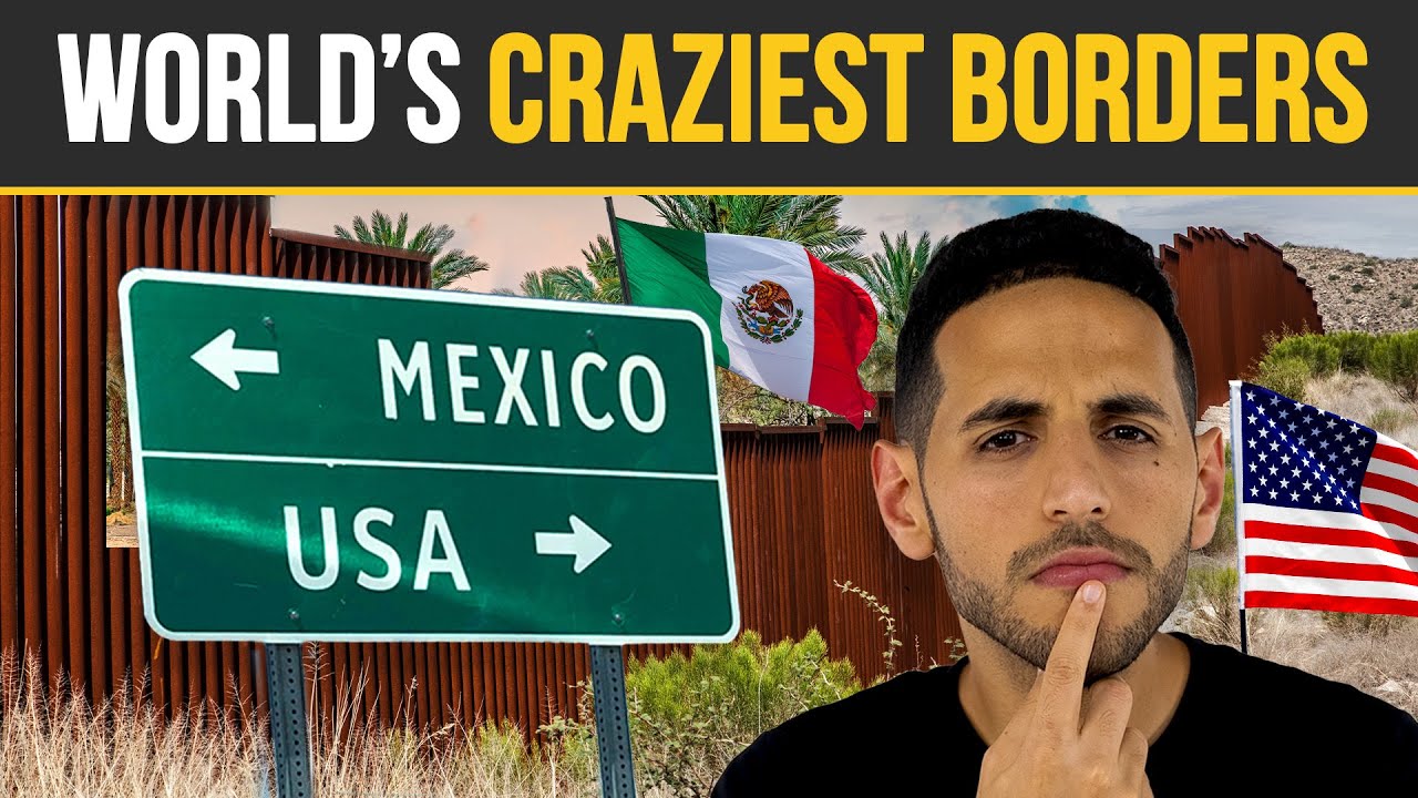
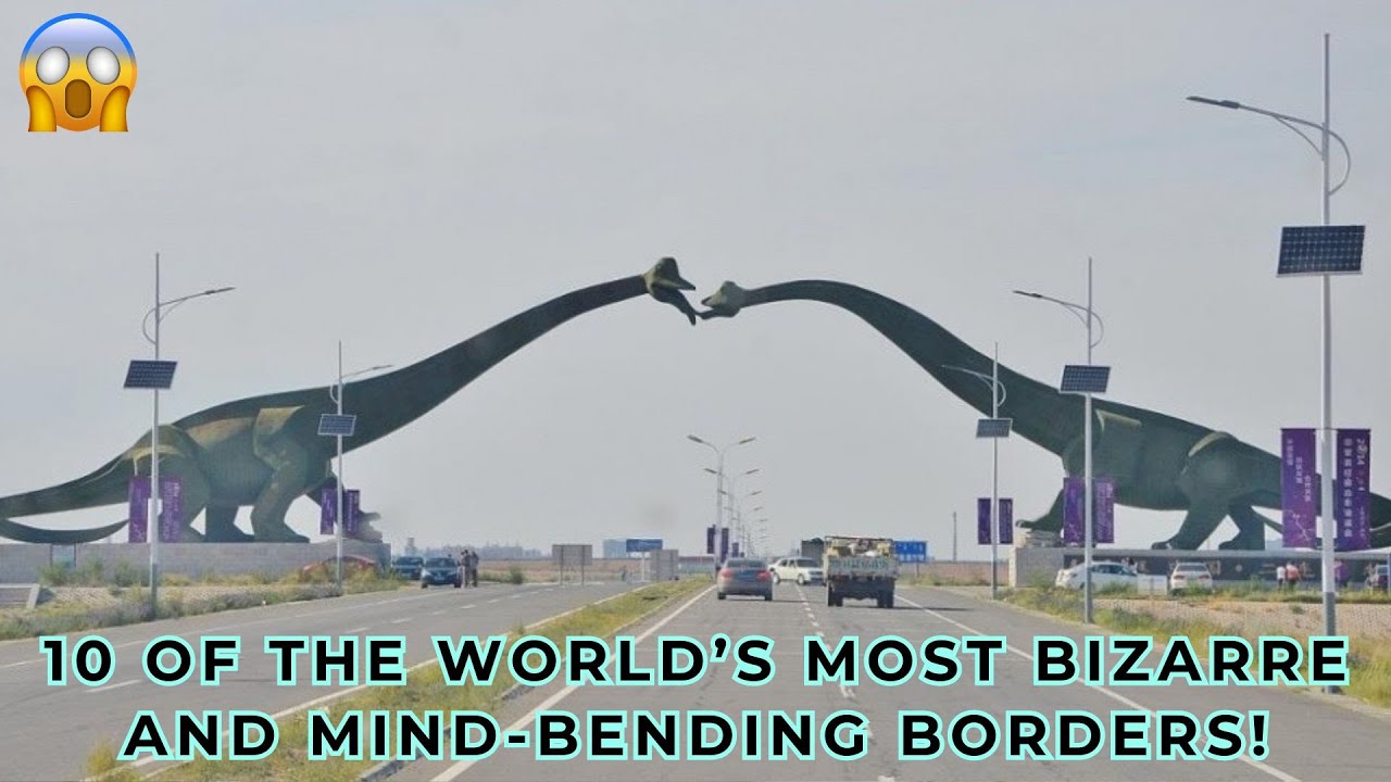
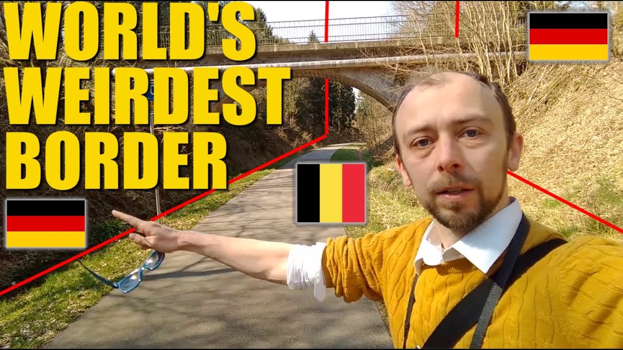
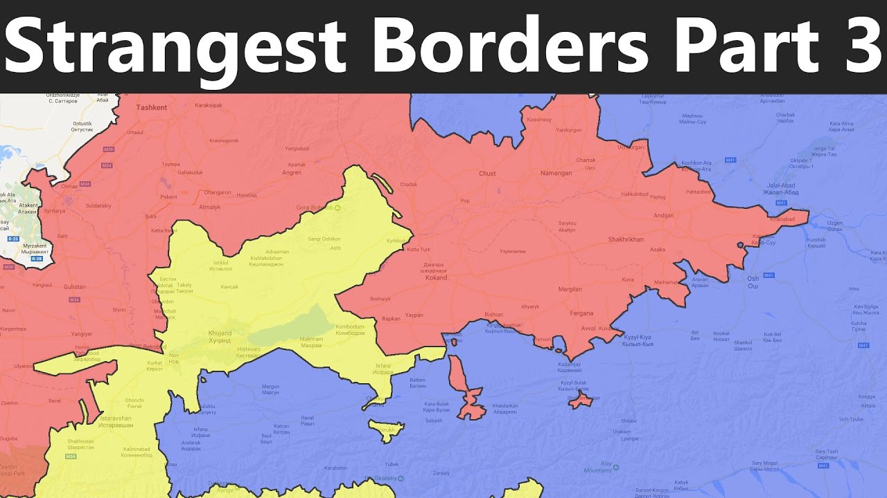
hey everyone you know every country has borders right they exist to separate nations from one another and crossing a border can have various consequences while some borders are quite simple looking laid out like a straight line there are some borders that are extremely unusual so we're going to take a look at the top 15 most unusual borders in the world number 15 San Marino Italy it seems pretty standard to have two countries sitting side by side with a borderline running right through between them but what about a country within a country San Marino is an enclave in southern Europe surrounded by Italy on the border between the regions of Amelia Romania and Marche and about 6. 2 miles from the Adriatic Coast at ramini San Marino was known as being part of the eponine mountain range with its high Rolling Hills and no substantial naturally flat ground the highest point in the country the summit of Monte tetano is 2457 feet above sea level some Arena was just one of three countries in the world to be completely closed by another country with the others being Vatican City also enclosed by Italy and lesufu enclosed by South Africa it's the third smallest country in Europe after Vatican City and Monaco and the fifth smallest country in the world San Marino has its own Constitution and democratically elected legislature called the Grand and general Council which calls for the election of two heads of state every six months known as Captain's Regent these two heads of state serve concurrently and hold equal Powers until their term expires after six months but the small population of about 33 000 people San Marino is one of the wealthiest countries in the world in terms of GDP per capita but it's also one of the lowest human development indexes in Europe number 14. Netherlands Belgium there's a town on the border of the Netherlands and Belgium named barl which is divided between the Netherlands and Belgium on the Netherlands side of the Border are a handful of distinct Belgian exclaves and many of these Belgian exclaves have Netherlands enclaves inside them and the craziest part is not only are all these borders actively drawn in the town some of which pass through restaurants and living rooms but different laws between the two countries are actively enforced inside of each exclave and Enclave yeah it's a bit confusing for example there was a time when there were different laws regulating how late a restaurant could stay open in the Netherlands and in Belgium and as a result since many restaurants are cross-border patrons would have to get up and move tables if they were sitting on the side of the country which closed earlier it's an incredibly odd way of life and there's quite literally a line drawn in the sand here but that line also runs right through residential buildings which can sometimes make things a little more complicated but both governments have agreed on a solution those homes have two addresses one for the Belgian side and one for the Netherlands side and while this border is one of the world's strangests the beautiful part is that citizens of both countries manage to make it work number 13 Dominican Republic Haiti the border of the Dominican Republic runs clean across the island of Hispaniola extending from the Caribbean Sea in the South to the Atlantic Ocean in the north and runs for about 295 miles as its Creation in 1929.
the island was divided by the Spanish and the French to create the two separate countries but the Border itself is one of the most interesting in the world because of the stark contrast of their respective countries the border is visible from the air with a lush Forest of the Dominican Republic very obviously separated from the Haitian side which is very much deforested the Dominican Republic side also holds many tourist facilities and attractions on their side while the much poorer and much less developed country of Haiti is on the other side seeing it can be quite sad and is a difficult reminder of some of the adverse effects of colonialism throughout history visitors can quite literally see how slavery wore over Mining and even Revolution can ravage a landscape today the economy any of the Dominican Republic is about 10 times larger than Hades which prompts many Haitians to move to the Drin hopes of more economic opportunities number 12 Poland Ukraine most International borders are defined by a simple sign reading welcome to so and so and a boring unassuming customs Office face it it can be pretty boring sometimes so why not spice things up a bit in a fun and artistic way well that's exactly what happened at the Poland Ukraine border at the stretch of Farmland that borders the two in 2011 the two countries looked to the polish-born artist Yara SLA kosiara to create a piece of land art that encompassed the landscape of both sides of the border for the annual Land Art Festival which celebrates the intersection between art and nature and in this case neighboring countries yaroslaw created a giant crop circle in the shape of a fish that symbolizes unity and friendship between Poland and Ukraine and while the entire Endeavor may seem complicated the artist used the simplest of methods he manifested the temporary Masterpiece simply by planting various seeds into a fish-shaped pattern but the fish is very intricate with lines and scales and even an open eye all of which can be seen perfectly from above of course there is a long line that's the physical border running through the fish but with both sides being relatively equal it's a nice aesthetic touch number 11 China Nepal one of the most unusual country borders also happens to be one of the coolest in the world running through the Tibet autonomous region of China and Nepal the border is an amazing 863 miles long and cuts right through the Epic Himalayan Mountain Range including Mount Everest the boundaries of this particular border have changed dramatically over time especially when considering events like 1949's annexation of Tibet but some of the most significant developments in recent times would be the signing of the agreement on maintaining friendly relations between the People's Republic of China and the kingdom of Nepal in 1956 and the Sino Nepalese Treaty of peace and friendship in 1960 both of which formally recognized Tibet as a part of China and confirmed the limits of the countries of China and Nepal as their note today it should come as no surprise that because crossing the border could be so treacherous here it doesn't happen very often in fact in 2015 there was a grand total of zero mountain climbers and many experts said that the Region's weather will only get worse which will mean fewer climbers and travelers here year over year number 10. Chile Argentina if you pull out a map of the world you'll notice that Chile and Argentina are divided by the Andes mountains and serve as an epic natural border this is a unique one though because both Nations share a long and hard history both Chile and Argentina gain their respective independence from the Spanish Empire in the early 19th century but didn't quite see eye to eye despite the shared plight they didn't manage to agree on the Newfound borders until 1881. what could have and maybe should have been the easiest treaty ever turned out to be an incredibly messy dispute the treaty stated that the Border will pass over the highest Summits of the Andes which divide the waters to the Atlantic and the Pacific Ocean accordingly but the powers that be on both sides didn't quite realize that the mountaintops and the flow of the waters weren't really in correlation with each other the water west of the highest Summits could flow East through the mountains to the Pacific Ocean and vice versa Argentina ended up claiming that the border is passing through the peaks of the the Andes while Chile of course was claiming that the border is passing according to the division of waters with each claim awarding their respective country more land than the other because an agreement seemed near impossible a neutral party was summoned to solve the dispute it was King Edward VII of Great Britain this gave the borders the peculiar appearance that we see today and whether each side will ever be truly content with the deal remains a mystery number nine United States Russia all right the next entry on our list may seem a bit odd because at first glance Russia and the United States aren't anywhere near each other but tell that to the Americans living in Alaska if they really wanted to and Alaskan could hop in a boat and roll their way all the way to Russia there are two small Islands lying in the Bering Strait between the USA and Russia known as the diomedes the small diomede belongs to the United States and is home to just 146 inhabitants while big diomede belongs to Russia and is completely uninhabited the distance between the two is only two and a half miles which makes even swimming from Russia to the United States completely possible albeit ice cold but things get really crazy when you get from one country to the next because the time difference between these two small islands is 23 hours it's enough to make your head spin but that two and a half mile distance between the two islands allows the citizens of the small diomede to literally look into the future as big diameters one day ahead on the calendar so for anyone who makes it to the big diabetes it maybe a little too hard not to focus on the past seeing as how it's right there number eight wagah border India and Pakistan have had a tumultuous relationship for Generations now with the Wagga border remaining one of the most important sites for the two Nations located in the waga Zone near Lahore City District Pakistan the Wagga border plays host to one of the most unique ceremonies the world has ever seen this border ceremony has been taking place every evening since its Inception in 1959 as a mutual peace agreement the Wagga Atari border ceremony happens right at the border gate two hours before Sunset each day by the Pakistan Rangers and the Indian border security Force the marching ceremony known as the silly walk ceremony is conducted along with the red flag ceremony the drill was characterized by elaborate and Rapid dance-like Maneuvers with each participant raising their legs as high as possible in a unique March it's not easy the drill is both a symbol of the two countries rivalry and the display of Brotherhood and cooperation between the two Nations since its Inception the Wagga border has become an enormously popular tourist traction and it never fails to disappoint in fact the daily Wagga ceremony has become so popular that other countries have adopted it as well number seven Portugal Spain the Portugal Spain border has the distinction of being one of the oldest borders in the world the current iteration is almost identical to the one created in 1297 through the Treaty of alkanesis also known as the stripe the border is 754 miles long and it's also the longest uninterrupted border within the European Union there are multiple ways to cross this border with the main crossing point between Portugal and Spain being Tue Valencia and the main international bridge concentrating half of the total International road traffic between both countries other important Crossings are Villar from Musso Fuentes de honoro Camina and braganya to Galicia Port Allegre and elvas tobayados and casserole marim and Villarreal de Santo Antonio to Almonte Bridges across the border include the guadiana International Bridge and the lower guadiana international bridge the world's shortest international bridge a wood structure just over 10 feet long connects the Portuguese Grande with the Spanish village of el Marco so there are clearly plenty of ways to travel between Portugal and Spain but there's one more way that you won't find anywhere else the Portugal Spain border is the only Border in the world with a zip line which is between San lucar de guadiana in Spain an output team in Portugal that sounds like one hell of a fun border crossing number six Austria-Hungary Slovakia if you're on the Belgian Netherlands border then you can be in two places at the same time if you're living on either the small or big diode then you can look into the past present and future but if you're at the Austria-Hungary Slovakia border then you can be in three places at once how is this possible well it's not hard at all it all comes down to a bench the TriPoint can be found in Salzburg Park a Sculpture Park built after the Iron Curtain fell in 1991 to symbolize Unity among those three countries all of the Park's sculptures were created by International artists and Incorporated a triangular shape to represent each of the three nations yes this triangular bench may not seem like much but things like rivers and walls remind us of what divides Nations what keeps us apart the bench at this European TriPoint is a strong reminder of not only what keeps us together but that much like the bench borders are movable made up things and this serves as an opportunity for the citizens of three nations come together and share a meal because food is always one of the best ways to unite us all we all may be from different places but we all need to eat and sharing and Cuisine is one of the best forms of cultural exchange and appreciation we can ever have number five Antarctica does anyone live in Antarctica well yes and no it's the only continent on the planet without a permanent human population but it is instead dotted with research facilities all belonging to different nations the continent is pretty harsh which is why it's the only one of two unclaimed land masses now while multiple countries have presence here and may say they've laid claim to specific regions they've all signed the Antarctic treaty which basically states that none of these claims imply any sovereignty to the claiming Nations but with that said there's a triple overlapping region in the Northwest that Chile Argentina and the UK all claim and there are two double overlapping regions in the Northwest one between the UK and Argentina and another between the UK and Chile and then there's the Southwest part of the continent which is completely unclaimed Antarctica is home to some of the strangest borders in the world because they all exist in a state of limbo being honored without truly existing of Schrodinger's cat hat of Nations but it gets even more difficult to comprehend because while America and Russia technically have no claims to the continent today in reality they have the right to own any land in Antarctica they want regardless of all the claims mentioned so does hold this make any sense well the safe answer is no number four xiachen Glacier do glaciers have any value well the siachen glacier does this Glacier is nestled between Pakistan and India and has caused one of the most futile border disputes in the world seeing as how it's a glacier this small patch of ice is completely uninhabited and inhospitable it's twenty thousand feet high nothing but ice and snow and absolutely desolate so when a post-colonial India and Pakistan were originally laying out their borders they just decided to say that the Border was defined somewhere on the glacier but neither side wanted to send up any people to delineate it any further it's as simple as that this worked well for a time but the piece didn't last long Pakistan started issuing permits for people trying to climb the glacier and upon hearing this India immediately laid claim to the entire Glacier and even sent a force of 300 troops to climb it and claim the cold land just so pakistanis couldn't climb it naturally Pakistan had to respond and so the country sent up its own troops to try to forcefully claim some of the land itself and the result has been a constant back and forth between the Nations for decades but all of this came at a cost countless soldiers on both sides have died defending the siachen glacier but most of them dying from the cold and extreme elevation number three Cyprus a relatively young country Cyprus is a tiny little island near Greece that's split into two pieces the Republic of Cyprus or Greek Cyprus and Northern Cyprus or Turkish Cyprus but then the UK decided to go ahead and move around some pieces of the chessboard that is Cyprus again leaving the world maps with what we see today and boy does it get weird Cyprus has four exclaves all in territory that belongs to the British sovereign-based area of dekelia then there's the northern part which is a refugee settlement and the southern part despite being located near the sea is also an exclave because it has no territorial Waters of its own those being UK Waters it's a strange puzzle that's been carefully crafted over the years that makes sense to perhaps only the people who put those pieces together but despite being so small and divided so strangely Cyprus is a major tourist destination in the Mediterranean the nation's got a great economy as well as a very high human development index number two United States Canada the biggest land border between these two countries looks really boring when you look at a map but upon further inspection it's one of the more unique borders the USA Canada Border was created in the 18th century by carving out about 20-foot wide space along the border for almost 5 500 Miles well the border that passes entirely through dense forests looks like a straight line on the map but it's anything but if it were just a straight line it would probably be the longest stretch of deforested land in the world by far so what's the story well in a pre-gps era the 49th parallel was chosen and then when you get down to it the line zigs and Zags in many areas around mountain ranges forests and bodies of water and if you're unsure of how Wild the line gets just as the residents of Point Roberts it's located just south of Vancouver the town for all intents and purposes should be part of Canada but the town only remained a part of the U.
S because the negotiators couldn't see it on the map no one knew about it well today Point Roberts is complete isolated from the rest of the United States the interesting part is that it wholly has an elementary school so high school students that want to study in the U.