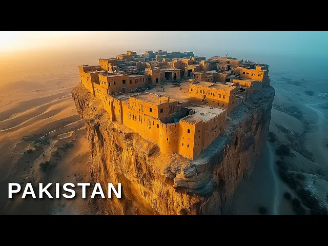
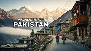
welcome to [Music] [Applause] Pakistan Pakistan is a land of breathtaking contrasts and profound history where ancient civilizations thrived and stunning Natural Beauty flourishes from The Towering Heights of K2 to the Serene Coastline of guad and from bustling bazaars to centuries old forts Pakistan is a tapestry of culture Heritage and Adventure before we dive into the wonders of this remarkable country let's uncover some fascinating facts that make Pakistan truly extraordinary Pakistan is not only a country rich in culture but also in geographical and historical Marvels it is home to the second highest peak in the world
K2 this peak is a prime destination for climbers globally offering challenging ascents and rewarding panoramic views additionally Pakistan boasts the world's largest deep sea port the port of guad this vital commercial hub connects Pakistan with international trade routes significantly boosting the local economy and providing numerous jobs opportunities another remarkable site is the cura salt mines one of the oldest and largest of its kind producing about 325,000 tons of salt annually visitors to the mines can explore its stunning Subterranean environment which includes an extraordinary salt cathedral made entirely of salt these sites showcase Pakistan's unique blend
of natural wonders and economic opport unities making it a fascinating country with a rich Heritage and promising [Music] future attabad Lake nestled in the Striking gojal region amidst the rugged beauty of the kakora mountain range attabad Lake emerges as a breathtaking Testament to Nature's transformative power born from the tragedy on January 4th 2010 following a massive land land slide that claimed lives and obliterated the village of attabad this Lake symbolizes both loss and renewal the landslide damned the hunza river rapidly creating a reservoir that submerged extensive areas including significant stretches of the vital Korum Highway
spanning over 21 km in length and reaching depths Beyond 100 m the lake displaced thousands and drastically altered the Region's landscape communities faced immense challenges as rising Waters engulfed roads homes and farmlands affecting approximately 25,000 residents this catastrophic event reshaped life in the hunza valley blocking access to essential services and disrupting daily life despite its origins in disaster attabad lake has morphed into a vibrant Hub of Tourism attracting visitors drawn to its stunning turquoise Waters and the Serene Vistas it offers the lake has become a popular destination for boating jet skiing and fishing captivating those
who seek Beauty and adventure in the heart of the mountains the disaster also spurred significant infrastructural developments including the construction of the Pakistan China friendship tunnels this project restored and enhanced the submerged sections of the Korum Highway strengthening trade and tourism ties and symbolizing a bridge between adversity and opportunity today attabad lake is a symbol of resilience a beautiful consequence of natural forces that reshaped a community's destiny it offers a unique juxtaposition of natural beauty and human endurance serving as a living reminder of the dynamic and everchanging Earth visitors to the lake experience not just
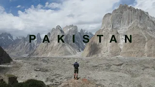
the Tranquility of its Waters but also the spirit of the people who transformed a disaster into a source of enduring strength and prosperity trango Towers perched majestically within the gilgit baltistan region the trango towers present a formidable skyline of jagged Rock spires that rise dramatically above the baloro glacier this cluster of Monolithic Towers part of the baloro Musto subrange of the kakora mountains is renowned for its breathtaking Cliffs some of the tallest and steepest in the world these towers offer climbers unparalleled challenges and have become a premier destination for big wall climbing the trango towers
family consists of several notable peaks with the great trango tower standing as the highest at 6,286 M its East face boasts the world's greatest nearly vertical drop making it the prime target for daring climbers seeking the ultimate test of skill and endurance the region is defined by its rugged terrain featuring a complex mix of steep snow and ice gullies vertical Rock faces and overhanging head walls among these Granite Giants the nameless Tower also known as trango Tower is perhaps the most iconic its pointed symmetrical Spire Rises about 1,000 M from the ridg line offering some
of the most technically challenging climbs the history of climbing here is Rich with pioneering ascents such as the first Ascent of the nameless Tower by Joe Brown and his British team in 1976 which opened the door to a succession of remarkable and Innovative climes the trango towers have witnessed some of the most significant climes in the history of mountaineering pushing the limits of what is possible at high altitudes these climbs often combine the technical diff difficulties of extreme rock climbing with the harsh environmental conditions typical of high mountain altitudes creating a unique climbing experience that
attracts the world's Elite climbers routes like the eternal flame on the nameless Tower stand as a testament to climbing Artistry blending sheer difficulty with the Elegance of line and form moreover the towers are not only about climbing they represent a symbol of Adventure that draws visitors from around the globe eager to witness these natural sculptures the climbing exploits have contributed to the lore of the region making the trango towers a symbol of human tenacity and the spirit of exploration whether viewed from the base or summited via one of their many routes the trango towers continue
to be a source of inspiration and wonder embodying the Grande and the challenge of the mountain environment they remain a profound reminder of the Earth's dynamic damic geology sculpted over Millennia and the enduring Allure they hold for those who seek to test themselves against some of the most formidable natural architecture on the [Music] planet cyel mulik nestled in the northern end of the Kagan Valley near nuran cipel mulik Lake stands at an altitude of 3,224 m above sea level this high altitude Lake formed by glacial marines that block the stream passing through the valley is
renowned for its Vivid Blue Waters and breathtaking surroundings surrounded by The Majestic peaks of the Himalayas including Mika parbat the highest in the valley cyel mulik offers a surreal landscape that feels like a scene from a fairy tale the area's ecology is Rich with a diverse range of plant species and large brown trout which thrive in the cold clear waters of the lake this biological diversity makes Ciel mulik a point of Interest not only for tourists but also for ecologists and biologists the lake is not only a natural wonder but also a cultural treasure steeped
in Legend and folklore it is named after the fabled prince cyul muluk who according to a local Legend crafted into poetry by Punjabi Sufi poet mean Muhammad baksh fell in love with a fairy princess here this story adds a layer of Mystique to the lake enhancing its Allure for visitors who are often captivated by the blend of natural beauty and romantic folklore accessible via a 14 kilomet Jeep track from nuran during the summer months the journey to the lake itself is an adventure offering stunning views of the valley and its rugged natural landscape the lake
is a popular destination for a variety of activities including boating fishing and Hiking visitors can explore the surrounding Trails or simply enjoy the Tranquility of the lakes's Azure Waters in addition to recreational activities cipel mulach is a perfect spot for photography enthusiasts and nature lovers who wish to capture the Ethereal beauty of the landscape the early morning light brings a magical glow to the lake ideal for those seeking the perfect shot or a moment of peace cipel muluk with its enchanting Waters and legendary backdrop offers a unique Escape into nature Splendor making it a must
visit destination for anyone traveling to Northern Pakistan it stands as a testament to the Natural Beauty and Rich cultural heritage of the [Music] region ppana dessert high in the rugged Landscapes of gilgit baltistan near scardo the katpana desert offers a surreal departure from typical desert imagery known as the cold desert it is famed for its freezing temperatures and unique white sand dunes which contrast sharply with the blackish gray mountains that surround it this high altitude desert sitting over 2,226 m above sea level is not only one of the highest in the world but also one
of the most unusual with its cold nights and strong winds that constantly reshape the landscape unlike the Golden Sands typically associated with deserts the Sands of katana Shimmer like pearls under the sunlight thanks to their unusual white color these granules are continually shifted by the powerful winds creating everchanging dunes and Landscapes that provide new scenes for visitors with each visit this Dynamic environment makes the katana desert a place of endless natural Beauty and Intrigue contrary to the sparse vegetation one might expect the desert is surprisingly Lush in some areas supporting a variety of plant life
that adds a splash of green to the otherwise Stark landscape the average temperature ranges from 8° to 26° C during the day and can plummet to as low as -10° at night challenging visitors to bundle up rather than strip down for for adventurers and Thrill Seekers the katpana desert offers a range of activities the unique experience of glamping allows visitors to enjoy the Stark beauty of the desert in Comfort nights can be spent around a bonfire enjoying the Eerie Silence of the expansive desert under a blanket of stars a truly mesmerizing experience mornings are equally
spectacular with the sunrise painting The Horizon in Hues of gold and Amber the desert is not just a natural wonder but also a cultural Landmark locally known as bana Nako or katpana bang a which translates to black sand it reflects the unique Heritage and linguistic diversity of the region this place with its Majestic dunes and extreme weather conditions invites a sense of adventure and offers an unforgettable [Music] experience Nar Valley nestled about 34 km from gilgit Nar Valley is a pristine Enclave known for its Lush forested terrain vibrant wildlife and stunning Mountain scenery this Valley
is distinguished not only by its natural beauty but also by its three mesmerizing lakes strangi lake Blue Lake and badlock Lake which add unique charm to its landscape surrounded by the lofty alar mountains the valley offers a tranquil retreat with its Alpine Meadows and dense Pine forests sitting over 3,000 m above sea level the area is accessible via the nalar expressway which extends towards the historic silk route leading to China this accessibility makes Nar a perfect day trip or a longer stay destination from gilgit a significant attraction in nter is the nter wildlife sanctuary established
in 1975 to protect its unique flora and fauna the sanctuary hosts a variety of tree species including Pisa and juniperus at higher elevations and diverse Wildlife like the aster maror Alpine ibec and The elusive snow leopard this Rich biodiversity makes Nar a Haven for nature enthusiasts and Wildlife observers the valley is also renowned for the Nar Lakes locally known as bashiri lakes comprising strangi lake Halima Lake and the remote badlock Lake these Lakes are known for their stunning Beauty and the Vivid colors that reflect the changing Skies the road to these Lakes winds along a
stream and is enveloped by the mountains offering breathtaking views and a sense of adventure as it is only passable in summer due to heavy snow in winter for adventure Seekers Nar offers more more than just Scenic Beauty it is home to the nter ski resort where ski competitions are held under the supervision of the Pakistan Air Force the resort features ski lifts and provides a challenging playground for winter sports enthusiasts Additionally the valley serves as a starting point for tracks across the nter pass to the ishkoman valley and over the dtar pass to chalt presenting
more vigorous challenges for hikers tourism in ntar is supported by various facilities including government and private rest houses hotels and the unique option of glamping combining camping with luxury these amenities cater to a range of preferences ensuring that visitors can comfortably enjoy the natural Splendor of [Music] Nar badshahi mosque located in lore the badshahi mosque stands as a Monumental relic of the mugal era constructed between 1671 and 1673 under the reign of Emperor aurangzeb known for its Grandeur and exquisite mugal architecture this mosque is one of the largest and most iconic in the region showcasing
an exterior of carved red Sandstone with marble inlay as a symbol of orb's military prowess notably commemorating his campaigns against the maratha emperor shivaji the mosque is strategically positioned opposite the lore Fort integrating it into the historic fabric of the walled City the badshahi mosque not only reflects the architectural preferences of its commissioner but also serves as a grandiose counterpart to the fort's alamgiri gate which or Zeb had built simultaneously the mosques Courtyard which can accommodate tens of thousands of worshippers was once purposed as a stable and quarters during the seik rule under Maharaja Ranjit
Singh and later served as a military Garrison under the British it wasn't until 1852 that efforts were made to restore the mosque to its original sacred purpose leading to its current status as a central place of worship and a major tourist attraction the mosque's architecture features an imposing Gateway which leads to a vast Courtyard surrounded by arcades the main prayer Hall adorned with intricate marble inlay work is flanked by two smaller halls and topped with three bulbous domes marking a majestic Skyline against Lor's backdrop its interior and exterior decorations remain unparalleled in their craftsmanship with
detailed floral motifs and geometric patterns that Captivate visitors in addition to its architectural Splendor the badshahi mosque has been a focal point for significant historical events it has hosted countless worshippers including dignitaries and heads of state during the second Islamic Summit in 1974 illustrating its ongoing relevance and sacred status in the Muslim world today the badshahi mosque not only stands as a testament to the rich history and cultural heritage of lore but also continues to awe visitors with its beauty and Grandeur making it a pivotal symbol of the Islamic architectural Legacy left by the malls
K2 rising to an imposing 8,611 M K2 is the second highest peak on Earth located in the Korum range this mountain straddling the border between Pakistan administered Kashmir and the China administered trans Korum tract is famously known as The Savage Mountain due to its formidable climbing conditions and high fatality rate for every four climbers who attempt the summit one tragically loses their life highlighting the peak's reputation as the deadliest of the world's five highest mountains k2's prominence as a challenging climb is not just due to its high altitude but also its harsh weather conditions Steep
and icy roots and the overall technical demands it places on climbers the mountain is less commercialized than Everest offering no easy paths to the top and requiring climbers to be self-reliant and extremely skilled in high altitude mountaineering the first successful Ascent of K2 was made in 1954 by an Italian Expedition led by arito deio with climbers Leno Ladell and achil compon reaching the summit since then K2 has become a coveted climb for Mountaineers who are drawn not only to its height but also to its reputation as a more pure and challenging Endeavor than Everest K2
is also notable for being the last of the world's 14 8000ers mountains above 8,000 M to be summited in winter this historic climb was achieved in January 2021 by a team of nepes climbers led by nural peria and mingma gal Sherpa marking a significant milestone in mountaineering history despite its Allure K2 remains one of the least attempted Peaks due to its difficulty it has never been climbed from its eastern face and many sections of the mountain are still unexplored preserving much of its mystique and Savage Beauty climbers continue to be drawn to K2 for the
ultimate test of ability endurance and courage underlying its status as not just a mountain but a Monumental challenge th desert spanning over 200,000 Square kilm across the Northwestern part of the Indian subcontinent the Thar Desert also known as the Great Indian Desert straddles the regions of India and Pakistan this vast arid region is the world's 18th largest desert and the ninth largest hot subtropical desert about 85% of the desert is in India mainly in rajastan extending into Gujarat Punjab and harana with the remaining 15% in Pakistan blending into the cholistan desert in Punjab the thar
is more than a Barren landscape it is a region of historical significance and Rich biodiversity recent discoveries like the 10067 milliony old decao SIDS highlight its paleontological importance the desert's climate is characterized by minimal and sporadic rainfall primarily occurring between June and September which influences its ecosystem of shifting sand dunes and sparse vegetation historically the thar played a crucial role in the desertification processes linked to the Ice Age and the shifting courses of ancient Rivers like the sarasvati which supported early settlements that evolved into the indis valley civilization as the climate changed and monsoons diminished
these settlements adapted to increasingly Aid conditions today the Thar Desert is vital for biodiversity conservation hosting unique wildlife sanctuaries and national parks such as rajasthan's Desert National Park which protects species like the Great Indian bustard and Pakistan's Nara Desert wildlife sanctuary home to the endangered mugger crocodile despite its harsh conditions the thar supports diverse fauna including several species of migratory and Resident birds and is integral to the local cultures which celebrate their Heritage through vibrant festivals and traditions efforts to combat desertification include Greening projects and the development of the Indira Gandhi Canal highlighting ongoing initiatives
to harness this challenging environment for sustainable development the Thar Desert remains a pivotal part of the Region's environment irental and cultural [Music] landscape Hingle National Park located 190 km from Karachi in the macran coastal region of balistan Hingle National Park is one of Pakistan's largest national parks covering approximately 6,100 Square km established in 1988 it spans the districts of guad lasbella and aaren the park is named after the Hingle river which flows along its boundary and merges into the Arabian Sea creating a dynamic ecosystem of both land and marine life hingol National Park features six
distinct ecosystems including desert Landscapes and plains and is renowned for its unique natural rock formations such as the bastan Sphinx and the princess of Hope sculpted by natural erosion these formations give the park a mystical appearance often likened to an archaeological site preserving the remnants of an ancient civilization the Park's biodiversity is impressive with 257 plant species and 289 animal species including rare ones like the cind IEX and the bastan Uriel the marine environment along the coast is home to indopacific dolphins and green and Olive Ridley Turtles which face threats from increasing plastic pollution impacting
their nesting grounds one of the Park's notable geological features is its mud volcanoes particularly those in the mid area some of which reach Heights of 800 to 1500 ft the completion of the mcran Coastal Highway has made these natural wonders more accessible to visitors the park also holds significant cultural value due to the presence of the hinglaj matam Mander a major Hindu Shrine that attracts hundreds of of thousands of pilgrims annually this Temple is one of the oldest in the region and plays a central role during the Spring Festival drawing large Gatherings from across sind
and belok kistan the Park's macran Coast especially K maler or virgin Beach is recognized among Asia's most beautiful beaches attracting visitors for their pristine conditions and Scenic views hingol National Park is a key area for conservation and Heritage preservation in Pakistan protecting a wide range of biodiversity and cultural heritage neum Valley located in the northernmost District of Pakistan administered aad Kashmir Nim Valley stretches over 200 km along the Lush vibrant course of the Nim River this area once known as kishanganga is renowned for its breathtaking landscape that rival the scenic beauty of Switzerland with elevations
ranging from 1,200 M to about 2,300 M the valley is framed by The Majestic peaks of the Lesser Himalayas which soar to about 5,20 M historically NM Valley was among the areas most affected by the 2005 Kashmir earthquake a testament to the Region's vulnerability and resilience the valley is not only a natural Haven but also a place rich in cultural heritage with a population of around 191,000 people as of 2017 the region is bordered by the high altitudes of gilgit baltistan on the North and by the districts of Kara and bandipora of Indian administered jamu
and Kashmir to the South this proximity to the line of control adds a layer of geopolitical significance to its Serene natural beauty Nim Valley is divided into two tasil a mukam and Sharda with a mukam serving as the district headquarters the economy is primarily based on subsistence Agriculture and handicrafts but tourism is emerging as a significant contributor thanks to the Valley's stunning Vistas and opportunities for trekking fishing and kayaking the district is linguistically diverse with Hino being the predominant language alongside Kashmir and others spoken by ethnic communities such as the guars and bakar wals the
area also features several endangered languages adding to the cultural tapestry of the region despite its challenges including accessibility and infrastructure development neum Valley remains a captivating destination for tourists and nature enthusiasts alike offering a unique blend of natural beauty cultural diversity and historic iCal [Music] depth deosai Plains discover the Ethereal beauty of the dosai Plains a mesmerizing high altitude Wilderness in the heart of Pakistan known as the land of Giants or diosi which translates to the shadow of the giant this Plateau stands over 4,000 m above sea level making it one of the highest plateaus
in the world its sprawling Landscapes Encompass nearly 3,000 square kilm across the gilgit baltistan region bordered by skardu Kang and asore designated as a national park in 1993 deosai is a crucial Sanctuary for biodiversity preserving a vibrant Mosaic of Flora and Fauna amid its vast Alpine Meadows the plains are famous for their spring carpet of wild flowers and diverse wildlife including the endangered Himalayan brown bear which the park specifically aims to protect deosai landscape is dotted with several streams and the Serene shiar Lake set against the backdrop of snowcapped Peaks this Lake along with the
Park's other water bodies supports not only the wildlife but also the ecological balance of the region the Park's elevation and isolation contribute to its unique weather patterns which can swiftly ly change from sunny skies to stormy clouds adding a dramatic element to its already stunning Vistas the area's Rich biodiversity is not limited to its famous brown bears but also includes a variety of other species such as the red fox golden Marmet grey wolf and numerous endemic and migratory Birds the Flora of dosai includes several medicinal herbs that have been harvested by local communities for Generations
visitors to deosai can indulge in activities such as trekking camping and Wildlife watching particularly near shaar Lake and the bar and kalapani streams the plains are accessible via scardo and are best visited during the summer months from June to early September when the snow has melted and the flowers are in full bloom lore fort a Monumental Citadel at the heart of lore this Fortress is situated at the Northern end of the historical wall City covering an impressive area of more than 20 hectares it is home to 21 notable monuments that reflect the rich tapestry of
its history especially prominent during the mugal era when the empire was at its Zenith known as Shahi Kila the fort embodies a significant chapter in the Region's architectural and cultural Al Heritage the foundations of the present day lore Fort were laid by Emperor Akbar in 1566 showcasing a Rich Blend of Islamic and Hindu architectural influences over the centuries the fort underwent numerous modifications especially under the Reigns of Emperor jangir and sha Jahan who added luxurious marble palaces adorned with Persian floral designs the fort's iconic alamgiri gate constructed by Emperor aurangzeb faces The Majestic badshahi mosque
forming a grand gateway to this Royal residence throughout its history lore Fort has witnessed various phases of occupancy from the mugal Emperors who enhanced its architecture to the seek rulers who utilized it as a strategic military stronghold under Maharaja Ranjit Singh the fort saw further additions and served as a royal residence the British Colonial period marked another significant chapter in the fort's history leading to its designation as a UNESCO world heritage site in 1981 recognized for its outstanding array of mugal monuments situated in the vibrant city of lore the fort lies near pivotal cultural landmarks
such as the minari Pakistan and ikbal park enhancing its stature as a central piece of Pakistan's Heritage this historic Fort not only embodies the architectural Grandeur of a bygone era but also continues to be a symbol of Lor's Rich historical tapestry attracting Scholars historians and tourists alike Huna Valley nestled along the hunza river the hunza valley is a stunning geographical Marvel located in a region bordered by ishan shigar Afghanistan's wakan Corridor and China's sh J the valley is set at an elevation of 2,438 M and is divided into three parts upper hunza Central hunza and
lower hunza each offering unique Landscapes and cultural experiences historically hza was a center of Buddhism before Islam became the dominant religion with many Buddhist archaeological sites like the sacred Rock of hza still present the valley was crucial on Ancient trade routes and played a key role in the spread of Buddhism across Asia after converting to Islam most of the population now follows the ismi sect and efforts are underway to restore ancient inscriptions left by Buddhist monks hunza was once a princely state that played a significant role during the British great game its capital was vaulted
now known as karimabad and it's home to historical landmarks like baltit Fort and altit Fort the landscape dramatically changed in 2010 when a landslide created the beautiful attabad Lake which has become a tourist attraction tourism is vital in hunza thanks to its breathtaking natural beauty surrounded by high peaks such as rakaposhi and ultar which attract climbers and nature lovers the valley is a starting point for high altitude TRS and is known for the karab pass the highest paved International border crossing connecting Pakistan and China the people of hunza are known for their hospitality and vibrant
culture the valley has a high literacy rate enhanced by community-led educational initiatives and the support of the aacon development Network the locals are engaged in sustainable tourism and agriculture which are crucial for their economy with its stunning scenery Rich history and vibrant culture h Valley offers a glimpse into the resilience and traditions of its people and showcases the awe inspiring beauty of nature thanks for joining us on this Unforgettable journey through Pakistan we hope you've been inspired by its stunning Landscapes Rich history and vibrant cultural heritage don't forget to subscribe for more incredible Adventures from
around the globe and until next time keep exploring the wonders of this extraordinary world