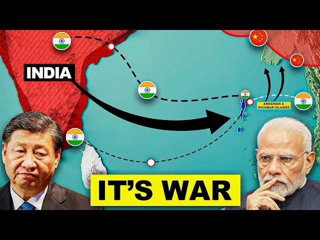
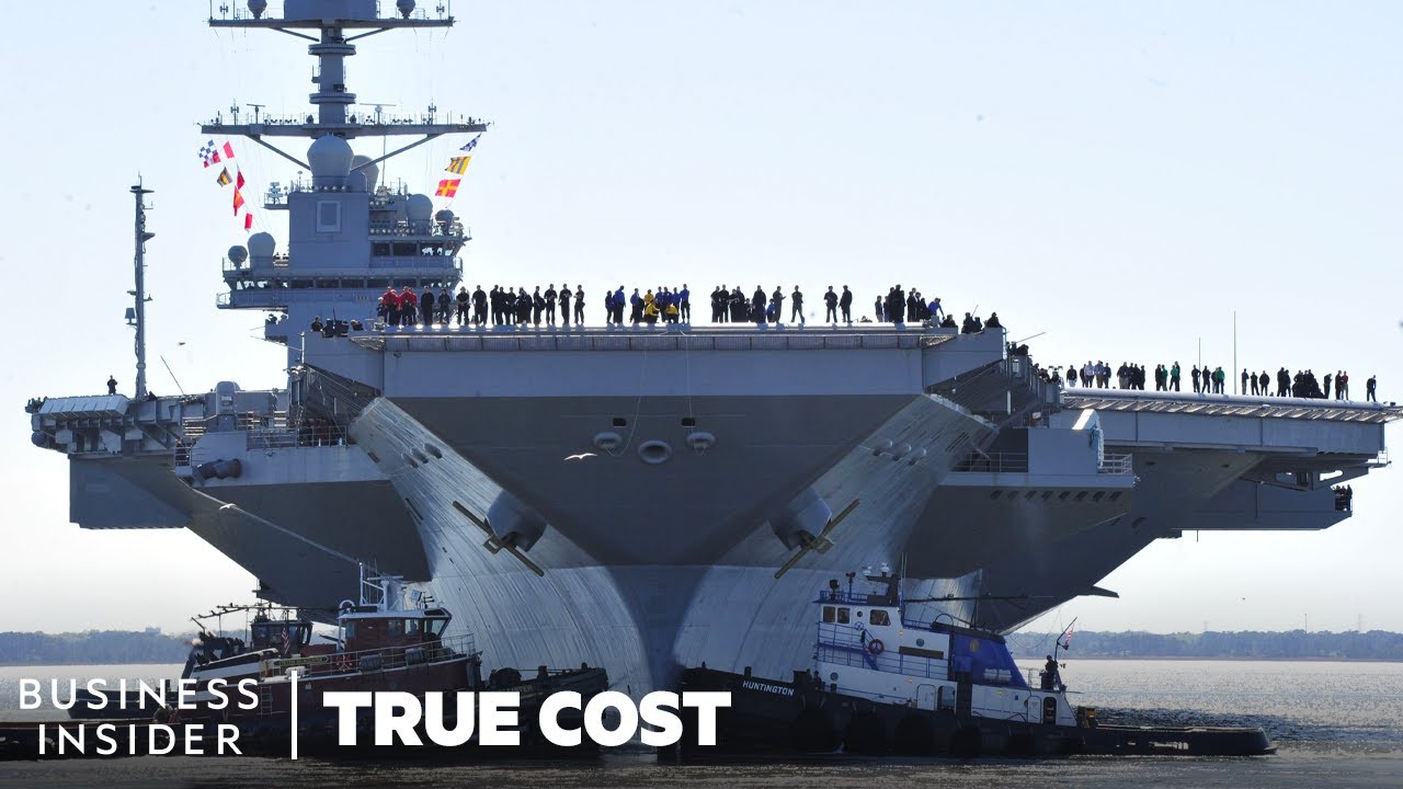
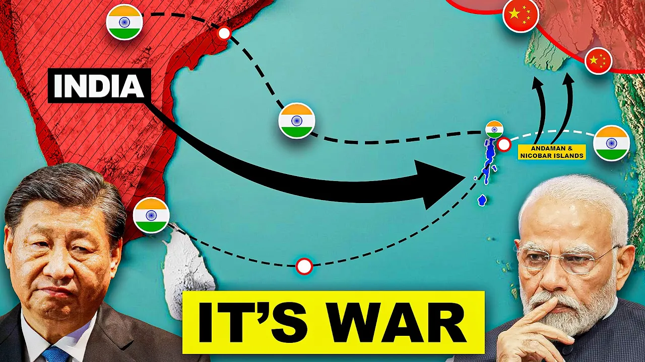
this tiny island in the Indian Ocean is controlling China and could become China's worst nightmare the moment it tries to mess with India here's an incident that proves this Indian Commanding Officer Colonel sash Babu along with his team set out to ensure that the illegally entered Chinese soldiers have moved back Beyond India's patrolling point 14 in the galwan valley region and he found they had not he asked them to evacuate the post but instead of evacuating on the night of June 15th 2020 the Chinese ready with massive reinforcements attacked the Indian soldiers with iron rods and spikes and killed 20 soldiers in retaliation Indian soldiers killed 40 Chinese and this was the first deadly clash in at least 45 years and while this conflict was going on in India's ladak region India silently played a master stroke 3900 kilometers or about 2500 M away in the Indian Ocean near a choke point that if India had blocked could have brought the dragon to its knees in no time soon after The galwan Clash the Indian Navy deployed its Frontline vessels along the malaka strait around the same time the Indian Navy swiftly but quietly avoiding any public attention sailed out its Frontline warship for deployment in the South China Sea where it was continuously maintaining contact with its us counterparts in fact these moves made China so uncomfortable that they raised objections about the the Indian warships presence during the Diplomatic level talks with the Indian side but it's not what you think these talks were not regarding some tensions in the Indian Ocean but rather to ease off tensions in the galwan region but the question is if both sides meant to discuss resolving the conflict in L do why did China becomes so uneasy and raise objections about a move happening thousands of miles away from the conflict Zone the simple answer is that the malaka strait is known as China's primary Maritime lifeline and it's obvious to raise concerns over enemy movement in a region that almost controls your entire country's economy but you have still not heard about the scariest part because these Indian islands known as the Andaman and nicobar Islands as you can see here are just 1,29 km or about 640 Mi away from the malaka Strait in fact the last Indian Island of the Andaman and nicobar archipelago the great nicobar island is just 90 km about 56 mi from the Western entrance of the straight of Mala this means India holds a significant deterrent against China in the Indian Ocean and block this route and the Chinese economy in no time in fact even in the case of a full-scale war despite having fewer warships and submarines than China these islands could give India a significant Edge over the Chinese Navy so let's understand why is the malaka Strait known as a Lifeline for China how does this tiny Island also known as India's Unsinkable aircraft carrier control China's lifeline and most importantly why is it becoming the worst nightmare of China but before we begin let's win a quick war against China a war against the CCP Bots by clicking on the like button because these Bots downvote our videos and try to bury them in the algorithm it doesn't matter if you throw bat soup on it or slap wi the Poo's face on it just make sure it gets clicked and with that let's start with the video Let's zoom out of the map and look at China now what we can see is a hammer and sickle and a red color around it ah sorry guys an editing mistake uh anyway China's economy survives on this one route called the malaka straight the straight of malaka is a strategic Waterway between Indonesia and Malaysia through which almost 67% of China's Maritime trade and 80% of its oil imports passes through in fact it's not just China more than onethird of all worldwide trade passes through the malaka strait so the malaka strait getting blocked would be a nightmare not just for China but really for the entire world and blocking such a point is much easier because all it takes is a few ships to block this very narrow route and the last time such an incident occurred the world faced a whopping loss of 54 billion in just 6 days in March of 2021 this ship named everg given got stuck in the Suez Canal and on the same day oil prices jumped about 6% and that too this 6% was when the world was facing the covid pandemic so this number could have been much higher if there was no pandemic at that time the sus Canal blockage roughly cost 12% of global trade and was holding up trade valued at almost $9 billion per day and since the ship was stuck for the six days the overall trade loss had been roughly estimated around $54 billion so now you know why such a location is extremely important and this is also why such locations are referred to as choke points but why am I telling you all this because this is where the game of geopolitics and deterrence comes into play if a country near the choke point decides to block this route for a rival Nation it could literally bring that country to its knees and this is where China's worst nightmare would become a reality a nightmare the Chinese themselves named as the malaka dilemma and you heard that right it's not a us or a European expert who coined this term but the Chinese president himself The malaka Dilemma is a word coined in 2003 by former Chinese president hentau it basically represents the threat of an entity choking its oil imports but who at the first glance it looks like the countries very close to the straight are Indonesia Malaysia Singapore Thailand and Myanmar now these countries might not block this route for China for a variety of reasons ranging from political to economic factors and maybe most of them don't even have a rivalry with China or I would say they don't dare to block this route because of China's military might yeah it's a harsh truth and we all have to see how China uses its military might to bully countries but if you look closely at the end of the malaka trade you will notice some tiny Islands or I won't be wrong to replace the word tiny islands with China's worst nightmare the question is if big countries like Indonesia Malaysia Thailand and Myanmar won't dare to block these Chinese ships then how is this group of tiny Islands even thinking of it well because it's part of one of the few countries in the Asian continent fighting back against China and that is India and while most people just know this India they actually miss these critical islands of the country the islands that are controlling China India can use these islands as a strategic deterrent against China as India can block Chinese slc's or SE lines of communications which are basically the primary Maritime routes used for trade military and other purposes we will discuss all the details regarding this in a few minutes but in reality it's just not what you think let me explain the fact that the Andaman and nicobar Islands also served as a strategic pit stop for Naval vessels of partner countries including Japan the United States Australia and France makes it even worse for China this simply means that the naval vessels of these countries can make brief stops for refueling maintenance or restocking supplies while they are on their way to their destinations so along with India this gives a huge advantage to the United States Japan Australia and France to pause during operations in the Indian oceans or before entering Southeast China and the South China Sea and this enables faster responses to strategic or emergency situations especially against China and why China because we all know who is the most mischievous kid in the class in fact suant Singh a senior fellow at New Delhi based Think Tank even said that in the event of a military clash between China and the us over Taiwan the us could ask India for support from the islands secondly these islands are also a very important part of a counter strategy that India is using against the Chinese belt and Road initiative which is known as the double fish hook strategy this is a maritime strategy to strengthen India's military hold in the Indian Ocean but what exactly is this double hook strategy the first hook starts here from the Andaman and nicobar Islands which extends to sabang port in Indonesia Koko islands and Australia and ends at the Diego Garcia which is the US military base in the chagos islands and each of these entities have an agreement with India this includes a port project agreement with Indonesia Mutual logistic support agreement with Australia which basically says that India and Australia can use each other's military facilities and lastly we have an agreement with the US called the logistics exchange memorandum of agreement also known as the L MOA even this agreement enables both sides to use each other's military facilities now comes the second hook which starts from the duk port of Oman extends to the French territories and the reunion islands and then to maius now if you draw a connecting line with all these points you will see that even this hook ends at Diego Garcia and even for this second hook India has military agreements with Oman France and maius because of these hooks India has a very strong hold over the Indian Ocean but for China the biggest threat the Andaman and nicobar Poe as we saw is that they could play a critical role in blocking the Chinese oil supplies but the most important question is if we know that this is a threat for China then China must have analyzed this threat way back right then why is China not doing anything to counter this sword hanging over its head actually they did but here's why they couldn't do much about it to understand the situation in China better let's understand the geographical context of this region if you see the maloca Strait Here It measures just 1,100 km it's about 68 forish miles in length in fact this point near Singapore known as The Philips Channel as you can see in this map is so narrow that it is just 2. 8 km or about 1 and 3/4 mil in width and this is the narrowest part of the malaka strait when it comes to the side near India's Andaman and nicobar islands where China faces its biggest threat the malaka strait is just around 400 km or 250ish miles wide between band AE in Indonesia and puket in Thailand and for such a narrow width it is way easier to block Chinese ships in fact Larry Bond the renowned Naval author in a podcast said and I quote if India wanted to cut off trade with China all they would have to do is Park a bunch of ships at the straight of malaka and that's it nothing else is getting through that way now if you look at the map closely you might be saying well hey there are so many other routes in the region China can consider even if India blocks the malaka strait for example the Sundar lomak and makasar Straits in the Indonesian archipelago and even other options like the sibutu passage or the mindoro strait so in reality there are a lot of other options to surpass the malaka straight so just consider alternative routes and the problem is solved right well actually the reality is far different the first alternative is the Sunda Strait it is 80 km or about 50ish miles long and 24 km or 15 Mi wide on the northeastern entrance and if Chinese ships pass from here then the threat of facing Indian warships would decrease to a large extent which is exactly what they need but what is stopping it from becoming a full-fledged alternative to the malaka trate is something that isn't visible on the map because in reality it has some serious drawbacks the water in this region flows with powerful fast moving moving currents making it difficult for ships to pass through safely on top of that its shallow Waters prevent large ships that are over 100,000 dead weight tons from passing through safely by the way dead weight tons or DWT is the maximum weight a ship can carry safely including everything on board like cargo fuel and crew this limit prevents overloading which makes the ship easier to control in the water so it's uneven seabed strong currents and depth limitations make it difficult for vessels that need over 18 M of water depth to pass through this straight on top of that there are risks from many oil drilling platforms just north of Western Java since oil drilling platforms create obstacles that narrows the passage even further and increases the chances of a collision and this makes navigating the straight even more challenging but surprisingly the next alternative the lambach straight is wider deeper and even less congested than the straight of malaka on top of that unlike the Sunda Strait the lambach strait has clear navigational channels without major obstacles this makes it one of the safest routes for super tankers while the depth across most of the malaka strait ranges from around 27 to 37 M and has enough minimum passage width of 2. 8 km or 1.
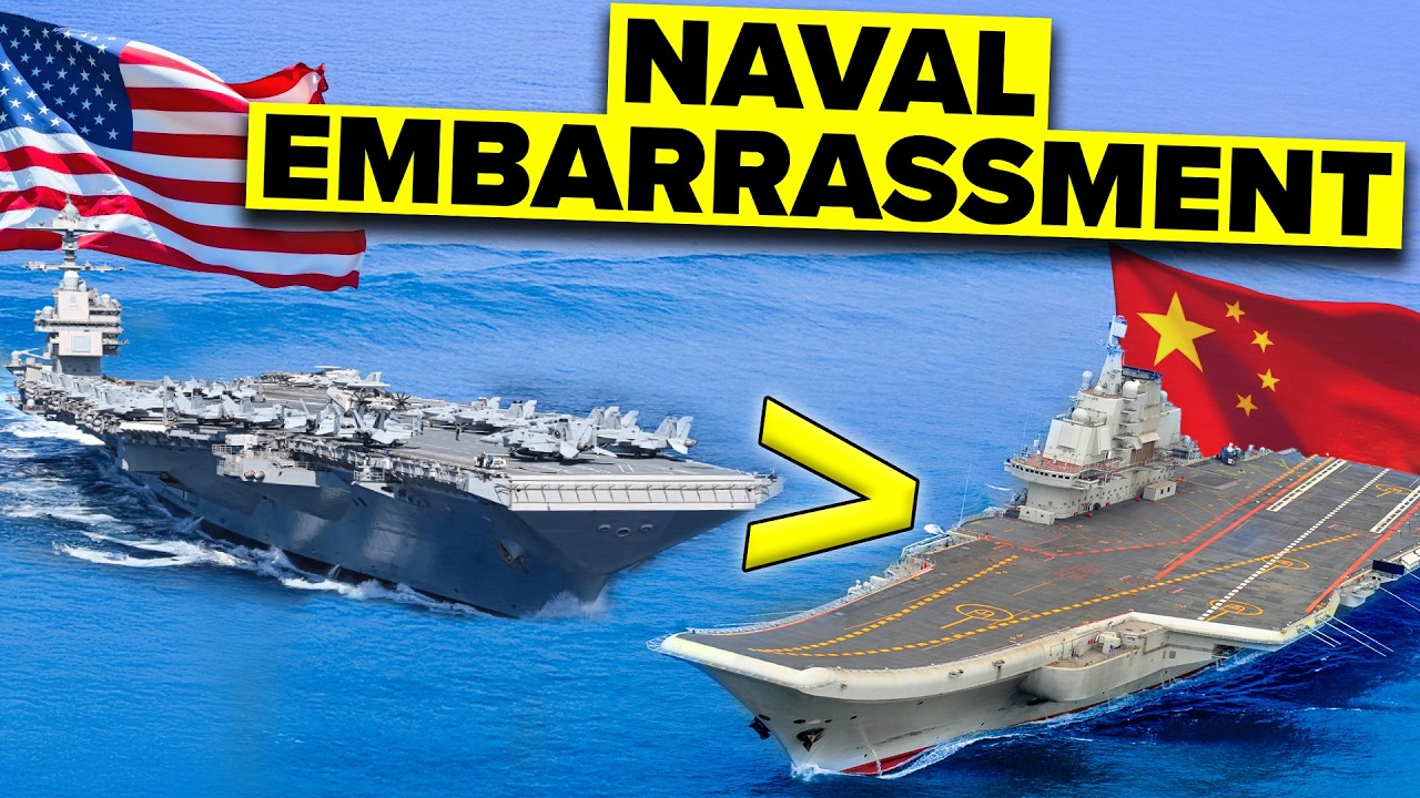
74 miles the lumboc straight has a minimum passage of 18. 5 km and a depth of more than 150 M but this route could increase the shipping cost by around $220 billion per year and this is for a very simple reason the straight could add about 1,600 nautical miles meaning ships would need an extra 3 and 1/2 days of travel at their usual speed of 14 to 16 knots this this longer distance raises Transportation costs making these routes less profitable for tanker companies and for this reason even this option is less popular than the malaka strait the same is the case even with other Alternatives we saw earlier in fact China might not even think of using the sibutu passage and the mendoro strait because they both lie in the Philippines and we've already talked about how tense the relationship is between China and the Philippines so malaka Remains the only feasible option to travel from East Asia to Western Europe via the Suez Canal I mean at least for now and I seriously mean it because increasing global warming might open another route for China and while the majority of countries consider global warming as a challenge it's actually a good sign for a few countries and China is one of them you might ask what has global warming got to do with an alternative trade route in fact this route is so efficient that ships passing through the malaka strait via the SE canal and then reaching to Western Europe have to travel a distance of around 21,000 km or about 13,000 Mi which takes about 48 days and if the same ship uses the Northern sea route in the Arctic the distance reduces drastically to 12,800 km about 1,000 Mi Which is less than 35 days so the Northern sea route or NSR Cuts The Distance by 39% as compared to the traditional Suz malaka path but would you be shocked to know that even with the longer distance around 94,000 ships still pass through the malaka strait each year whereas the NSR just saw 2,994 trips in 2022 too if the NSR is shorter than the malaka strait saving both time and money then why do ships still prefer the malaka strait this is because of the geography of the region the NSR lies in and the major reason why ships don't prefer this route is actually ice so even though this route is short ships can't use it because of the frozen Arctic water even if they want to use this route they must either rely on icebreaking ships or travel between May and September that is during the summer season when the surface ice on the Arctic water is lower on top of that in some years the ice free period May last as little as 6 weeks basically there's no guarantee when ice free conditions will start or end this is where the root cause of the problem lies because most cargo ships follow regular schedules known as liner Services where they travel specific routes and stop at various ports to pick up and drop off cargo this approach is mainly used by container ships which follow set schedules to keep cargo moving smoothly around the world the global shipping industry relies on just in time delivery meaning cargo arrives exactly when needed and for this system to work shipping companies need reliable predictable routes which is very difficult in the case of the Northern sea route but in summers even if a ship decides to take the NSR it would have to face the ice drifting into their route due to winds and currents plus Arctic weather can change quickly with fog poor visibility and strong winds making it hard for ships to stick to their schedules also because of these environmental challenges the insurance premiums for vessels operating in the Arctic are high due to the increased risk and this adds on to the overall shipping costs so environmental changes limited infrastructure and a shortage of ice breakers are some of the major challenges that prevent ships from taking this route so does this mean this golden routes dream is over for China well probably not remember we mentioned about why global warming could be good for some countries well as temperatures rise arctic ice will melt more quickly extending the shipping window and making this route an increasingly attractive option for trade in fact from 1979 to 2006 the length of the ice free season in all seas and Straits in the Russian Arctic increased on average from 84 to 129 days and this will keep increasing as global warming worsens additionally according to the Canadian and American Maritime experts 2% of global Shipping could be diverted to the Arctic by 2030 which could reach 5% by 2050 but the problem for China is that this change won't happen in a few years it could take decades in fact analysts expect the Northern sea route to be ice free by 2050 and a study on Arctic Marine shipping by the Arctic Council estimates that the NSR will be navigatable without Icebreaker help by 2080 and that too is only for 90 to 100 days but wait a second I know what question just crossed your mind it must be will the NSR solve China's oil problem because even though it can help China with an alternative route for its exports to a large extent when it comes to oil China is still dependent on the malaka strait right actually the scary fact for China is that 80% of China's oil imports come from the straight of malaka and this is something that the northern sear route cannot solve the reason is simple the Northern sea route is much longer which would significantly raise shipping costs even when it comes to other sea routes like the trans specific shipment routes it doesn't solve China's oil problem and when it comes to other modes of transportation like air roads or Railway here's how it would look while the average cost of International Air Freight is between $4 to $8 per kilogram average cost of rail Freight is 80 cents to $3 per kilogram Road Freight transport typically ranges from about 50 Cent to $2 per kilogram whereas ocean comes in at just 30 cents to 50 cents per kilogram making it the cheapest option by far to transport Goods so C transportation is the king and this is proven by the fact that 90% of traded goods are shipped by sea that is using water transportation and when it comes to shipping via Waters we have already seen who rules the shipping lanes at least when it comes to the Chinese shipments which is none other than the malaka strait now you know the reason why the malaka strait is considered the OG despite so many Alternatives in fact this is what makes it the scariest fact for China and the these Indian islands are making it scarier by each passing day and as we mentioned earlier these islands could help India win against the Chinese Navy despite having a lesser number of ships and submarines but how as we've already seen that the Andaman and nicobar islands are very close to the malaka strait and this serves as a threat to China but what is India doing to make them more scary for China the Andaman and nicobar are 572 islands with the Andaman group having 325 Islands while the nicobar group has 247 Islands out of which which only 38 of them are inhabited this line is known as the 10° Channel which is approximately 150 km or about 93 Mi wide and 10 km or about 6. 2 Mi long separating the Andaman and nicobar islands and here Channel basically means a narrow stretch of water that connects two larger bodies of water like Seas or oceans the 10 degree Channel also known as the great Channel or grand Channel within India's EZ is one of the world's busiest trading routes if India were to block the 10° Channel it could pose a significant threat to China by disrupting Chinese access through this area this strategic position allows India to control or limit movement which could impact Chinese maritime operations in the region similarly even the sixth deegree Channel could play a major role in countering China why because these channels sit near one of the most critical sea line of communications that China uses for trade and oil imports which is the malanca Strait in fact over 6,000 commercial ships pass through these 6° and 10° channels each year so along with malaka Strait even the 6° channel is one of the main nine choke points controlling access to this area in fact you may be surprised to know that even submarines are set to surface while passing through this checkpoint to prevent accidents so by controlling these channels India can monitor or in extreme cases even restrict access to the critical routes exactly how from the Andaman and nicobar Islands India could employ anti- acccess and aerial denial or a2ad weapons to block or limit Chinese ships from entering Indian Ocean Waters here anti-a ESS and area denial or A2 a is a military strategy to keep enemies out of a specific area or limit their movement within it anti access involves blocking the enemy from entering while area denial restricts their ability to operate effectively if they do get in and A2 a zones use weapons like longrange missiles and anti- ship defense to make enemy movements more difficult and risky but the question is all this sounds really good in theory but can India really take action against China because if we compare the size of their militaries it tells a completely different story well have a look at this according to the Firepower index while India's defense budget was $74 billion China spent three times more with a military budget of a whopping $227 billion in fact according to a US Think Tank China is spending over 700 billion a year on defense over three times the country's publicly stated budget and if we specifically compare the Navies of these countries while China has two aircraft carriers three helicopter carriers 49 destroyers 42 frigs 72 Corvettes 150 Patrol vessels and a whopping 61 submarines on the other hand India has two aircraft carriers zero helicopter carriers only 12 destroyers 12 frig 18 Corvettes 137 Patrol vessels and 18 submarines so clearly China is ahead in numbers and I actually mean because in quality this is how it looks like but anyways hypothetically even if India blocks these choke points for China China can use its military might to fight back and easily break the blockade or if we consider a second scenario where India and China go to war the Chinese Navy would easily outnumber the Indian Navy and get an edge in the Indian Ocean region right in reality these numbers are misleading and second India has a major advantage over China that these numbers aren't showing us but why did I say that these numbers are misleading because in case of an indo-chinese War China can never deploy its entire Navy against India because that would be a huge blunder the reason they won't do this is because they would still have to keep a sufficient number of naval fleet in their home Waters to safeguard eles from a possible us Japan attack however big the threat is in the Indian Ocean region China's primary goal will always be to maintain its presence in the South China Sea and the East China Sea but even if China deploys a significant number of its naval fleet against India it would be very difficult to win against India because of the geographical Edge that India has you see the conflict will take place in the Indian Ocean region which is actually India's home Waters and this one single fact would give India three major advantages over the Chinese Navy number one India would have access to short routes to potential scenes of battle number two the Chinese Navy would have to travel long distances to access the Indian Ocean and history has proven that going a long way from home and traveling a long distance for a battle is itself a disadvantage so short distance always favors the defender and becomes disadvantageous for the aggressor number three battles over long distances put a lot of strain on resources and create tough logistical challenges for example refueling ships also China will always have to maintain a stock of ammunition Fuel and other War components and this would be challenging whereas for India this won't be a big challenge also the Andaman and nicobar Islands would play a critical role as the military installations there could help keep the Chinese Navy away from Mainland India and this is because the Andaman and nicobar islands are 12200 km or about 745 Mi away from Mainland India but the question is even if India is in an advantageous position and despite all the advantages India has it would still need a substantial amount of military infrastructure and high-tech weapons to fight the Chinese Navy so is India even prepared to give the Chinese a befitting reply well you'll be shocked to know that the Chinese Navy might have to encounter the Indian Navy Thrice even before reaching near the Andaman and nicobar Islands via the Mala Strait firstly Vietnam has granted exclusive access to Indian naval ships to use the natrang port in Vietnam in fact the Indian Navy has been making regular visits to the southern Vietnam Port also Vietnam has asked India to help develop this Naval facility another reason why this is so special is because the natrang port is located very close to the kamran Bay Port which is considered as the finest deep waterer port in the Indo Pacific which is ideal for docking submarines large aircraft carrier and other naval ships and why is Vietnam doing this actually Vietnam sees a partner in India to fight off China in the South China Sea so it has been improving its relations with India in fact there are speculations that an Indian military base in Vietnam might be possible at kamran port on on the other hand India and Singapore have signed a bilateral agreement that grants Indian naval ships access to logistical support including refueling at Singapore's chungi Naval Base so this allows the Indian Navy to maintain a strategic presence near some of the narrowest points of the straight of malaka next as we already saw we have an Indian military base at the sabang port in Indonesia Indonesia has agreed to give India economic and Military access to the Strategic island of sabong also known as we Island this was a big deal because this island is located just 710 km about 440 Mi southeast of the Andaman Islands and less than 500 km or 310 mi from the entrance of the malaka strait itself and now finally comes the Andaman and nicobar Islands a strategic military asset for India these islands are home to The only integrated Tri service base of the Indian Armed Forces this simply means that this is India's only military base where the Army Navy and Air Force all work together as one unit also various Indian military lead leaders have described the islands as an Unsinkable carrier but why if you have seen an aircraft carrier it is like a mobile airport in the sea which allows fighter jets to take off for operating far from the land and this helps a country extend its reach across the ocean but in the case of the endan and nicobar Islands these islands are already located at the most strategic location which is at the mouth of the malaka strait and also at a key location in the Indian Ocean region the Andaman and nikobar command operates seven military bases of which two are full-fledged Air Force bases bases two serve as naval air stations for Logistics and administration and the remaining three are Naval bases or air stations but what would make these islands extremely lethal are the upgrades they will see in the next few years for example in 2019 an exclusive 68.
7 2 million military infrastructure development plan was passed According to which some of the naval air stations would be having their runways extended and once the runways are operational the Indian Navy will be able to operate its GameChanger p8 Poseidon Nar time surveillance and reconnaissance aircraft and the reason I said it's a game changer is because it's literally a nightmare for the Chinese ships and submarines in fact a top Navy officer said that there is no way any country ships or vessels can pass through the Indian Ocean without being detected by the Indian Navy's p8 I anti-submarine and surveillance planes and p8 I will not only detect such targets but will also classify and Destroy them by using Torpedoes depth charges and missiles here depth char is basically are explosive devices designed to combat submarines once fully completed this investment will allow India to station infantry soldiers missile Batteries More warships and drones in the ents to make the bases more lethal the Indian Air Force has also deployed s30 mki and jaguar strike Jets along with some of the most advanced surfac to- air missiles in the Andaman and nicobar Islands additionally the inauguration of the chai UNAM and nicobar undersea internet cable would play a critical role in communication the high-speed internet connects seven remote Islands which not only gives people better access to communication but also helps the military by providing reliable communication channels for strategic purposes Additionally the Indian Navy has aimed to increase its Fleet from 140 to 200 warships by 2027 but surprisingly it's not just India preparing against China in this region Japan the United Kingdom and Australia have teamed up with India encountering the Chinese submarines this is because there have been reports that India might consider installing the Japan us veloped Fish Hook sound surveillance system which is a chain of sensors designed to track submarines once the system is operational it is expected to enhance intelligence sharing among Japan the United Kingdom Australia and India which will create a foolproof counter wall against Chinese submarines in the Andaman Sea and South China Sea along with this the endan and nikobar command regularly conducts joint Maritime exercises with partner Nations one example is the Singapore India Maritime bilateral exercise or simex which helps the Indian Navy and the Republic of Singapore Navy improve their interoperability India also holds Milan the largest naval exercise in the region with navies from all over the indopacific taking part in a Malibar exercise between the Indian and US Navy these exercises show that India is committed to keeping the region safe and strengthening its relationship with other friendly Nations now along with military development on these islands India has also allocated a massive 8.