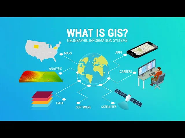
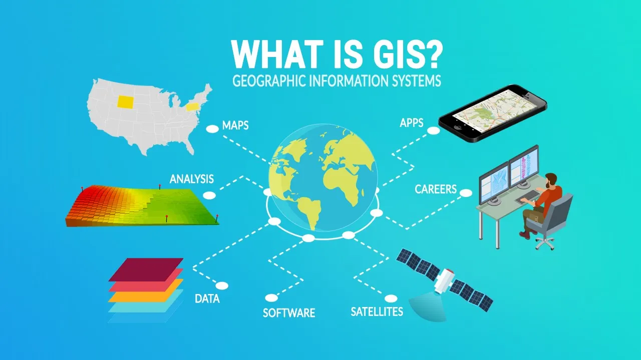
in this video I'll provide you with a thorough definition of GIS from mapping to analysis you'll learn how we use GIS to model the world around us let's get started GIS stands for geographic information systems it's a computer-based tool that examines spatial relationships patterns and Trends in geography using a GIS allows you to store analyze and visualize data for Geographic positions on Earth's surface there are four main functions of a GIS first a GIS has a data management component for storing Geographic locations secondly a GIS visualizes Geographic data typically using Maps thirdly GIS software can
analyze spatial relationships and patterns using geoprocessing and finally a GIS can either create new data or edit existing data let's take a look at each of these four functions at number one we're going to look at the role of data management in GIS data management in GIS is the process of organizing storing retrieving and maintaining Geographic and attribute data GIS data consists of either Vector data or raster grids first vectors are points lines and polygons with vertices for instance administrative boundaries are often represented as polygons whereas something simple like fire hydrants is stored as points
roads are a good example of line data the other type of data type is raster for example satellite images aerial photographs and digital elevation models are examples of raster data we also call it grid data because it's represented as rows and columns we use these two data models every day in GIS each type has its own strengths and weaknesses and is better suited to different kinds of spatial data and Analysis at number two we have visualization let's say you have latitude and longitude coordinates in a table I think you can agree that it's really difficult
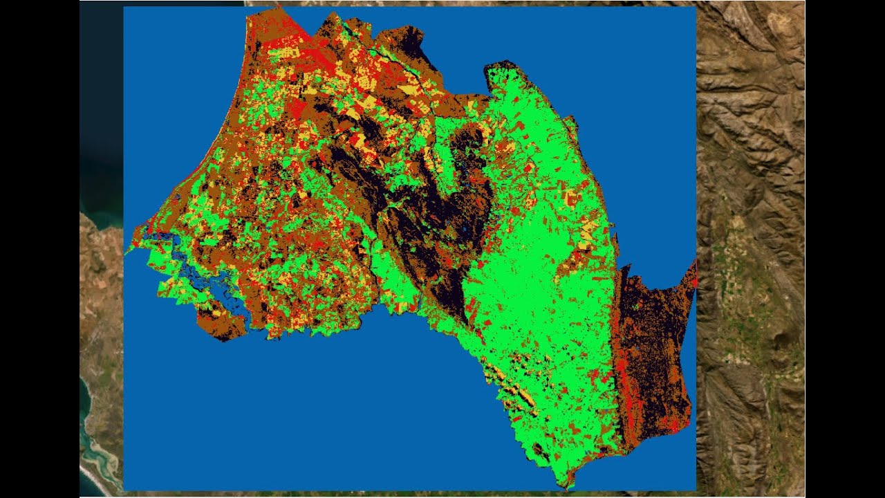
to know where those locations are but once you show the data on a map it provides Geographic context so you can fully understand where these locations are in the real world GIS works with these physical locations instead of tables and we map it all out here are some of the most common types of maps choropleth Maps use shading or color to represent data values for different regions or polygons such as visualizing demographic or socioeconomic data heat Maps use shading to represent the intensity or density of data values in an area heat maps are often used
for visualizing spatial patterns and data such as crime or traffic density an isoline map is a type of map that uses contour lines to represent data they connect points on a map that have the same value such as temperature elevation or rainfall at number three we're going to look at geospatial analysis the purpose of GIS is to analyze Geographic relationships and patterns using geoprocessing geoprocessing can be used to perform a variety of tasks with a focus on extracting meaningful information from Geographic data for example a GIS can identify the shortest route between two points or
it could create buffers around features it can also overlay different data layers to identify spatial relationships and conduct statistical analysis on Geographic data they say you don't truly know your data until you can visualize and analyze it geographically through spatial analysis you can solve location problems to measure quantify and understand our world better and finally at number four we're going to look at the role of GIS editing GIS data is a key component in the development of accurate and effective applications because without geospatial data the field of GIS wouldn't exist editing involves building new data
sets from the ground up or updating existing Geographic data it's important because it ensures that the data being used is accurate up-to-date and relevant to the problem at hand now that you have a bit of background on what GIS is all about let's take a closer look at some of the most common types of GIS jobs if you're just starting out in the field of GIS you'll likely start as a GIS technician this role involves most of the grunt work like data editing and map production The Next Step Above This level is either a GIS
analyst or specialist both types of roles typically are heavily involved in geospatial analysis and it may involve data modeling and coding another common job in the gis field is a cartographer cartographers specialize in creating visually appealing map products and communicating this information finally GIS developers strictly work at code development this might be for the purpose of automating workflows of building customized scripts that perform a specific task although it's seen its fair share of twists and turns GIS has steadily increased in demand and is becoming more mainstream in various Industries around the world we use GIS
in a wide variety of applications across many different Industries here are some of the biggest users of GIS urban planners use GIS to model and analyze Urban Land Use transportation and infrastructure this helps planners make informed decisions about development and growth Environmental Management leverages GIS to Monitor and manage natural resources track species habitats and predict the effects of climate change Emergency Management uses GIS to manage and respond to natural disasters disease outbreaks and other emergencies marketers use it to help businesses Target their marketing efforts by analyzing demographic data and consumer Behavior patterns in agriculture GIS
can optimize crop yields manage land use and monitor soil and water quality in energy management we use GIS to manage and optimize energy distribution networks monitor energy usage and identify opportunities for energy conservation there are countless ways where we are using GIS to improve efficiency and make a difference in the world as technology evolves so does the entire industry of GIS here are some of its current and future trends mobile GIS has really been mainstream for a long time already because of the increasing use of smartphones and tablets mobile GIS enables users to access and
interact with geospatial data from anywhere using mobile devices this is leading to new applications in areas such as field data collection asset management and emergency response open data and open source GIS software are also mainstream now open source software like qgis provides access to a wealth of geospatial data and tools at little or no cost in addition to open source software we are seeing more open data portals which are common in all levels of government cloud-based GIS Services allow users to store process and access geospatial data in a highly scalable and cost-effective manner cloud-based platforms
offer flexible Computing resources and easy access to a wide range of geospatial data with the explosion of big data and GIS and the increasing availability of AI and machine learning tools are transforming the way we analyze and visualize geospatial data these Technologies are helping to unlock insights from vast amounts of geospatial data finally we have 3D data with the increasing availability of 3D data and visualization tools it enables users to visualize and analyze data in a more realistic and immersive perspective all right there you have it that was our definition of geographic information systems now
we'd love to hear from you any questions you might have in the comments section below also please don't forget to like And subscribe to our channel for more great videos see you next time