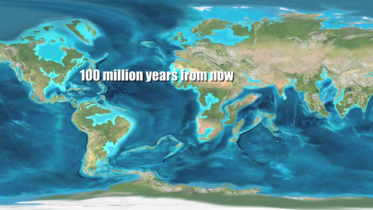
in this video we're going to read about the distribution of oceans and continents today continents cover 29% of the total surface of the Earth and the rest that is 71% is covered by ocean bodies that is the reason planet Earth is also called as Blue Planet due to the Abundant water on its surface when you look at the world map the distribution of ocean bodies and land mass how they are today it was not like this earlier it was something like this so in this chapter we will understand how why and what made them change
so much that it changed from the picture on your left to the picture on your right we will also learn how scientists came to know about this because scientists and philosophers are the ones who formed theories and collected evidence regarding the structure of the earth therefore it gets very fascinating to know about their way and methods of coming to a conclusion which everyone of us today are reading about let's begin with the first topic continental drift Contin Al drift is a theory based on the fact that if you look at the coastline of both side
of Atlantic Ocean which is these two places basically you will see some similarity it looks as if they were together as one land mass once upon a time and then it broke apart and because of this observation scientists believed that the two American continents then Europe and Africa they were once joined together initially there was this Dutch map maker Abraham atius who came up with this observation about the three continent being together but in 1912 it was a German meteorologist by the name of Alfred Wagner who gave a comprehensive argument in the form of continental
drift theory because he thought that the continents are drifting away from each other I've made a separate video on this topic the theory of continental drift and the evidence in support of this Theory you can find both the videos Link in the description please have a look at it so far we have studied about what is the continental drift theory and what are the evidences in support of the continental drift theory now we are going to read about the forces behind continental drift theory Alfred Wagner the person who suggested the theory of continental drift he
suggested that there were two reasons behind it first one is pole fleeing force and the second one is tidal Force let me tell you in quick what these two forces are by the name pole fleeing Force we can think of something that is fleeing away or running away from the pole in this case we are talking about the land mass that is fleeing away from the South Pole because in initially it was considered that Pang was originated near South Pole and the Earth's centrifugal forces caused Pang to break apart and the resultant continents to drift
towards Equator the second force that was suggested by Vaga was the tidal force it is due to the attraction of the Moon and the Sun that develops tide in Oceanic water so WEA believ that it is due to these two forces that worked for millions of years led to Breaking of continents now there is a Twist in this Theory most Scholars considered these forces to be totally inadequate meaning they did not find enough strength in these two reasons that was suggested by wager which ultimately led to the rejection of his theory so please remember it
is due to the invalid reasons presented by vager led to the rejection of his theory on Continental Drift and those invalid reasons were pole fleeing forces and tidal Force now we are going to read about post drift studies meaning after the rejection of vean continental drift theory there were some more research and studies done so that it would be better to know that what if there are some unknown Avenues which were left unexplored now the problem with vag's theory on Continental Drift was the evidence which were completely focused towards landmass in fact they were collected
from landmasses so if you remember from the video evidence in support of continental drift theory Again the video link is in the description we spoke about distribution of fossils of Flor and FAA or deposits like Delite so all these evidences were focused towards landmar now Alfred Wagner proposed his theory on continental drift in 1915 that was the time of World War I a number of discoveries during the post-war period added new information to geological literature particularly The information collected from Ocean flow mapping provided New Dimensions for the study of distribution of oceans and continents now
let's read about what are those new information that came out the first one is convectional current theory now what is the meaning of the word convectional convection is the circular motion that happens when warmer air or liquid which has faster moving molecules making it less dense Rises while the cooler air or liquid drops down so how does rainfall occur when warm air that goes up it holds a lot of liquid basically the moisture part and when it condenses the warmer air is cooled the mo moisture inside it it breaks into liquid molecules and it falls
down as rain now in the similar sense there's this person called Arthur Holmes in 1930 he said that there is a possibility of convection current operating in the mantle portion now if you remember anything from the video different layers of the earth there I have discussed that the Earth is divided into these layers right crust mantle and core and especially mantle is divided into two parts the upper mantle and lower mantle and the upper mantle is also called as asthenosphere which means weaker layer so Arthur Holmes is basically saying that there is a convection current
which is operating in this part of the earth which is the upper mantle because here all the rock is in molten State and there is this motion going on wherein the wherein the molten rock is moving in a circular path and that is what makes this layer very weak so Arthur Holmes says that there exists a system of such currents in the entire mantle potion so this was a very major contribution to our understanding of how the earth works and this also became the basis on which the Contemporary scientists discarded the continental drift theory so
I hope you understood the convectional current theory now we're going to read about mapping of the ocean floor by the very name you can understand that it speaks about mapping or exploring the ocean bed so while mapping the scientists found that ocean floor is not just a vast plane but it is full of relief meaning it has similar uneven surface like we have on landmar there are mountain ranges as well as deep trenches and then deep valleys in the ocean bed so trenches are deep cavity or crack in the ocean bed they usually occur when
two continental plates move apart there's another thing called the mid Oceanic ridges ridges are long mountain ranges now imagine how there could be a long mountain range inside the ocean and the reason behind that is due to volcanic eruptions so always remember right under the crust we have the mantle mantle is again of two types that is upper and lower mantle but this mantle consists of molten rocks that keeps circulating that is why the mantle is not a stable layer of the Earth so whenever there is a volcanic eruption the magma comes out of the
oceanic crust it then becomes solidified Rock after cooling this solidified rock is also known as oceanic crust and this oceanic crust after repetition forms Oceanic rich rich bridge is an uplifted land mass that looks like a mountain range so what the scientists did was they took samples of rock particles from this Ridge area as well as from the Continental area they just wanted to experiment and see whether which one of them is younger in terms of age and it turned out that the sample of rocks that were collected from The Ridge area is younger and
that has to be obviously younger because the volcanic eruption is happening every now and then so newer molten rocks are forming layers of oceanic crust and this was an interesting finding which made the post- drift studies more real and valid now we're going to read about ocean flow configuration here the entire ocean flow has been divided into three segments and it has been done purely based on the depth as well as relief meaning based on the looks let's read about each segment of the ocean floor the first one is Continental margin by The Heading you
can again figure out that it's talking about area between the shore that is Continental Shore and deep sea bessin if you are on a beach as you go further towards the sea you'll notice the land form shows depression as a result the water level increases like this there will be a point where the water gets really deep and from above it looks deep blue that is the deep sea bessin so this area is called the Continental margin and this consists of continental shelf continental slope which is the land depression then continental rise and deep Oceanic
trenches again trenches mean deep cavity which occur when two continental plates move apart the second one is Abyssal Plaines so Abyssal means very very deep we are talking about deep plains that lie between Continental margin and mid Oceanic ridges so I have explained you what is Continental margin and what is mid Oceanic ridges so the area in between is called the abysal plane there's something special about this place all these sediments that is the mud or Rock particles it gets deposited here so if you see there is land depression as we move away from the
continent towards deep sea due to this natural depression all the mud particles or sediments it moves downwards it moves towards the abysal plane and the third component of ocean floor is mid Oceanic ridges I've explained what they are they are long chain of mountain system within the ocean it is also the longest mountain chain on Earth but it is inside the ocean water and these rich occur due to intense vol iic activity when the magma comes out of the mantle it breaks the oceanic crust so that the molten rocks can come out and after cooling
it forms layers of crust this is how there is an upliftment that makes it a rich now we are going to read about the distribution of earthquakes and volcanoes for this we are going to refer to this figure the big black dots represent hot spots which basically means that here the magma comes out of the mantle that's why they are referred to as Hotpot spots many such hotpots are located in ocean floor and there are few on Continental mass as well the next you see the tiny black dots these are places where you will find
a volcano many of them are located on Continental mass and a few in ocean floor then we have these tiny gray dots forming a long line sort of a thing these are regions of shallow earthquake and they are found on Ocean bed they are also known as mid Oceanic ridges and I've explained what mid Oceanic rides are they occur due to movement of continental plates and if you see earthquakes are Tremors originating from plate movements at last we have the gray shaded regions they are deep earthquake zone again they are part of mid Oceanic ridges
but these are deeper ones and a very active earthquake zone so if you look at the grish area near Indian Himalayan region this region is very unstable because the Indian and uian plates are constantly converging and creating tension so this this was the entire distribution of earthquakes and volcanoes that we saw with the help of a figure now we go on to the topic concept of seaf flow spreading now this is where things get really interesting so you remember Alfred Wagner's continental drift theory in case you haven't seen the video I recommend you do so
the video link is in the description or you can also click on the info card on top vag's Theory focused more on the Continental evidence like the fossils of animals found in various Continental landmasters then how the South American east East Coast kind of looked like a missing puzzle when joined with the African West Coast so things like that were Alfred Wan's arguments now what happens is the post- drift studies gave some valid arguments and information against Wagner's continental drift theory especially mapping of the ocean floor and testing of oceanic rocks were very crucial steps
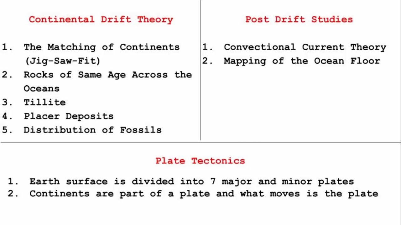
that were taken by the scientists they revealed some real facts that gave the post- drift study good amount of weight when compared to Wagner's continental drift theory I know things are getting a little confused using so what I'm going to do is create a nice differentiation between both the theories side by side so that it makes clear sense as to what is what and it will also serve as a quick revision so on your left hand side is the continental drift theory given by Alfred Vagner and on your right hand side is the post- drift
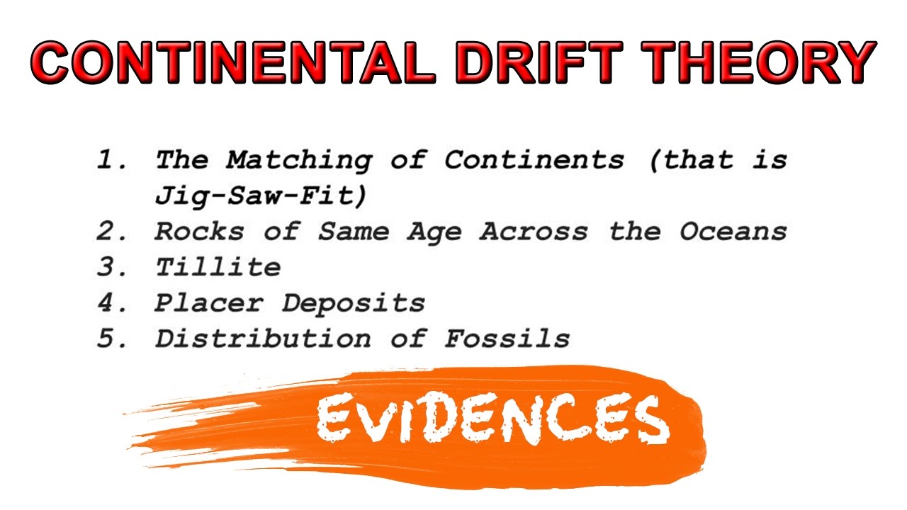
studies which were done by various scientists just to prove the point that there are reasons much more Beyond What wagonner suggests the continental drift theory talks about the matching of continents Wagner said if you look at South America and Africa they look like a jigsaw puzzle fit when brought closer which is true that once upon a time both land masses were together but the reason behind that is much more deeper than just merely looking at the world map and saying they were ones together the second point in continental drift theory talks about the fact that
rocks from different continents were of the same age and this point made Vaga believe that the land masses were once together and they slowly drifted away again the reason behind the drifting is much deeper than just looking at rocks and saying they all are same the third point in continental drift theory talks about tillite formation the Gana land consists of six land masses they are India Africa Madagascar Australia Antarctica and folkland Islands under the base of these six land masses teite sediments were found so that made Vaga think that okay these six land masses were
once together and now they are aart so this is a pretty good observation however the reason is much bigger and in depth rather than observing Delights the fourth point in continental drift theory talks about Placer deposits they are deposits of Rich minerals like gold diamonds Etc so if you look at the coast of Ghana and then coast of Brazil you'll see that these Placer deposits looks like Wayne that were once joined together this point again made vagona believe that Africa and South America was once a single landmar and the last point in continental drift theory
talks about distribution of fossils when identical species of plants and animals were found on landmasses it made Vaga strongly believe that once upon a time there was only a single landmass and with time it started splitting into different continents so these were the evidences of Alfred wager that made him come up with the continental drift theory now coming to the right hand side that is the post drift studies after the World War II many discoveries were made which added new information scientists started arguing the fact that Alfred Vagner only looked at evidences that were collected
from the Continental areas which is true if you look at the left hand side all these evidences were taken by simply looking at the land masses so in the post- drift studies the scientists felt hey why don't we do some comprehensive study by mapping the ocean floor and that led to the convectional current theory where Arthur Holmes said it is because of the magma present in the mantle which is causing the ocean flow to expand since the oceanic crust is thinner than the continental crust therefore it is easy for the magma to come out from
the ocean bed and that's why the mid Oceanic ridges give a solid proof about this Theory and the second point in post- drift theory is the mapping of ocean floor when the ocean floor was being mapped scientists saw that ocean bed is not a flat piece of land it has similar terrain uneven surface just like we have on land this was an astonishing finding and then they also went on to find mid Oceanic ridges on the ocean bed which are these long range of mountains that were formed due to the rocks that came out of
the mantle in the form of magma and when scientists took samples of rock from the mid Oceanic ridges as well as from the Continental side they found that the rocks from the mid Oceanic Ridge were comparatively younger in age hence they concluded as we move away from the mid Oceanic ridges the age of the Rocks increases so this was the post- drift studies which totally focused on the concept of sea flow spreading that is the ocean flow gets pushed to the opposite side due to volcanic eruption at the crest and making the sea flow spread
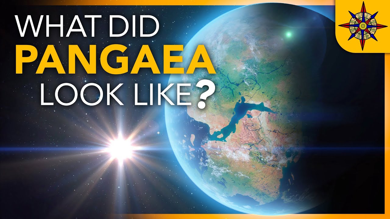
and it was presented by Harry hes in 1961 whereas the continental drift theory by Alfred Wagner focused on the argument that all the continents were once upon a time a single Continental Mass named pangi and then the single Continental Mass began to split into smaller ones and that's how the world looks today so if you see two totally different theories proposed by two different people hold on we are not done yet now we have a third concept which brings us to the topic plate tectonics now this is the third concept that tries to answer the
questions related to distribution of oceans and continents if you see this entire chapter so far has been trying to answer the questions related to distribution of ocean and continents I mean that's what the title says and we have so far seen two theories the concept of PL tectonics was presented by mezi Parker and Morgan three people in 1967 just after 6 years of hess's SE floor spreading Theory so what the plate tectonic Concepts say is the lithosphere which is also the combination of crust and upper manle it is in the form of irregular slab of
solid rock so think of the lithosphere as a large plate and now when a plate breaks this is exactly what it looks like when we say irregular slab of solid rock this is what the plate tectonics concept is suggesting so we know that lithosphere consists of crust and upper mantle and the crust is both continent Al as well as Oceanic in nature the oceanic crust is thinner than Continental but in general it is one complete crust hence the lithosphere covers both ocean as well as Land And now when we think of a plate we can
easily relate that a plate consists of land as well as ocean doesn't matter which of the two occupy a larger portion of the plate now let's look at the world map according to this New Concept which is plate tectonics our entire Earth surface is divided into seven major and some minor plates and the these major plates are the first one is Antarctica and the surrounding oceanic plate and the second one is North American with Western Atlantic flow separated from South American Plate along the Caribbean islands plate the third one is South American with Western Atlantic
floor spread it from the North American Plate along the Caribbean islands plate and the fourth one is Pacific Plate and the fifth one is India Australia New Zealand plate and the sixth one is Africa with the Eastern Atlantic floor plate and the seventh one is uraia and the adjacent oceanic plate now let's look at some minor plates the first one is Cocos plate which is between Central America and Pacific Plate then we have nasca plate that is between South America and Pacific Plate and then we have Arabian plate mostly the Saudi Arabian Landmark then we
have Philippine plate between Asiatic and Pacific Plate and then we have Caroline plate between the Philippine and Indian plate north of new guinia and the last one is Fuji plate that is northeast of Australia now the reason this plate tectonic theory is so interesting is because it makes a very important argument that continents do not move in fact continents are part of these plates and it is the plates that has been moving throughout the history of Earth and it will continue to do so in the future as well I hope you're getting what I'm trying
to say so if you remember Alfred wner said that initially everything was one single land mass named as Pang but it according to new discoveries it is now believed that Pang existed due to the convergent mechanism of plates on which continents reside convergent means coming closer now we're going to read about three types of plate boundaries the first one is divergent boundaries the meaning of the word Divergent is pulling away so plates that moves apart from each other is due to Divergent mechanism and it creates a fault or depression which is known as divergent boundaries
places where plates move away is also known as spreading SES one such example is the Mid-Atlantic Rich here the American Plate is separated from Eurasian and African plates the second one is convergent boundaries now convergent is opposite of Divergent meaning coming closer so what happens when two plates come towards each other one plate Dives under another and it is usually the smaller plate that converges under the bigger plate leaving that land area a little uplifted so this mechanism happens between an oceanic and Continental plate then between two oceanic plates and then finally between two continental
plates the third one is transform boundaries in this mechanism what happens is the motion of the plate is horizontal or in other words here the two plates slide past one another I mean the best way to imagine is look at this picture and see how the plates are moving past one another now that we have read about different plate movements it's time to understand what is the rate at which these plates move I don't know whether you have seen this program that used to come on Discovery called strip the city in that they discussed in
one of the episodes how geologists find the rate at which the plates are moving it is very fascinating to see what they do is they Place sensors all over the regions to record movs of a plate they use an instrument called creep meter it monitors the slow surface displacement of an active geologic fault in the earth its objective is to record the tension that's building up in the Falls they put two rods attached with steel wire so when the Surface starts moving it puts the wire and the geologist measure that expanding Gap it's usually measured
in millim and roughly a fault moves around 5 to 10 mm a year I recommend you watch that video in your free time it's really fascinating we now come to another important topic what is it that is making these plates move I mean what is that Force so when we see Earth we see this round solid body floating in space right but I want you to know this solid body is not motionless if you have seen my video on different layers of Earth in that I have explained the mantle consists of molten rock and how
this magma moves in a circular manner making the upper mantle a weak layer and from this weak layer often heated material Rises to the surface spreads and then sinks back again this cycle keeps repeating over and over to generate what scientists call a convection cell or convective flow again you can go back and look at the convectional current theory that we discussed under post drift studies so to answer the question what is the force that is moving the these plates the answer is it is the soft mantle and the circular flow of heated material inside
the earth which is the driving force behind the plate movement coming to the last topic of this chapter movement of the Indian plate okay let me just quickly wrap up this topic in the most shortest and simplest form look at this picture it's the movement of Indian plate so initially India was part of this huge Australian plate it was like India was a large island situated of the Australian coast and this Australian plate was part of the Gana land we are talking about 200 million years ago then India broke from the Australian plate and started
moving upwards towards the euroian plate about 40 to 50 million years ago Himalayas started forming and it is due to convergent mechanism we have read about this when two plates come closer a rapid uplift of land surface takes place that's how Himalaya came up before all of this in between India and Eurasian plate there was the tetis Sea and the Tibetan block while moving up upfor roughly around 60 million years ago the Indian plate faced some events like outpouring of lava and that's how the decken Trap were formed and you'll find all ignas rock there
so ignas rock is formed from solidified lava that's how we are sure of the volcanic eruption that happened on the Indian subcontinent the Indian plate includes Peninsula India and the Australian Continental portions and then if you see the Indian plate the northeastern side it extends through Rakin yomo mountains of Myanmar towards the island Ark along the Java trench so if you see the northeastern side is going inside of the uran plate a little bit and on the western side we have the Arabian plate which extends up to the Red Sea and then if you go
to the southern part the Antarctica plate so you can see the oceanic Ridge which is a divergent boundary it is connected to the Indian plate so it's kind of a nice mapping system when you look at these plates how they are well connected with each other so anyways that was all about the movement of the Indian plate so basically in this chapter we discussed about three important theories that shape the reason behind the distribution of oceans and continents they are continental drift theory by Alfred wner then concept of seaf flow spreading which is referred to
as post- drift theory proposed by Harry hes and then finally the concept of play tectonics presented by McKenzie Parker and Morgan which is now well accepted Theory when it comes to the reason behind the distribution of oceans and continents with this we have come to an end of this chapter question answer can be found on the website link is there in the description thanks for watching and I'll see you in the next one if you want to see more of such educational content make sure you're subscribed by doing so you'll get an alert when my
next video comes thanks for watching and I'll see you in the next one