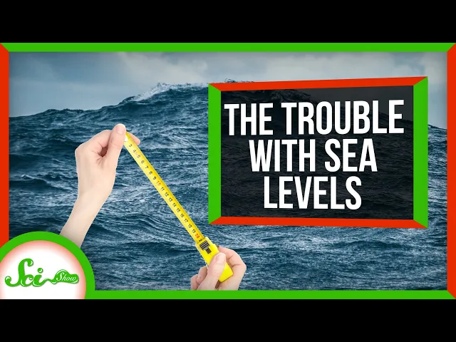
[Music] sea-level might sound like a pretty simple concept it's the height of the sea but coastal water levels are always shifting and even here in Missoula Montana I can confidently say that I'm nine hundred and seventy six meters above sea level which what does that even mean there's no ocean for hundreds of kilometres defining and measuring sea level is a surprisingly hard problem and the reasons why are almost ridiculous I'm talking problems with the moon the lumpiness of the earth even basic laws of gravitation get in the way but the impressive thing is that in
spite of all that we can measure it at first glance at measuring sea level doesn't seem like too complicated a problem yeah there's waves and stuff and weather and the tides go up and down but you can average all that stuff out right after all storms pass and tides come in and go out every few hours so you might think a few weeks data should do the trick but the cycles that pull and push the water around the planet are way more complicated than that for instance you can watch tides change over a whole 29
day lunar orbit and factor out their effect to get a number that's sort of accurate that still doesn't account for the Sun which creates tides about half the size of the moon's to make matters worse solar and lunar tides don't line up sometimes they amplify each other sometimes they partly cancel each other out in fact the Sun Moon and Earth only line up in the same way about every 19 years so you have to wait at least that long to get a reliable average and even then one cycle isn't enough because of the Sun Also
drives Earth's weather and weather alone can change sea levels way more than some of these tidal cycles so it can take multiple decades to get a really solid average and this is the simple stuff the stuff that eventually averages out a lot of things that affect sea level aren't so neat and cyclical for instance the shape and location of coastlines constantly change making sea levels sort of a moving target and in lots of places land is subtly moving up and down yeah sea level is hard to measure partly because the land were standing on keeps
moving tens of thousands of years ago parts of Europe and North America were squashed under kilometers of ice and even though that ice is long gone the earth is still bouncing back land that was crushed by glaciers is relaxing and in places like Scandinavia and northern Canada it's rising by about a centimeter a year in some places like the east coast of the United States land buckled upward near all that ice so today it's sinking down at a centimeter or so a year and that might not sound like much but centimeters here and there add
up and each natural change makes it harder to separate out the human driven changes in sea level as the planet warms it also means we can't just park instruments on land because remember the land isn't sitting still so to get around that little detail scientists use satellites with radar to measure sea level from space radar works by timing how long light takes to bounce off a target and the radar on these satellites is so sensitive that it could see a dime lying flat on the ground from a dozen kilometers in the air these satellites give
us maps of global sea levels every couple weeks letting us watch how sea levels change which sounds great throw a satellite around the earth in a fixed orbit and measure how long the light takes to bounce back to the satellite but there's another hitch Earth's gravity isn't perfectly even all the way around the globe different regions have different rocks and different amounts of water making some parts of the planet denser than others these more or less dense regions are known as gravitational anomalies and they affect how water spreads out across the surface areas with stronger
gravity pull more water toward them so water bunches up in some places meanwhile where there's less gravity it fins out and I'm not just nitpicking here some spots in the open ocean have water that's almost a hundred meters higher or lower than you'd expect if gravity pulled evenly across the globe so even if you could stick a number on global sea level it wouldn't actually describe the whole globe satellites have revealed that there are sea levels plural but that's still useful after all one of the biggest reasons we're looking at sea level lately is to
understand climate change and that will affect sea level differently in different places anyway except the thing is as the climate warms even that pattern of ups and downs is changing in some surprising ways that's because two things happen as ice melts first as glaciers melt into the ocean the water level immediately around them drops the reason is glaciers are so massive that they actually have a significant gravitational pull it's like having a bunch of mini moons on the surface of the earth they pull water toward them so when that mass melts away the surrounding water
recedes for instance sea level is rising three millimeters on average but if all of Greenland's ice melted sea level would actually drop by a couple dozen meters in Iceland but on the flip side it would rise more than the average in the southern hemisphere second all this melting redistributes mass on the planet's surface and that changes how the earth itself spins in space that's right by heating our planet we are melting glaciers which shifts the Earth's mass which changes how our planet moves in space and that's not the end of the story Earth's rotation then
affects how water and air spread out across its surface when its rotation changes even a little it alters how all that mass moves and as that mastery distributes itself it changes the Earth's rotation again this changing spin can also lead to a drop in sea level in some places even as the average level rises so if you haven't noticed yet this whole thing makes sea level a really complicated thing to untangle or even define for that matter sea level means what we need it to mean sometimes we need a global average that tells us something
about the overall impacts of climate change and sometimes we need a local estimate that tells us how ice melts will affect a certain City as long as we're consistent however we define sea level can be meaningful and instructive even if it isn't simple thank you for watching this episode of scishow and thank you to our patrons for your support it takes a lot of people to make a scishow video and your dollar goes a long way if you like what we do and are interested in joining our community you can learn more at patreon.com/scishow [Music]