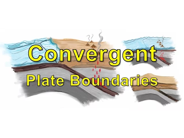
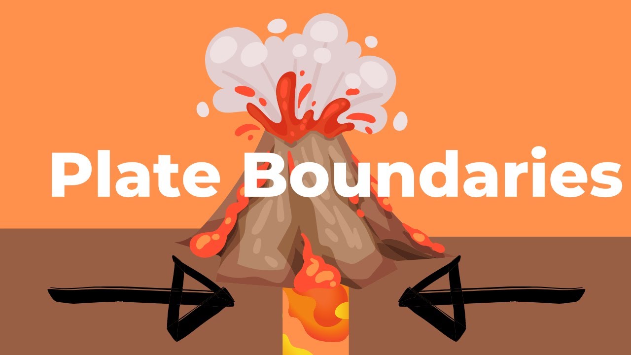
When geology shows up in the news it is often a result of something that happened at a convergent plate boundary. For example, earthquakes and volcanic eruptions are common at these locations. Our objectives for this lesson are to make some observations of features found at convergent boundaries and then use those observations to make interpretations of the geological processes that occur at these locations.
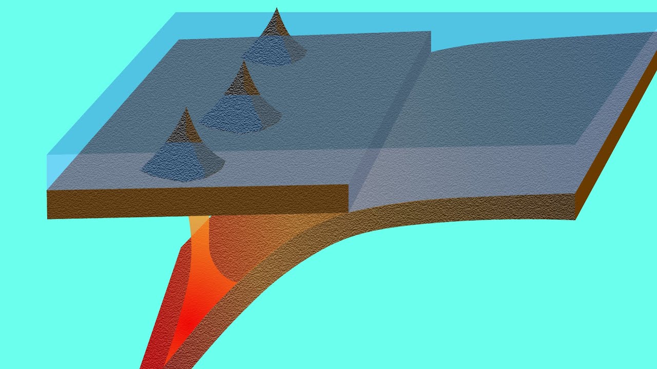
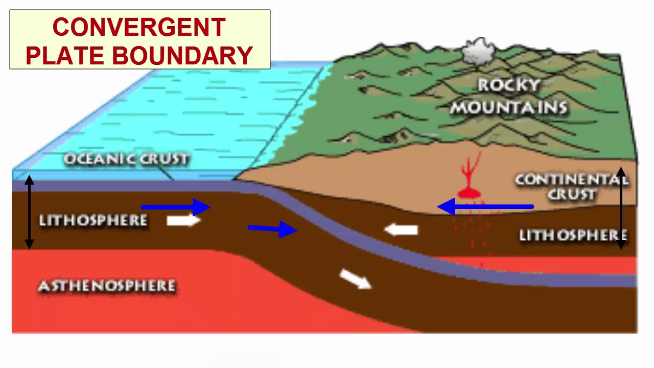
Then we will explain why the processes we described produce similarities and differences among the three common types of convergent boundaries. We'll begin by explaining the physical features associated with a convergent boundary formed when a plate composed of oceanic lithosphere is consumed below a continental plate. First we often have a descending plate that is pushed down into the mantle.
In this example we have a plate composed of oceanic lithosphere that turns downward along the trench which represents the boundary between two plates. We also have an over-riding plate that remains at Earth's surface. In this case the over-riding plate is composed on continental lithosphere and has a line of volcanoes some distance from the trench Both plates rest on the asthenosphere in the upper most part of the mantle.
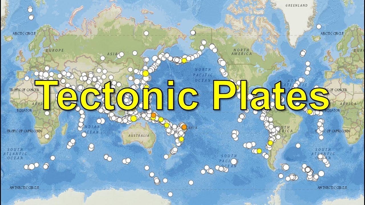
Plates move toward each other along convergent boundaries. This map illustrates divergent boundaries in red, transform boundaries in green and convergent boundaries in blue. We can find examples of where oceanic lithosphere is consumed below continental lithosphere here Where the Pacific Plate is destroyed below the North American plate in Alaska and where the Nazca plate collides with the western margin of South America And where the Indian-Australian plate is consumed below the Eurasian plate.
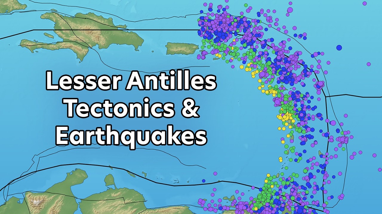
This map shows the locations of more than 1600 earthquakes of magnitude 5 or greater that occurred in a single year. Note that there are continuous zones of earthquake activity associated with our three examples of oceanic-continental convergent boundaries. Zooming in on two convergent boundaries on either side of the Caribbean plate, we can take a closer look at where exactly these earthquakes are occurring.
In this image we have trenches here and here, associated with convergent boundaries between the Cocos, Caribbean and North American plate. Our map suggests that there are lots of earthquakes clustering between the trench and the western margin of Central America. But if we look more carefully, what we realize is that most of these earthquakes occur at some depth.
We want you to be able to explain the processes that cause the earthquakes to occur and to account for their distribution in sloping zones reaching from the trench down to several hundred kilometers below the surface. Next we are going to zoom in to these two trenches to take a closer look. We'll start in Central America Notice the red triangles on the maps and the yellow triangles on the section.
All of these triangles indicate the presence of volcanoes located approximately 200 kilometers behind the trench. The volcanoes form a line known as a volcanic arc that trends parallel to the trench. We see a similar pattern to the west of the Puerto Rico trench but this time because the volcanoes form islands they are known as an island arc.
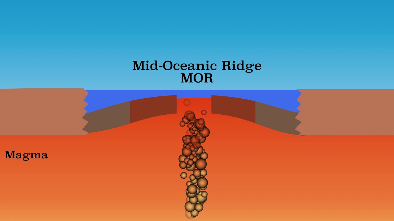
Our explanation of geologic processes at convergent boundaries will have to be able to explain why volcanoes are present and why the arc is consistently located several hundred kilometers from the trench. We call it subduction when one plate descends into the mantle below another plate. The feature that results is known as a subduction zone.
The oceanic lithosphere sinks below the continent as the rocks of the oceanic plate are more dense than those of the continents. Water-rich sediment rests on top of the ocean floor and the minerals of the oceanic crust often contain water in their crystal structure. Earthquakes occur as rocks in the descending plate fracture and high pressures cause minerals to undergo changes in composition and crystal structure.
As the plate descends into the mantle, it is compressed and the water is squeezed out of the sediment and minerals. At a depth of approximately 100 kilometers, the water enters the much hotter mantle rocks immediately above the subduction zone. The addition of the water causes these mantle rocks to melt.
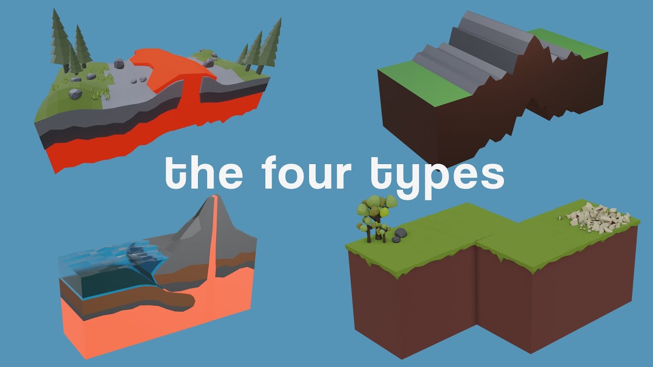
Melting generates magma that rises to the surface to form volcanoes. Finally the force of the collision produces mountains along the leading edge of the over-riding plate. Similar processes occur where two plates of oceanic lithosphere collide.
One significant difference is that we no longer have a contrast in the composition of the converging plates. So what determines which plate undergoes subduction? While each plate is composed of similar rocks, the rocks are often of different ages.
Relatively young oceanic lithosphere is warmer and less dense than older lithosphere Consequently when two oceanic plates converge the plate with older lithosphere undergoes subduction. We see this in the western Pacific ocean where the older Pacific plate in subducting below the Philippine plate that is composed of rocks more than a 100 million years younger. Just like in the ocean/continent convergence, earthquakes occur in the descending plate and the rocks of the plate are compressed to squeeze out water which enters the much hotter mantle rocks overlying the subduction zone and causes them to melt.
The principal difference is that magma rising to the surface now forms an island arc, rather than a volcanic arc, and there are no associated mountains. Otherwise, the processes are similar. The third type of boundary is represented by continent-continent collision.
Before the two continents can collide we have a typical ocean-continent boundary but eventually the ocean basin is destroyed and the two continents converge. This is the process that occurred before the Indian subcontinent could collide with the rest of Eurasia about 10 million years ago. Continental crust is too buoyant to descend into a subduction zone so there is no source for magma generation and subsequent volcanism.
Instead, the leading edge of each continent stacks up to produce unusually thick continental crust and results in higher elevations. similar to those observed in the Himalaya mountains today. Finally we will leave you with some simple analogs for the characteristics of convergent plate boundaries.
We can use some basic geo-gestures with the addition of some very geological oven mitts to model the processes of the three boundary types. We also summarize the basic characteristics of each boundary below the figures. How well do you think you can respond to the learning objectives of the lesson?