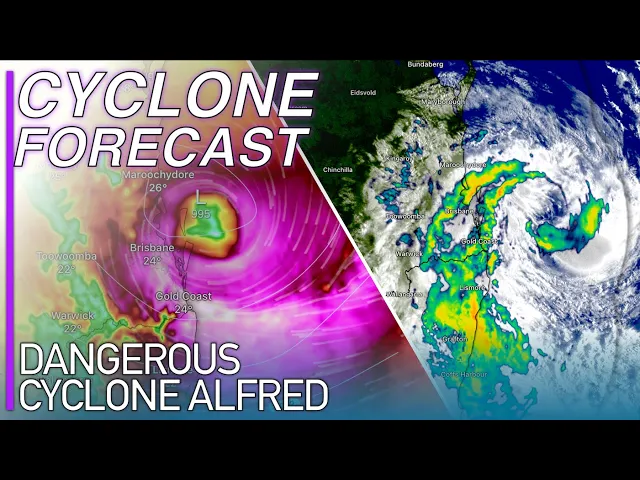
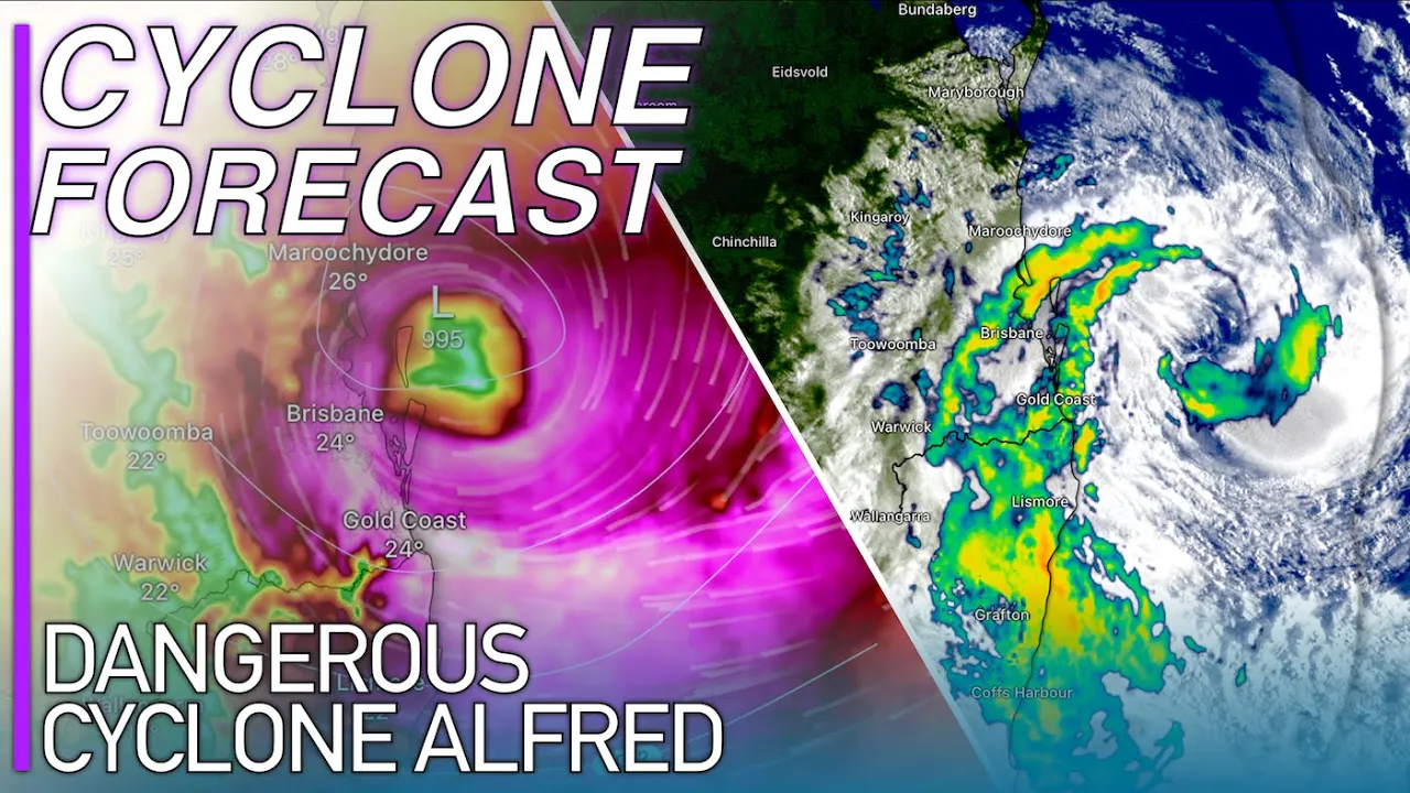
good morning my name is Josh from cycl a and here is your latest forecast update on tropical Cyclone Alfred a category 2 strength historic tropical Cyclone offshore from the southeast of Queensland where a landfall is now imminent in the next 24 hours Alfred is moving towards the Queensland coastline is expected to make land fls either a category one or two strength tropical Cyclone on Morton Island uh and bringing cyclonic conditions obviously into the brisban metro area and then down to the Gold Coast into the northe Eastern corner of New South Wales throughout the course of
today all the details of this tropical Cyclone plus more coming up in this forecast update if you are brand new to the Channel please consider subscribing but let's get stuck straight into things today with tropical cycl Alfred is just situated offshore from the Queensland Coastline it's drawing closer and closer now it's only about 150 km away from the nearest uh land on stradbroke island and it is rotating up and developing along quite nicely this morning which is a very scary Prospect for the southeast of Queensland it's certainly on the intensification spring once again just with
how the convection and uh rainfall is now wrapping around this system here and also some of the wind observations along the new Southwest Coastline especially you can see down towards Cape bar and the winds now sustained at 90 km an hour so nearly at Category 2 status down there the tropical cycl winds considering that this storm is officially estimated with Winds of 95 km an hour I mean it's pretty obvious that it is marginally stronger than that considering the winds down on Cape Baron are already at 90 km an hour over 350 K Away From
The Storm Center and only increasing as well with peak wind gusts up to 120 kmph peak wind gusts now developing along the Gold Coast up to 120 kmph supported by some of the videos and wind observations that I'm being sent through it is looking really really gnarly as well you can see on the massive bands in this system here especially the one that came through a couple of hours ago through the Gold Coast which is slow moving and housing some intense rainfall unlike pretty much anything ever seen before in this part of Queensland in New
South WS normally when rainfall comes through from uh tropical weather events it is slow moving and it's also not coupling with 100 kmph wind gust so the rainfall that down there has been unlike anything that they've seen before in these rainbands here with some with some very intense rainfall and the one that came through last night has pushed rainfall accumulation since 9:00 a.m. yesterday up to about 200 mm with still a couple of more hours of observations to go so this tropical cycl already shaping up to be substantially better than what the forecast was initially
suggesting let's dive into the forecast right now and see what this tropical Cyclone is expected to be going uh or doing you can see the tropical Cyclone still situated by the forecast models just offshore from quens line they've got a pretty good idea on what's expected to happen now by the looks of things yesterday we had a lot of jumping around and chopping and changing with the forecast models but now they really have honed in on that landfall site on either North stradbrook Island or onto Morton Island and I do believe right now it's going
to happen on the southern tip of Morton Island again there's just a couple of discrepancies here and there like the exact landfall location and the exact landfall timing and intensity that still need to be ironed out but the nitty-gritty has uh is the only thing left for this tropical cycl to decide what it's going to be doing the bigger picture stuff so the cyclonic conditions they're set in stone for Southeast Queensland Northeast New South Wales there's not really going to be much change on them depending on where this tropical Cyclone makes landfall the bigger picture
is set in stone it's just those nitty-gritty details that need to be ired out and that will happen throughout the course of today you can see the E be calling for that landfall at about 6:00 local time tomorrow morning I reckon it will happen slightly sooner than that the GFS forecast model calling for that landfall on stradbroke island to happen at about 3:00 local time tomorrow morning uh the icon forecast model calling for the landfall to happen much later into Saturday afternoon which is a again a little bit of a bogus forecast I don't think
it's going to hang out to see that long and the axis G3 forecast model a very reliable for model over the last couple of days and has done very well with tropical cycl Alfred so far calling for that landfall at about 6:00 in the morning on Morton Island so again we've got that landfall time more or less locked in it's going to happen sometime between midnight and about 8:00 tomorrow uh it is still a wide range of uncertainty but the gist is those tropical Cyclone impacts already beginning to develop and they're not going to have
a Major Impact or the landfall timing is not going to have a major impact on some of these landfall conditions so again it's not a big deal when this tropical cycl does cross the coast uh it will be crossing the coast coinciding with high tide and there's nothing really that uh is going to change about that the tropical Cyclone will be right next to the Queensland Coastline along the high tide because it is slow moving and even tonight when we get a high tide coming through we'll already notice some storm surge beginning to develop across
Southeast Queensland so again the uh timing of this tropical cycl coinciding with a high tide even though that's normally a pretty important factor with the tropical cycl considering how slow moving tropical cycl Alfred is and how close it's going to be towards landfall coing with those High Tides it really doesn't matter that much that's uh for sure this tropical cycl after its initial land and either stradbrook or Morton Island will then move into the Morton Bay Area and then landfall either on Red Cliff or around the Brisbane airport sort of area the second landfall is
expected somewhere between Cobble and Bruin uh so a very small scope of uncertainty through here and I do imagine that the land flu is just going to go straight in towards redcliff or just towards the south of redcliff as a category one strength tropical cycl beyond that into Saturday afternoon we're going to see the tropical cycl move up towards uh kilcoy uh north of Tober and Gat I'm expecting these and then I'm expecting this tropical cycling to weaken off very quickly and quite dramatically just fall to bits as it gets itself north of Brisbane and
all major forecast models are also suggesting that detailed right now you can see as it gets itself Inland out towards Crow Nest it completely falls apart on itself and collapses and it's basically a Remnant Low by early tomorrow afternoon and just moving through Queens land in towards New South bar there's a messy rain makinging depression out there but yeah forecast models really set in stone now on when this tropical Cyclone is going to make landfall and where about it is we're still not 100% sure of exactly where the landfall side is going to be but
like I said those details really don't matter what you need to know is that those cycling conditions really beginning to develop now across Southeast Queensland into Northeast New South Wales with destructive winds only expected from year and out for the next 24 potentially up towards the next 36 hours now just honing in on that landfall forecast I would there's two uh factors from the wind speeds here that I want to talk about there's two separate parts of this tropical cycl that are very important to understand so initially before the landfall you can see here and
I I guess the radar and satellite imagery is the best way to outline this we're seeing those cyclonic winds develop across the southeast of Queensland they're extending up towards Brisbane right now with wind up to 95 km hour in the brisman metro area and these are through the rain bands here and now I wouldn't necessarily call this de band of the tropical cycl because it is certainly the in core stuff that's coming through but on the back side of this rain band through here any showers and storms that sweep in on the southern side of
this tropical Cyclone through this funnel which will develop along the coastline we will certainly be seeing some of the most destructive winds in this tropical cycl and the most destructive winds with gusts up to 155 km hour are being housed in this rain band that I'm circling right now which you can see highlighted pretty well by this really dark Mass here on the convective satellite imagery that's uh kind of approaching that - 60 to -70° C in convection a really intense thunderstorm developing there offshore from Queensland this is where the first batch of cyclonic winds
is and where some of the strongest winds in this tropical Cyclone are which are cyclonic right down towards Yas including Byron Bay the Gold Coast uh up through stradbroke islands and then through Morton Island and even up towards the brisban metro area and these tropical Cyclone WS will continue to develop along the coastline get more and more intense through tonight into early tomorrow morning as the Cyclone makes landfall and keep in mind anywhere further south the landfall immediately further south rather will receive the most significant winds which right now is looking like South stradbrook Island
down in towards the Gold Coast with very significant wind gusts up to 155 K an hour in these areas here from North stradbroke Island South stradbroke Island down to the Gold Coast and extending down south towards tweet heads with peak wind gusts up to 130 km hour extending down towards spon Bay strong wind gusts also expected Inland but I'll get to those in a later part of this forecast update and then as this tropical cycl moves in towards Morton Bay and makes second landfall tomorrow late morning into early afternoon on Red Cliff as a category
1 strength cycl we're going to see these winds Whi around from the north to out towards the Northeast into WS of Morton Bay Area which means we'll get a second round of cyclonic winds into Red Cliff the Brisbane uh Harbor area the Brisbane airport area and then down towards Redland city as well and these will extend over Morton Island and North stradbroke Island as well so significant wind gusts and significant winds just in general expected throughout tomorrow afternoon as well as tropical suland Alfred moves further Inland and of course it goes without saying that these
will be coupled with rainfall so wind gusts up to 125 km an hour possible as Alfred makes second landfall and these will happen in the hours after the landfall sweeping up the Brisbane Valley and then in towards Brisbane City our area itself the brisban river rather than not the brisban valley I don't know what I'm talking about but up in towards the Brisbane City area and through Red Cliff and surrounding communities down towards Redland City and even out towards Logan City as well some strong winds expected into Saturday avvo and in towards Saturday and night
and towards Sunday morning as well leads me nicely on into the rainfall forecast which spoiler alert is looking pretty dramatic across the southeast corner of Queensland even the major forecast models calling for some really significant rainfall accumulations and they can't crank out the detail that some of those convective forecast models can and the rainfall is going to stick around towards Monday as well why is that well the tropical Cyclone is going to be slow moving and it's going to remain close enough to the coastline where it is going to be able to drag in a
lot of moisture from the Coral Sea and whilst the sea temperatures will be sapped where tropical cycl Alfred is going to be headed uh some of the temperatures offshore from the uh Sunshine Coast are still looking pretty healthy for convective development and as such plenty of rainfall and plenty of convection expected to stream into the southeast of Queens lone over the next 4 days so after the tropical Cyclone impact we're going to be seeing rainall accumulations amounting to potentially up to a meter in the Gold Coast hint and into parts of the uh mountains ranges
along the new South ws and Queensland borders so some really significant rainfall accumulation has looked to be possible as tropical Cyclone Alfred heads further Inland let's break those down for you hour by hour day by day and town by town so you can see tropical Cyclone Alfred really funling that rainall of shore right now as it sits itself just offshore and we've had some significant accumulations overnight with like I said accumulations up to 200 mm into the northeast corner of new southw and up to 180 mm into the southeast corner of Queensland those accumulations will
continue throughout today they're not going to be too heavy for the Maj for the most part but still some heavy Falls expected here and there and then later on tonight some really heavy rainfall expected to develop along the Gold Coast as this tropical cycl approaches landfall intense rainfall expected later on tonight coupled with extremely strong and damaging winds uh through later tonight into very early tomorrow morning for north south at stradbroke islands and then down towards the Gold Coast and as far south as tweet heads plenty of rainfall expected to sweep into the Gold Coast
hland as well through tomorrow uh midm morning as the tropical Cyclone crosses the coast and the rainfall being very heavy at times in fact locally intense right through Saturday and into Sunday morning and then you can see on the back side of this tropical cycl this rain band that's going to sweep down the Sunshine Coast begin to develop so some good Falls expected along the Sunshine Coast as well anywhere between 100 to 300 millim expected tomorrow afternoon and then this rainfall sweeping right into the Brisbane City area right through the Gold Coast hland into the
wats the mountains adjacent to the New southw Queensland border plenty of rainfall to be talking about there as well with some rainfall rates that could be approaching in 75 mm an hour sustained for multiple hours at a time and this is where we're going to be seeing rainall accumulations through Saturday approaching 6 potentially up towards 700 mm into parts of the Gold Coast hland some huge rainfall accumulations possible in the backside of tropical Cyclone Alfred from that moisture band that's going to be dragged in from the north that rainfall won't ease off until Sunday afternoon
where there's still a couple of showers here and there and thunderstorms lingering around the southeast corner of Queensland showers continuing through Monday and in towards Tuesday as well but the rainfall will clear out by about the 11th of March by the looks of things but yeah tropical cycl Alfred it's going to be wet one that's for sure so let's talk on those rainall accumulations right now and obviously I think it goes without saying that the EAS Earth is certainly lowballing on some of these numbers here we are talking about a subtropical environment here so obviously
rainfall accumulations are going to be substantially higher than what the East forecast is suggesting other forecast models are saying around the same numbers as well but I'm trying to find one that kind of Paints the most accurate picture and I think right now it's going to be the axis G3 minus some of the rainfall up in the north so I'm going to give uh what the forecast you suggest and then my two cents worth on this rainfall forecast as well so starting in the north and South those along the Sunshine Coast anywhere between 100 up
towards 300 mm possible through Saturday Avo and into Sunday morning plenty of rainfall expected there along the coastline and especially into the mountain series adjacent to the coastline and it will be coming through thick and fast so again make sure you are prepared for flash flooding up there the storm certainly isn't going to feel like nothing up around the maruchi door area there is going to be their chances of flash sling into some locally destructive wind gusts as well from tropical cyclon Alfred so I'm glad that everybody is heating the Cyclone warnings up there there's
a lot of people saying that the Sunshine Coast is going to miss it they will miss it in compar into the Gold Coast but it is still going to get quite gnarly up there Robie Island can expect up to about 300 mm through the duration of tropical cycl alfro coupure as well up to about 350 mm and then the real rainfall starts further south Brisbane can expect a further 400 MM potentially a little bit more as well we're really up on the rainfall forecast of Brisbin because of the rainfall that's going to come through on
the backside of slow moving tropical Cyclone Alfred through Saturday Avo and into Sunday morning big accumulations out towards ipsw and low wooden into some of the mountains out towards esque and katton as well some good rainall accumulations that could approach 550 mm through there are expected out towards Logan City rainfall accumulations up to 400 MM expected with about 200 mm coming through in the next 36 hours from tropical cycl Alfred so plenty more rainfall expected on the back side of this system through Morton Island and North and St South Str Brook Island rainall accumulations up
to about 400 millim possible as a result of tropical cycl Alfred's landfall slightly more rainfall can be expected down in towards the Gold Coast down towards the kumra area as well with rful accumulations between the Logan City right down towards Tweed heads including the Gold Coast kumra Nang uh and Sanctuary Cove rainfall accumulations up there could be anywhere up to about uh 800 millim of rainfall so along the hland then about 500 millim along the coastl with plenty of very heavy rainfall expected to come through tomorrow more heavy rainfall around the Tweet heads area like
I said up to about 800 mm in the mountains and about 400 MM along the coastline out towards Mar willar rainfall accumulations up to 800 millim with spot accumulations over the next 4 days up to 1,000 millim being possible there the most heaviest Falls will be in the northeastern corner of new southw but the looks of things with another patch of very heavy falls out towards bua and into the Spring Brook National Park as this tropical Cyclones backside with all that moisture comes through as well down towards Byron Bay rainfall accumulations up to 300 mm
possible throughout the remainder of tropical suland alfreds Crossing rainfall accumulations between 2 and 300 millim along the coastline down towards yamber with rain accumulations between 3 and 500 millim in the mountains adjacent to the coastline rain accumulations between 100 and 500 Millet expected in the mountainous areas outside of K haror with rainall accumulations being very high Doro as well which have been excessive last uh the other night with rainfall accumulation so up to about 300 mm very heavy Falls expected about as far south as the barington tops port mcari and kempsey as well the rainfall
accumulations will drop off as you get down further south of about Port mcar so again the barington tops not expecting too much in the way of significant rainfall and some good Falls also expected into the northern Rivers part of New South Wells as well out towards Mor Arab lightning region will get it's been a while since we talked about our friends over there and you can see significant Falls also expected there in the next 4 days as tropical cycl Alfred moves further Inland through Sunday and in towards Monday uh the heavy rainfall won't ease off
from this tropical Cy until by the looks I thing is at least Tuesday or Wednesday when the remnant energy will be dispersed across interior parts of New South Wales so some heavy Falls still expected in those areas and you can see weekl long rainfall accumulations actually out there really starting to push up into the higher 200s and even out towards the early 300s in some in in some of these locations of some much needed rainfall so looking very good indeed and I think it goes without saying as well that these locations are expecting some dramatic
flooding as a result you're under flood warnings across much of Northeastern New South Wales and all of Southeastern Queensland expecting major flooding over the next 24 hours as a result of tropical cyland Alfred's landfall passage and I need to stress this the fact that this rainfall uh is being really heavy and it's unlike anything seen before across parts of Southeast quens mean we're looking at rainfall rates here approaching the 20 to 30 millimet a mark an hour and I mean this radar imagery isn't really doing some of these storms Justice here but some really excessive
rainfall accumulations are expected so as such some significant Falls can be expected uh and some really significant flooding can be expected across the southeas Queen zone so expect moderate to Major rivine flooding in your area and flush flooding to be widespread through the next 24 to 48 hours as well some really significant rainfall accumulations will give way to that and another interesting impact from this tropical cycling is is of course going to be the season the storm surge already those wave heights getting absolutely massive across parts of Southeast Queensland and Northeast New South Wales I'll
see if we can pull up some webcam V uh footage right now because there are some huge waves along the coastline and those webcams can give us a pretty good idea of what is really expected in terms of the massive wave heights uh we've got the tweet webcam here I think that might be out of action but you can oh no it isn't you can just see how big some of these waves are here throughout the sunrise hours and just how gnarly some of these cycling conditions look I'm not sure if you be able to
see it on the uh video footage here but you can see the wave heights are just absolutely massive then it's just gray conditions with the amount of rainfall That's Falling in these areas so again these waves really starting to become a problem now across uh Northeast New South Wales and Southeast Queens here's another one at Bina the airport here it's completely gray there so the conditions really rapidly deteriorating in these waves absolutely massive as a result and storm surge will cause some really significant impacts from this tropical Cyclone now I had a couple of people
in the comments say that wave Dam sounds like fearmongering well it's not a phenomenon that's often seen from tropical Cyclones but because we've got so much water here that's protected by the these islands across the Gold Coast it's kind of going to it's kind of going to work against the Gold Coast here in terms of their flood mitigation Str uh strategies because you can see for the Nang River the kuma River as well there's really only two drainage points here for these rivers to exit and that's where the Gold Coast Seaway is which is a
very narrow channel and very strong currents there on a normal day so imagine what they're going to be through that throughout the course of tropical Cy Alfred then up here between South and North stradbrook Island there's another channel here north of South stradbrook Island and between South stradbrook Island up towards north Str broke Island there's another Channel there and as a result that's the only two locations that water can exit from the especially the Nang River and the kuma River I mean it does have a chance to exit up into the Morton Bay Area with
the storm tides are really pushing the water back down into the Gold Coast Canal system which means that the storm surge when it comes in it's not going to allow the water to uh exit because it's going to be blocking up these uh places here effectively speaking like obviously water will be able to flow in trickles here and there but it's going to be the amount of water heading in is just going to be the amount of water heading out and that's like pushing a hand against your other hand as well I mean you can't
push your hand through your hand so that's kind of the best way to describe it here there going to be a bit of a wave Dam developing and that's going to exacerbate the storm surge and the flooding impacts across the Gold Coast and that's why we're expecting such a significant storm tide from what's effectively a pretty weak tropical cyclone that's another thing as well people saying that this is just a category 2 strength system relatively speaking this would be like a category 4 strength cycl going up towards CS this is a very very dangerous tropical
cyclone and I feel like that's being taken out of perspective just because of its number that rating that it's been given tropical Cyclones are not fair and they are not even they will uh impact areas differently depending on their size the amount of rainfall that they're carrying so again keep that in mind and this tropical cycl here just with it being a category 2 and an era that is not built for let alone a category one strength tropical cycl that's going to cause some really sign problems and some significant damage and that is more or
less a guaranteed to this time make sure you are hungering down across the Gold Coast it is quite clearly way too late to be beginning preparations tropical Cyclone just make sure you are ready it is also too late to evacuate right now it' be way too dangerous to be on the road so today it is a stay inside day and watch this tropical cycl as it comes through keep up to date with the latest information as well make sure you're tuning in to updates from different weather agencies every single hour you want to be as
up to dat as possible through a tropical Cyclone like this and it is imperative that you stay inside and stay safe there are a lot of people out there that are becoming Avid Storm Chasers from this tropical cycl and they are doing it at their own risk and I strongly advise against stuff like that if you are trying to get footage of this tropical cycl for different weather agencies or for yourself make sure you are doing it from the confines of your own home stay away from Windows stay away from doors and make sure you
are in a very secure part of your house an interior living room or an interior bathroom it is imperative that you stay safe from the flood waters from the winds and from the tropical Cycles wrath this is a very significant tropical cycl threat and it is going to be a history making system for Southeast Queensland there's going to be three uh two further updates today on the Cyclone SI Channel plus a landfall update which I'm dreading if it's going to make landfill at 4:00 that's going to be about 1 or 2:00 my time so again
I'm absolutely dreading that but I will be making the updates on this tropical cycl as it happens so again make sure you are subscribed and staying ready for this channel uh there's going to be plenty more information to come on tropical cycl Alfred but that is all from me this morning a special shout out to the channel sponsors the dames are on screen right now as well and if you want to help out then click the join button down below and select uh the channel sponsor status it is much appreciate and all the support has
been very helpful lately anyway that is all for me today and I'll catch you all on the next storm stay safe goodbye