in my last video I went over what started and ended to the five ice ages briefly at the end I mentioned how one of these ice ages is still going on to this day and has been for the whole of human history what I didn't get to talk about was just how different our world was beneath the ice the planet's climate had changed and within its geography quite simply the world were familiar with today was not the same world humans knew thousands of years ago so today I'd like to explore this frozen earth and uncover
some of the lost geography from the earliest days of human history first off modern humans have been around for roughly two hundred thousand years meaning we've witnessed to severe glaciations as a species together between them fitting the Eemian inter glacier where conditions were more or less similar to what they are today from this what we can see is that the climate has been in constant flux for our entire evolutionary history making it impossible for me to make just a single map to represent at all so instead I'll be using this period around 25 to 20
thousand years ago as an anchor point but may diverge a couple thousand years here and there at this time around 8% of the planet's surface and 25% of its land was buried beneath ice sheets for some comparison only about three percent of the planet's surface and less than eleven percent of the land is underneath ice today this difference equates to an additional 56 million cubic kilometers of ice on the planet which ultimately comes from the ocean what I'm trying to say is that during this time the sea levels fell by over 130 metres below current
levels revealing far more land area across the surface of the earth than we're familiar with today first and foremost however we need to address the glaciers obviously they were all much larger than they are today but not all ice sheets were created equal Antarctica froze over 41 million years ago and for all of that time has maintained ice or even while the north pole remained ice-free the explanation for this is simple it's much easier for ice to form on land than it is for it to form over water what this means is that while the
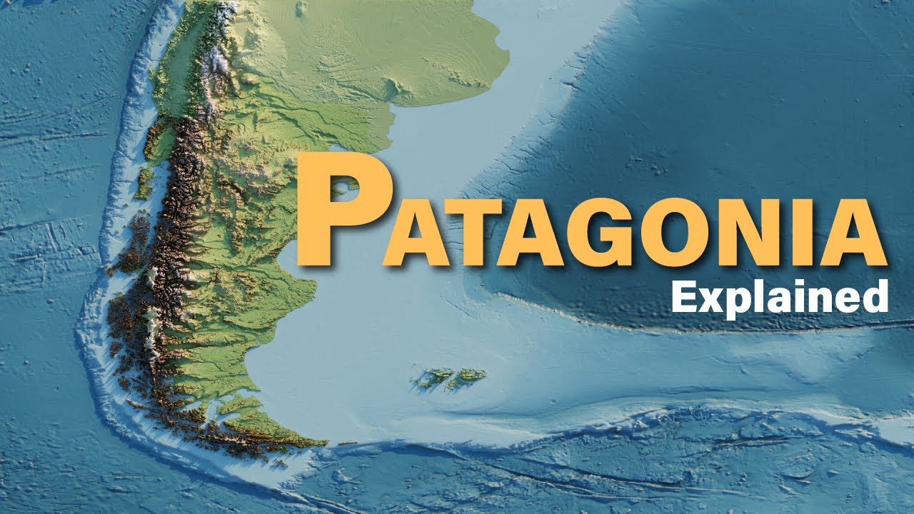
continent of Antarctica itself has stayed icy for far longer than any other place on earth the waters surrounding the land essentially act as a barrier for any ice trying to expand beyond this point and therefore the Antarctic ice sheets didn't actually see all that much growth where there were other lands to be found in the south like the southern tip of the Americas the Patagonian ice sheet reached far into the Andes Mountains spanning all the way in to modern-day Peru showing just how vital dry land is for ice to form besides this however only smaller
ice sheets were to be found in the southern hemisphere in places like Tasmania and New Zealand the northern hemisphere on the other hand is where we'll find most of the Earth's land area which means that's also where we'll find the majority of the new ice before even going all the way north the third largest ice sheet on the planet back then and today can be found over the Himalayas and Tibetan Plateau forming at this time an island of ice surrounded entirely by cold desert besides this the Laurentide Ice Sheet extended over most of Canada with
glaciers making it as far as the northeastern United States strangely enough what remained of what's now the u.s. is one of the only places on earth to have received more rainfall at this time than it does now causing several of the basins here to fill with excess water the biggest of which was the Great Salt Lake Basin which expanded into what's known as Lake Bonneville not too far away the Pyramid Lake Basin filled in as well to become Lake Lahontan besides these numerous smaller lakes increased in volume here as well but the greatest lake in
North America came about as the glaciers began to retreat here melt waters pooled against the ice forming Lake Agassiz the further the ice retreated the greater this lake became until it had grown big enough to connect with the by Lake Ojibwe as glaciers continued to move the lake followed until the ice wasn't enough to contain it all and eventually the lake drained into the ocean some 8,000 years ago today only the deepest remnants of this once ginormous Lake remain such as Lake Winnipeg Cedar Lake Lake Winnipeg OC Lake Manitoba and the Lake of the Woods
besides North America another important Ice Sheet formed over Europe spreading from the British Isles all the way into Siberia depending on sea levels and the state of plate tectonics the Strait of Gibraltar would periodically open and close cutting off the Mediterranean from the Atlantic Ocean without the influx of water from the ocean sea levels within dropped exposing even more land and leading to a breakup of the sea into a series of lakes the effects of this sea-level drop reached as far as the Black Sea cutting it off entirely from the Mediterranean leading to a substantial
reduction in size here as well this however is where things kind of reverse instead of being cut off from the ocean the bodies of water further inland like the Caspian and Aral Sea actually had a new source of water each summer the glacial melt waters would flood nearly all of the drainage basins here causing the lakes to expand far beyond their modern banks when the ice advanced far enough it could block the open Yenisei rivers both of which normally discharge into the Arctic Ocean cut off from their typical outlets the water from these and other
rivers would also periodically pool forming in the process the West Siberian Lake system an integrated extent some fifty thousand years ago this lake reached over eight hundred and eighty thousand square kilometres more than twice the size of the Caspian today this form of glacial bounded Lake likely would have been common wherever ice overstepped onto land meaning what I've touched on is likely only a small fraction of the many lakes that could have arisen during times like these the last major glacier system will talk about formed around the Alps becoming a smaller glacial island entirely surrounded
by land this is worth mentioning because the whole concept of an ice age came about as a result of observations made by scientists visiting the Alps it was here that they first observed the deposition of large glacial boulders far beyond where modern glaciers sat and came to the conclusion that there must have been a time in the Earth's past when the glaciers extended much further than they do currently if we look further east we can see the Eurasian ice sheet actually tapers off somewhere in the far reaches of Siberia leaving most of what's now Russia's
Far East surprisingly free of ice now the initial assumption here would be the temperatures weren't low enough to sustain continual ice growth but if you know anything about this part of the world you'll know that it is actually one of the coldest regions on earth switching our map real quick over to average annual temperatures we can actually see this region is clearly colder than both Northern Europe and North America what this means is that it doesn't really make sense that glaciers did not form here that is until we look at the land itself with less
water in the ocean the entire Siberian shell sat above sea level filling in much of the nearby Arctic Ocean to the north and pushing coastlines further east as well by further distancing these lands from sources of water I eat the ocean this region became extremely difficult for moisture to reach this compounded with the airs reduced ability to hold water and together means the deep interior of Asia just never received enough snow to begin building up ice a season after season to make matters even less favourable wind patterns at this latitude blow air towards the Northeast
pushing dry continental air out over moist ocean air meanwhile over here the exact opposite occurs where moist ocean water was pushed over the land which explains why we see ice forming off the west coast of North America but not Russia's Far East this is important because the lack of ice combined with lower sea levels led to the formation of a land bridge between North America and Asia what's now known as Beringia it was this land bridge that early human explorers crossed to begin populating the americas meaning we have this land bridge to thank for an
entire chapter of in history this of course wasn't the only land revealed by lowered sea levels further down the coast we can see the shallow seas surrounding Japan were dry at this time too connecting the islands to the mainland when sea levels reached their absolute minimum the lower parts of the Japanese peninsula would connect with Korea to create yet another massive lake in the interior of Asia the Yellow Sea on the other hand was completely drained at this time connecting the Korean Peninsula not only to Japan but to China as well and sorry Taiwan but
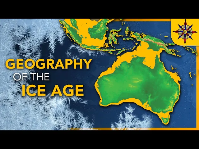
during this time you too were part of mainland Asia even further down the coast we'll find perhaps the greatest reclaimed land anywhere on earth at this time as the shallow waters dividing the islands of West Indonesia dried up and a contiguous landmass rose to connect Sumatra Java and or neo to Southeast Asia forming what's known as the Sunderland's at its greatest extent the Sun the basin could reach as far as the Philippines while never pushing further east than the island of Sulawesi as a result it's here that an important natural boundary was formed being an
extension of Eurasia animals moved freely between Asia and the sundaland populating this region with the animals typical to the continent such as elephants apes Tigers rhinos you know Eurasian animals pass to this line however only animals originating from Australia and New Guinea had access which is why you'll find things like marsupials and monotremes over here and basically nowhere else making what's known as the Wallace Line the natural barrier between two entire continents the last major Island to join Asia was that of Sri Lanka which tagged itself nicely on to India and it was only 500
years ago that this changed when a cyclone came through and washed away the last bridge between the two lands continuing west will find the Persian Gulf entirely filled in turning the Arabian Peninsula into well not a peninsula around the other side of Arabia we can see that the shallowest part of the Red Sea cut the rest of it off from the Indian Ocean turning the Red Sea into the red while simultaneously connecting Asia to Africa in two places instead of just one Africa on the whole however was perhaps the least changed of all the Earth's
landmasses gaining a little ground here and there but nothing huge especially when compared to Asia so moving on to Europe if it wasn't under a tremendous sheet of ice you'd be able to see that ocean levels dropped far enough to drain the Celtic North and Baltic seas exposing the lands of doggerland and connecting Britain Ireland and Scandinavia to the rest of Europe while even creating a few new islands between expanded Europe and Iceland even further north we can see a huge area of land would have been exposed filling in the Barents and caris seas though
all this new land really did was make it easier for ice to come in and cover it all up North America has a very similar story actually we're under the ice virtually all of the Canadian islands became fully connected to North America again even going as far as Greenland besides these expansions hidden under the ice however North and Central America weren't changed all that much we'll find the most notable differences by looking at the Caribbean actually where we'll see the Florida peninsula was about two to three times bigger than it is now though all of
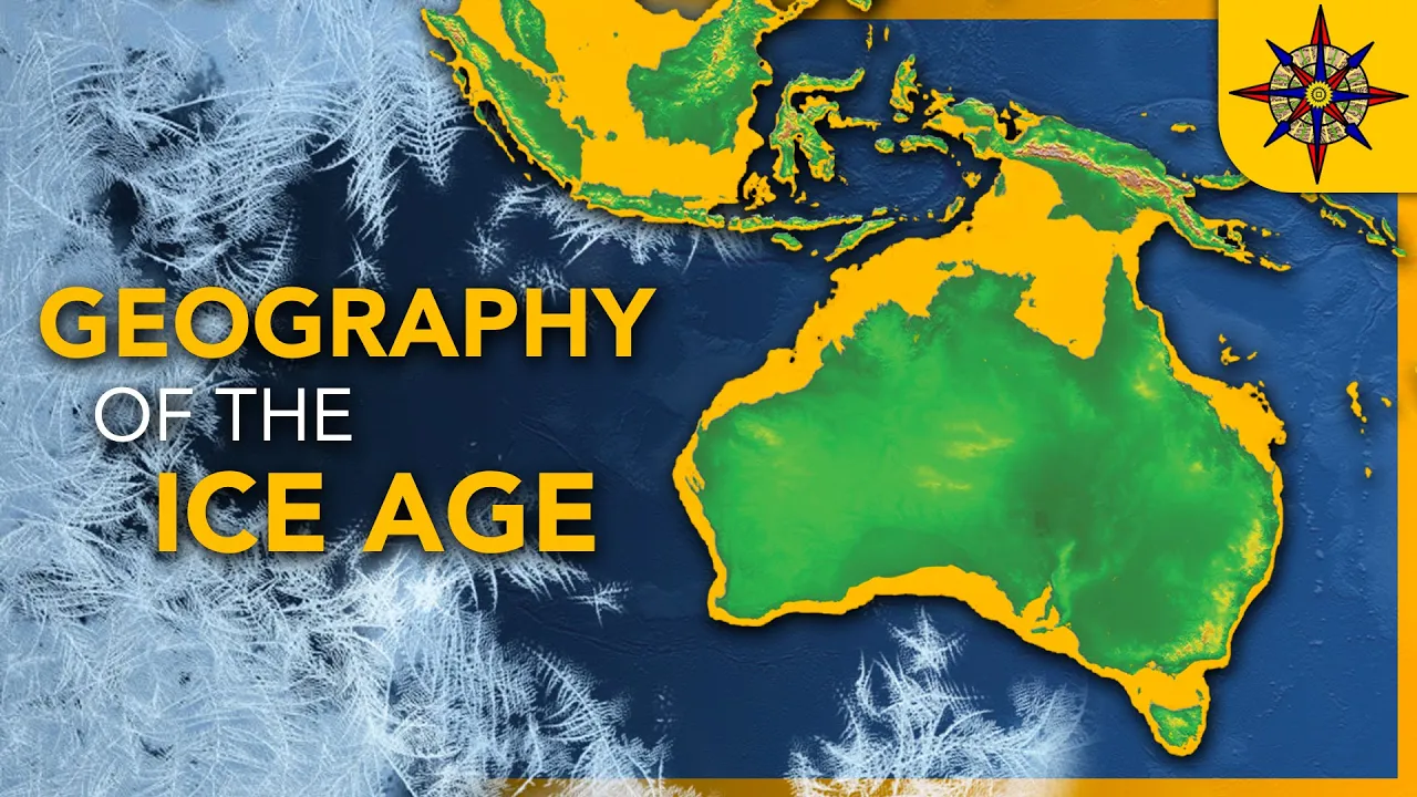
the islands throughout the Caribbean crew in size as well with Cuba nearly connecting to the extended Yucatan Peninsula and Nicaragua reaching out to nearly grab Jamaica the biggest visible change to the American land mass however and really the only big change to happen to South America came with the draining of the Argentine Sea which added over 1.3 million square kilometers of incredibly flat land to the continent though to be honest most of this would have been uninhabitable tundra for the most part the last a big change to the continents comes by looking at Australia and
New Guinea today we can see only the thin and shallow Torres Strait separates the land masses but I'm sure at this point you can guess what's coming lowered sea levels closed this gap and connected the two lands into a single continent while also managing to absorb island of Tasmania to the south this continents given the name Sahul would have measured nearly 12 million square kilometers making it roughly equal in size to modern-day Antarctica besides those small glaciers found in Tasmania I mentioned earlier Sahul would have been the largest ice-free land mass on the planet and
therefore the landscape here was largely unaffected by the Ice Age beyond the continents all of the Earth's islands were also changed considerably by the lowered sea levels but I can't actually go through every single Island because there are just too many so an honorable mention definitely goes to the islands of New Zealand for at the very least trying their very hardest to become a continent while they did manage to unite themselves into a single Island sea levels never dipped low enough for the entire Zealandia shelf to be exposed so what the planet was left with
was a mega New Zealand measuring roughly five hundred and twenty thousand square kilometres making it the second largest island on earth at the time as many of the larger islands today weren't exactly Islands back then the title of largest island if you're curious would have gone to Madagascar which while only around 580 thousand square kilometres today would have reached a size of over 700,000 square kilometers act then now beyond all of the glaciers lakes islands and continental shelves the surface of the earth was changed in one last considerable way and that's in terms of its
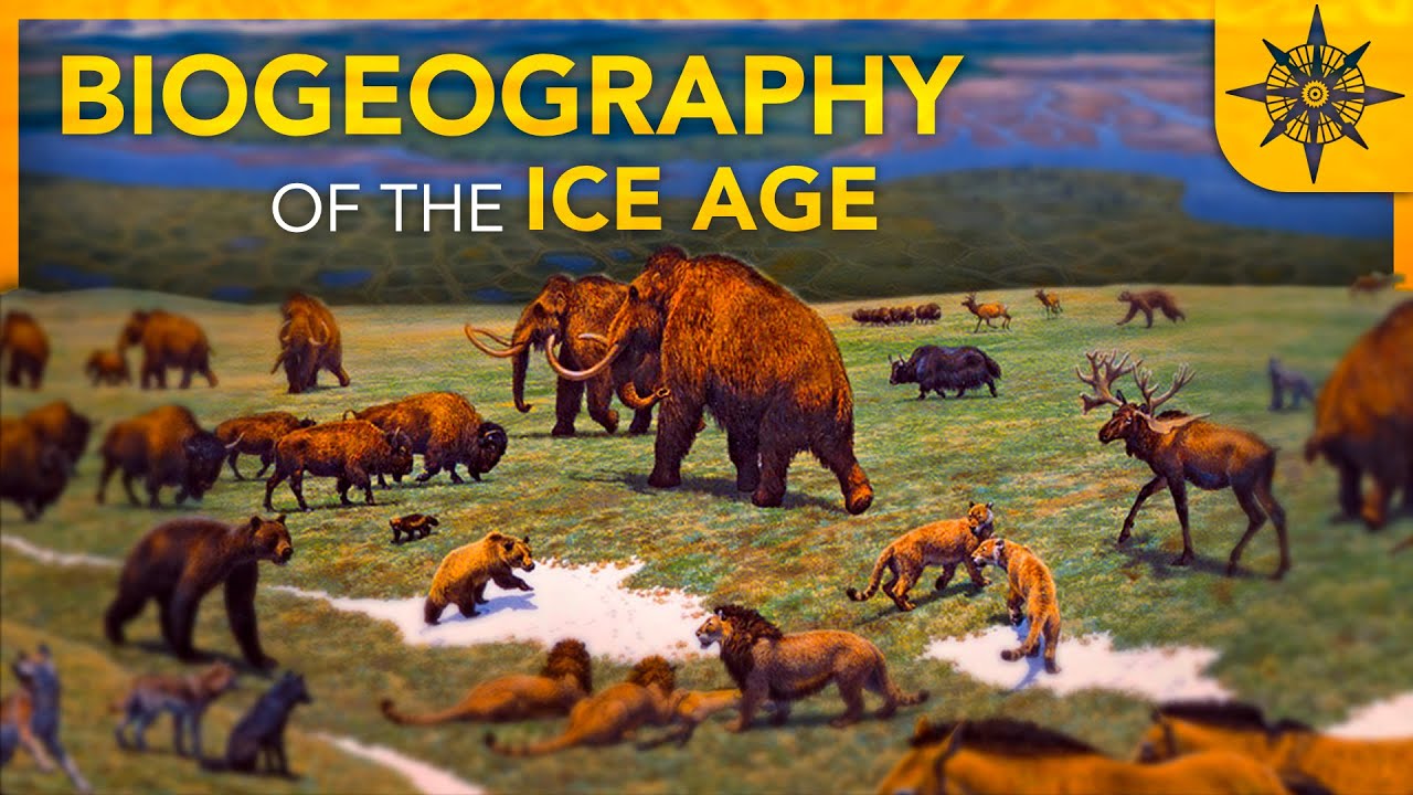
natural environment or in other words its biogeography this however could fill a video of its own so if you'd like to see how nature reacted to all of these shifting conditions let me know in the comments okay it's at this point in my videos that I usually ask people to help support me over on patreon but considering the worldwide pandemic that's happening right now it kind of feels wrong to ask people for money while my revenue has largely been unaffected by this so to everyone who continues to support me thank you so much but also
please don't hesitate to stop your commitment if this situation has affected you other than that make sure to watch my last video if you haven't already to learn what caused this and other ice ages in the first place stay inside wash your hands thanks and goodbye