t Cascadia Megaquake: How the ‘Big One’ Could Wipe Out the Pacific Northwest The Cascadia Megaquake isn’t just a possibility—it’s an inevitable disaster! This seismic beast, expected to hit the Pacific Northwest, threatens to rival the most destructive earthquakes in U. S.
history. The Cascadia Subduction Zone, a 700-mile fault line off North America’s west coast, has been building tension for centuries, and experts predict a magnitude 9. 0 earthquake.
The 1700 quake left a trail of destruction, submerging towns and creating tsunamis that reached as far as Japan. Now, the stakes are even higher, with over 13 million lives and trillions of dollars in infrastructure at risk. In this video, we break down the science, examine potential impacts, and gauge our preparedness for the Big One.
Ready? Let’s get in! California, perched on the western edge of North America, is a hotbed of seismic activity thanks to its spot along the boundary of the Pacific and North American plates.
Just north of California, there’s the Cascadia Subduction Zone—a geological powerhouse stretching from northern California all the way to British Columbia. Here, the Juan de Fuca Plate is sliding under the North American Plate, stirring up earthquakes and volcanic action. This 700-mile-long fault line has long been a ticking seismic time bomb.
Geologists have been hard at work analyzing layers of soil, estuaries, beaches, and tidal flats around the Pacific Northwest. Using radiocarbon dating, they’ve pieced together a timeline of 40 massive earthquakes over the last 9,850 years. That averages out to one earthquake every 246 years.
For context: the last big quake rocked Cascadia 324 years ago, meaning we’re technically 78 years “overdue. ” But averages are just that: averages. Earthquakes have hit as close as 27 years apart and as far as 577 years apart.
So, while we might be partly right in saying the "Big One" is overdue, the reality is not that straightforward. To kick things off, let’s take a closer look at the fascinating area where this dangerous fault line is located. The Pacific Northwest, one of the most stunning regions in the U.
S. , is famous for its rugged coastlines, dense forests, lively cities, and breathtaking mountain peaks—including some pretty impressive volcanoes. It’s also a hub of innovation, giving the world staples like Microsoft and Starbucks.
With its national parks and endless outdoor adventures, the region draws millions of visitors and is home to 13 million people—a number that’s growing fast. But beneath all this beauty and bustling growth lies a serious threat: the Cascadia Subduction Zone. This massive fault line, which shaped the Pacific Northwest’s iconic landscapes, is also capable of unleashing earthquakes and tsunamis of staggering proportions.
The last big one hit on January 26, 1700, shaking the region and sending tsunamis across the Pacific. Now, experts warn that the "Big One" could strike again—possibly reaching a magnitude of 9. 3.
That would make it one of the strongest earthquakes ever recorded. The fallout would be catastrophic: tens of thousands of lives lost, entire communities destroyed, and life in the Pacific Northwest changed forever. The scary part?
It’s not about if it’ll happen—it’s about when. But to understand the scale and impact of this ticking time bomb, let’s travel back to the 1700 Cascadia megathrust earthquake: On January 26, 1700, around 9:00 PM, a massive earthquake estimated at magnitude 9. 0 shook the Cascadia Subduction Zone.
The ground shook violently for nearly ten minutes, affecting areas from Vancouver Island to Cape Mendocino in California and everything in between. A tsunami, towering as high as 100 feet, crashed onto the coast, obliterating Native American villages and creating a night of unimaginable terror for indigenous tribes from California to British Columbia. But the event of that night was only the beginning.
On January 27th, ten hours after the earthquake occurred, out in the ocean, the sudden shift in tectonic plates pushed an unimaginable volume of water upward. That water didn’t stay still for long. A tsunami with waves as tall as 16 feet, born thousands of miles away, slammed into Japan’s coast.
Villages were swept into the sea, families were torn apart, and lives changed forever. A particular village Miyako, located in the Tohoku region of Northern Honshu, Japan, was wrecked. According to documentation from local magistrates, samurai, and villagers, houses were destroyed.
But that wasn’t all—records from the magistrate of Otsuchi accounted for the ruin of several houses and rice fields, which were sent to the Tokugawa Shogunate. The Japanese called these “orphan waves” because there had been no warning—no earthquake to shake the ground, no reason to flee. It was a mystery they couldn’t solve at the time, though they carefully recorded every detail—how high the waves were, how far they reached, and how much they took.
Thanks to Japan’s meticulous recordkeeping during the Edo period, we know the exact date and time of the disaster. Interestingly, no earthquakes were reported in Kamchatka, Alaska, or Chile around the same time, which left Cascadia as the only plausible source for the massive tsunami. After piecing together the historical accounts and geological data, scientists identified the earthquake in the Cascadia region as the cause of the disaster that struck Japan’s East Coast.
Unlike the Japanese, who documented their histories in writing, the Indigenous peoples of the Pacific Northwest preserved their past through oral traditions. The War of the Thunderbird and the Whale was one attempt to explain the 1700 Cascadia earthquake. According to this legend, it was a night so dark and stormy it felt like the world was about to end.
And that’s when Thunderbird made her move. Out of nowhere, she swooped down from the storm clouds, her massive wings silent and invisible in the black sky. In her claws, she snatched up the Whale, her ancient rival.
Then, she rose high into the night, higher than anyone could see. And when she finally let go, the Whale descended to the earth, hitting the ground with such force that the world itself shook. That’s when everything went sideways.
The ocean pulled back from the shore—so far back that the bay was left completely dry. For the people on the coast, that was the first sign. The wise ones grabbed their canoes and paddled out as fast as they could.
They knew what was coming. The water came roaring back like a monster, swallowing entire villages. People, homes, and everything they’d ever known were swept away.
The lucky ones who survived told of canoes stuck in treetops and land that looked completely unrecognizable. So, what caused the conflict between these legendary creatures? Some said Thunderbird was a hero, protecting the world from the evil Whale.
Others thought she was the villain, attacking an innocent creature. But the Thunderbird and Whale story wasn’t the only explanation people had. Up on Vancouver Island, the Huu-ay-aht people told a different tale.
They believed dwarfs living in a giant mountain had invited a man to dance around their sacred drum. But the man accidentally kicked the drum, and somehow, the sound got trapped in his foot. When he left the mountain, every step he took made the earth shake, causing the flood that destroyed their villages.
Further south, in Northern California, the Yurok people told of a being called Earthquake. They said he had huge, heavy feet that cracked the earth wherever he ran. On that same night, an earthquake tore up the coastline, shaking the ground and sending the ocean inland.
The Yurok gathered on a hilltop and danced to drive him away, but when they came down, their homes were gone, drowned beneath the floodwaters. These stories are all that’s left to explain what happened that night. Whether it was Thunderbird, Earthquake, or something else entirely, one thing is clear: the world shook, the waters rose, and life along the coast was never the same.
It took centuries before anyone connected the dots: the earthquake in Cascadia and the devastation in Japan were part of the same story. This wasn’t just a local disaster—it was a global one. The 1700 Cascadia earthquake left behind a level of destruction that forever changed the region’s landscape and its people.
When the ground shook, it caused parts of the coastline to rise and fall—some areas were lifted above sea level, while others sank into the ocean. But the reshaping of the coast didn’t just change the land—it wiped out fishing grounds and altered the river mouths that were once a source of trade and transportation to those who lived around and traveled through it. For Indigenous communities, the effects were devastating.
Their fishing grounds, essential for food and trade, were lost, and with them, a way of life. The land that had supported their crops and offered resources for tools and shelter was now changed beyond recognition. But it wasn’t just Indigenes, settler communities faced similar struggles.
The infrastructure they had built was damaged, and food became scarce. Trade routes were cut off or altered, making it difficult to get the supplies they needed. Even the rivers and oceans, which had sustained the region’s ecosystems, were affected.
The tsunamis and flooding that followed disrupted the estuaries and tidal flats that salmon and other fish relied on for breeding. For the Indigenous people, the loss of salmon was especially devastating, as it was their primary food source. Without the fish, the region faced a severe food shortage.
The ecosystems that had supported life in the region for so long took decades to begin to recover. However, for many decades afterward, the true extent of this incident was largely unknown. Why Was The Scale Unknown?
And What Exactly Is The True Science Behind These Quakes In The Cascadia Subduction Zone? The scientific community largely dismissed Native American legends and Japanese records about catastrophic events tied to the Cascadia region until the 1980s. That’s when geologists began to rethink their assumptions about the Cascadia subduction zone.
In the late 1980s and early 1990s, geologist Brian Atwater and biologist David Yamaguchi conducted groundbreaking research that changed the narrative. Their studies on the Cascadia subduction zone revealed a history of massive earthquakes, convincing the scientific community that this seismic fault was far more dangerous than previously thought. Atwater’s work, in particular, shifted the consensus, highlighting the immense threat this fault posed to over 13 million residents in the Pacific Northwest.
Atwater’s research uncovered compelling geological evidence of past megaquakes by examining soil layers, tidal zones, and the growth rings of old coastal trees. Three key indicators pointed to the region’s seismic history: rapid land subsidence (where land suddenly drops), layers of marine sand trapped between estuarine mud, and signs of abrupt stress or death in trees. These clues were directly linked to the plate dynamics beneath the Cascadia region.
Specifically, land subsidence occurred when the North American Plate slipped during a major earthquake. To grasp this, it’s essential to understand the type of earthquake unique to Cascadia: the megathrust earthquake. These are the most powerful earthquakes on Earth.
The term “megathrust” combines their scale “mega” with the mechanics of their origin -- “thrust” faults. A thrust fault forms when compressive tectonic forces push one layer of rock over another. As tectonic plates collide and compress, one plate inevitably slides under the other, creating immense pressure.
In subduction zones like Cascadia, this process happens on a massive scale, making them colossal thrust faults. In the Cascadia subduction zone, the smaller Juan de Fuca Plate dives beneath the much larger North American Plate. This action causes the North American Plate to crumple and rise slightly.
However, during a megathrust earthquake, the stress built up between the plates is suddenly released, forcing the uplifted North American Plate to drop back to equilibrium. Some coastal areas can sink by as much as six feet in an instant. An example of this phenomenon is the Copalis Ghost Forest in Washington.
There, a grove of Western red cedar and Douglas fir trees died abruptly due to land subsidence triggered by the 1700 Cascadia earthquake. Another key piece of evidence is the layers of sand found between mud in coastal estuaries. These sand deposits are remnants of tsunamis that followed major earthquakes.
When a tsunami crashes onto the land, it carries sand and marine debris, which settles over muddy tidal zones in rivers and wetlands. Over time, mud covers the sand, and the process repeats as subsequent earthquakes and tsunamis strike. Atwater’s team discovered these sand layers in nearly every estuary from Canada to California, from small creeks to large rivers like the Columbia.
These findings provided a clear record of repeated tsunamis over thousands of years. Finally, the sudden death or stress observed in trees in low-lying coastal areas provided another “smoking gun. ” The simultaneous subsidence, sand deposits, and tree stress directly aligned with the 1700 Cascadia earthquake.
These trees, particularly in ghost forests like those in Copalis, tell a story of dramatic land changes and environmental upheaval. All told, Atwater’s team identified evidence of 40 major earthquakes in the Cascadia subduction zone over the last 9,860 years. This averages to one major quake every 246 years.
However, the timing between events has varied widely, with intervals ranging from as short as 27 years to as long as 577 years. The last megathrust earthquake in the region occurred in 1700, meaning 324 years have passed since. Although the average recurrence suggests these events happen every 246 years, the variability in timing adds uncertainty to predicting the next catastrophic earthquake.
Statistically, one could argue that the "Big One" is overdue, particularly when considering the average recurrence intervals of major earthquakes. However, averages can be misleading; for example, the average of 10 could result from both 9 and 11, or from 1 and 19. What we can agree on is that there is a 14% chance of an earthquake of magnitude 9 or greater occurring by 2050, alongside a 37% likelihood of an earthquake of magnitude 8 in the same timeframe.
A magnitude 9 event would indicate a complete rupture of the Cascadia subduction zone, while a magnitude 8 would likely result in a partial rupture, potentially affecting either the northern region near Vancouver or the southern section in Northern California and Southern Oregon. So, what does this mean for the approximately 13 million residents of the Pacific Northwest? The outlook is concerning.
The Cascadia subduction zone itself was not identified until 1970, and earlier assumptions suggested it was either inactive or dormant. It wasn't until research by Atwater gained traction in the 1990s that awareness increased. Unfortunately, by that time, cities like Seattle, Portland, and Tacoma had already developed significantly.
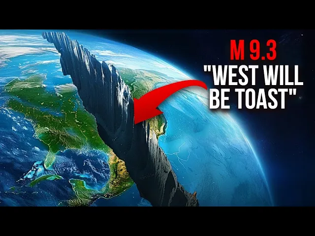
Seismic building codes were only implemented in 1994, leaving countless structures—including homes, bridges, and commercial buildings—constructed before then at considerable risk of collapse during a mega-thrust earthquake. A FEMA spokesperson aptly summarized the potential devastation, stating, “Our operating assumption is that everything west of I-5 will be toast. ” But seriously, what does “toast” even mean in this context?
What does a magnitude 9 earthquake feel like? Stay tuned as we are going to tackle all these questions and more! First, we’ll dive into Cascadia’s geologic setting by checking out other subduction zones.
Then, we’ll break down what a magnitude 9 earthquake really means by looking at how earthquake magnitudes are calculated and what it would feel like. Finally, we’ll discuss what could happen in the Pacific Northwest if one of these massive MegaQuakes hits. Let’s get started!
The scientific literature indicates that a significant earthquake, potentially as powerful as magnitude 9. 3, could occur in the Cascadia subduction zone. This region is notable because all recorded earthquakes above magnitude 9.
0 have taken place in subduction zones. A prime example is the 2004 Sumatra earthquake, which registered a devastating 9. 2 on the moment magnitude scale and resulted in the tragic loss of approximately 230,000 lives.
It's essential to clarify that the moment magnitude scale, which is currently used by geologists, has replaced the older Richter scale for measuring seismic activity. The Richter scale has been outdated for about 45 years due to its inability to account for various factors influencing earthquake strength. The moment magnitude scale is logarithmic, meaning that each whole number increase on the scale signifies a thirty-twofold rise in the earthquake's total energy release.
For instance, an earthquake with a magnitude of 8. 0 is 32 times more powerful than one measuring 7. 0, and it is a staggering 1,024 times more powerful than one measuring 6.
0. Recent studies by seismologists estimate that the maximum potential earthquake along the Cascadia subduction zone could reach a magnitude of 9. 3.
This assessment is based on the dimensions of the fault itself. The locked zone of the Cascadia subduction zone is approximately 1,000 kilometers long and, on average, about 83 kilometers wide. To grasp the potential strength of an earthquake should the entire fault line rupture, we can employ some calculations.
The rigidity constant of basalt—the primary rock type along the Cascadia fault—is about 78 gigapascals, or 7. 8 × 10¹⁰ Newtons per square meter. The last significant rupture of this fault occurred in 1700, and the Juan de Fuca Plate, which is the tectonic plate involved, moves at an average rate of 1.
6 inches per year. Over the 324 years since the last major rupture, this translates to an accumulated strain of approximately 58. 4 inches, or 43.
2 feet, which is equivalent to about 13. 17 meters. If the entire fault were to release this accumulated strain in a single rupture, it could theoretically produce an earthquake with a magnitude of around 9.
22. However, this scenario assumes that all stress has built up since 1700 without any release, which is unlikely. A more realistic possibility involves a partial rupture of the Cascadia subduction zone.
For instance, if only 520 kilometers of the fault were to slip, with a slip width of 46 kilometers, and only 5. 15 meters of the accumulated strain were to be released, we would use the same calculations to estimate the moment magnitude. In this case, the earthquake would register at approximately 8.
59. These calculations are consistent with estimates by the U. S.
Geological Survey (USGS) and other geological organizations, which anticipate significant seismic activity in the region. Understanding these potential scenarios is crucial for preparedness and risk management in the Cascadia subduction zone. The implications of such powerful earthquakes are far-reaching, affecting infrastructure, emergency response, and community resilience.
Hey, everyone! Just a quick pause— if you’re enjoying this video, please like it, subscribe, and tap that bell for instant updates! Now, what can we expect to go down when Cascadia finally erupts?
We’ve run the numbers on two scenarios: a magnitude 9. 2 full rupture and a magnitude 8. 6 partial rupture.
Let’s focus on the full rupture—because let’s face it, a partial rupture, while still serious, would be far less catastrophic and more geographically limited. By diving into the full-rip scenario, we’re essentially preparing for the worst while hoping for the best. So, let’s set the stage.
It’s a hot summer afternoon in the Pacific Northwest. People are leaving work early, hoping to escape the sweltering heat. Traffic is gridlocked as cars inch toward beaches, rivers, and lakes.
Coastal towns like Seaside, Astoria, Newport, Ocean Shores, Arcata, and Brookings are packed with visitors. Many people from inland areas like Redding and Medford have also joined the throngs heading toward the coast. Little do they know, they’re moving into the heart of the tsunami zone.
Meanwhile, just offshore, the Cascadia Subduction Zone has reached its breaking point. Decades of strain between the Juan de Fuca and North American tectonic plates are about to unleash an unimaginable force. The fault line—stretching from Vancouver to northern California—begins to slip.
Seconds before the ground starts shaking, phones across the region buzz with an emergency alert: “Earthquake warning: Drp, cover, hold on! ” Scientists monitoring the situation from the USGS and seismology labs worldwide are already on high alert as their instruments detect the primary (P) waves of the quake. These are the silent precursors to the ground-shaking secondary (S) waves.
The alert buys precious time for some. Many scramble under desks or doorframes. But others freeze in panic, unsure of what to do—or worse, they dismiss the warning altogether.
Pets and wildlife, more attuned to nature’s signals, are already in a frenzy. Dogs bark, birds scatter, and livestock grow restless. And then, it begins.
A deafening roar, like a thousand freight trains, fills the air. The ground starts shaking violently, tossing people and objects. For over five minutes—an eternity in an earthquake—buildings sway, bridges crack, and infrastructure crumbles.
In waterlogged areas like Seattle, Portland, and other low-lying regions, the shaking turns solid ground into liquefied sludge. Entire neighborhoods sink and twist as the earth fails beneath them. Buildings constructed before the seismic codes of 1994 stand no chance.
They collapse, burying tens of thousands under rubble. Utility lines rupture, sparking fires and spewing sewage into the streets. Major highways like I-5, I-90, and I-84 are devastated as overpasses and bridges buckle.
Airports in Seattle and Portland are rendered useless as liquefaction destroys their runways, leaving them unable to receive emergency aid. Some people survive the initial shaking, but the challenges have only just begun. With utilities out, water unsafe to drink, and roads destroyed, survivors must fend for themselves.
Aid could take weeks, if not months, to arrive, leaving many unprepared for the harsh realities of living off the grid. For those along the coast, the nightmare doesn’t end when the shaking stops. A massive tsunami, with waves over 100 feet tall in some places, is racing toward the shore.
Residents have 15 to 30 minutes to reach higher ground. Panic sets in. Roads are clogged with cars and debris, and many people on foot simply can’t outrun the wave.
When the tsunami hits, it obliterates everything in its path. Entire towns are swallowed, leaving behind little more than muddy ruins. Thousands of lives are lost as the wall of water crashes over the Pacific Northwest coastline.
Survivors who make it to higher ground can only watch in horror as the ocean consumes everything they once knew. By the time the quake and tsunami subside, the Pacific Northwest is unrecognizable. Cities like Seattle and Portland are shattered.
Skyscrapers have crumbled, bridges have vanished, and fires rage uncontrollably. Landslides in mountainous regions bury roads and villages, cutting off entire communities. Coastal areas are permanently altered, with some regions sinking by as much as six feet due to rapid subsidence.
FEMA estimates that a magnitude 9. 2 earthquake in Cascadia could kill around 13,000 people and injure 27,000 more. However, these numbers could skyrocket, as the region is home to 13 million people.
Seattle-Tacoma alone houses 4 million, and Portland adds another 2. 2 million—many of whom live in buildings that aren’t up to modern seismic standards. If you think this sounds exaggerated, let’s look at history.
In 2011, Japan—the global leader in earthquake preparedness—was struck by the Tohoku earthquake and tsunami. Even with their gold-standard engineering, over 20,000 lives were lost. If the most seismically prepared nation couldn’t escape such a catastrophe, why would a region like Cascadia fare better?
We’ve also seen the grim consequences of ignoring seismic safety in Turkey. In 2023, a magnitude 7. 8 earthquake killed over 60,000 people, largely because poorly built structures collapsed.
While the Pacific Northwest’s buildings aren’t as subpar, a disturbing number still lack proper seismic retrofitting and will likely crumble under the pressure of a major quake. But there is hope. It is much more likely that a partial rupture will occur rather than a full one.
While a partial rupture would still be significant, with potential magnitudes ranging from 7. 6 to 8. 6, it would be far less catastrophic than a full magnitude 9 event.
Moreover, progress is being made. Since 2014, seismic retrofitting has become a priority across the Pacific Northwest. In Portland, for instance, there were no earthquake-resistant bridges a decade ago.
Today, two bridges meet seismic standards, and more are being reinforced. Similar efforts are underway in cities like Seattle and Eugene. Schools, hospitals, and critical infrastructure are being upgraded to withstand a major quake.
Emergency preparedness campaigns have also ramped up, encouraging families to stock up on supplies, create evacuation plans, and learn basic survival skills. Awareness is growing, and while there’s still a long way to go, the region is slowly becoming more resilient. Despite these efforts, it’s a race against the clock.
If the "Big One" were to strike tomorrow, the Pacific Northwest would face an unparalleled disaster. However, if it holds off for another decade or two, the region will be in a much better position to withstand the blow. Ultimately, preparation is key.
While no one can stop the Cascadia Subduction Zone from unleashing its fury, building resilient infrastructure and cultivating a culture of readiness could mean the difference between survival and catastrophe. For now, the clock is ticking, and every effort counts. And that's a wrap for today!
Do you think the next Cascadia earthquake will happen anytime soon? Is there a region you think is more prone to a more urgent earthquake? Feel free to leave your answers in the comments below.
If you liked this video, then you should check out the one on your screen. This video on 30 Mind-blowing Facts About The Solar System! Thank you for watching!